Good Morning! Our storm-free, dry pattern continues for a few more days. Here’s my brief forecast discussion.
CLIMATE DATA: Yesterday’s high was 86, after a chilly morning low of 47. It was the coolest morning of the season so far. Normal: 84/59. Rainfall: 0.00”. Sunrise 6:44, sunset 6:21.
TODAY: Today will be the warmest day of the week. Sunshine. Tolerable humidity. High 88. NW wind 6 to 11 mph. Clear and cool again tonight. Low 56.
A Cold Front sweeps through the state today, but it is a “dry front. No rain.

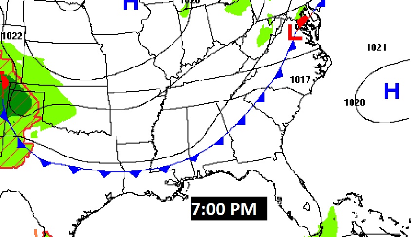
It will be breezy and cooler behind the front Saturday. Northwest winds at 12 to 22 mph. Highs in the 70’s.

NEXT FEW DAYS: Our long string of dry, storm-free days continues. A Cold front will swings across the state this evening.
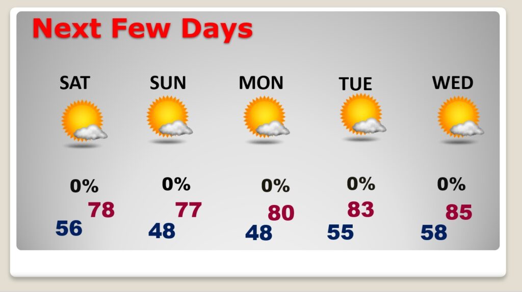
It will be noticeably cooler this weekend behind the front. Breezy & Cool. Highs in the 70’s. Chilly 40’s at night. Still dry for several more days, at least through the middle of next week.
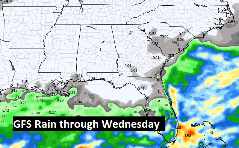
We should be dry for at least through next Wednesday. This is day 18 without rain. Here’s the Euro model through next Wednesday.
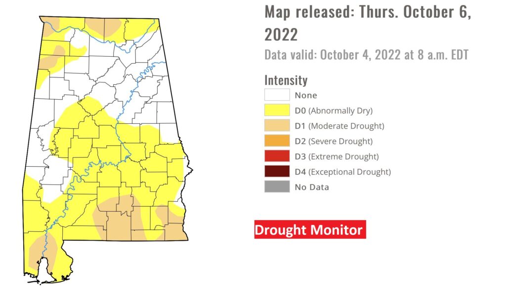
The new Drought Monitor map came out yesterday. There has been a significant escalation since last week. Much of the state is in the Level 1 Abnormally Dry stage. And now, parts of south Alabama are in the Moderate Drought stage.
Now, more than 2/3 of the United States are in some Drought Level. I’ve never seen the map look like this.

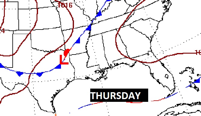
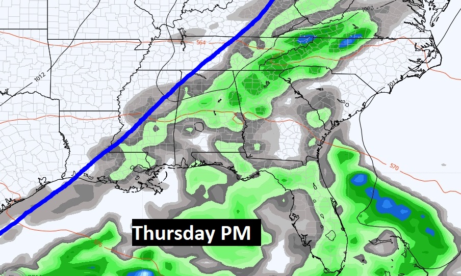
RAIN NEXT WEEK?: FINALLY, it looks like a frontal system next Thursday could bring showers back to Alabama.
TROPICAL OUTLOOK: Tropical Depression 13 could become Tropical Storm Julia today. This system is expected to become a hurricane before landfall in Central America Sunday.

Tropical Depression 12 has fizzled and is now just a post tropical remnant low.
The rest of the tropical Atlantic is very quiet for now.

Thanks for reading this Blog this morning! I’ll have another update for you in the morning. Have a nice day!
–Rich
