
Good Morning! This is day 19 without rain. But, finally there’s at least some hope for late next week. Here’s my brief forecast discussion.
CLIMATE DATA: Yesterday’s high was 82, after a morning low of 56. Normal: 83/58. Rainfall: 0.00”. Sunrise 6:46, sunset 6:19.
TODAY: Great Fall weather continues today. Sunshine. High in the upper 70’s. North wind 6 to 12 mph. Clear skies, chilly tonight. You’ll need at least a jacket. Low in the upper 40’s.
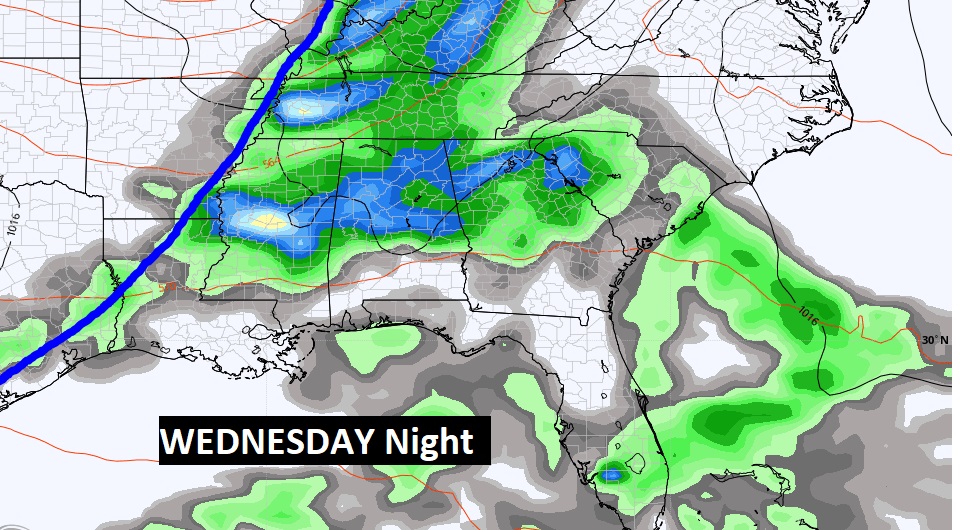
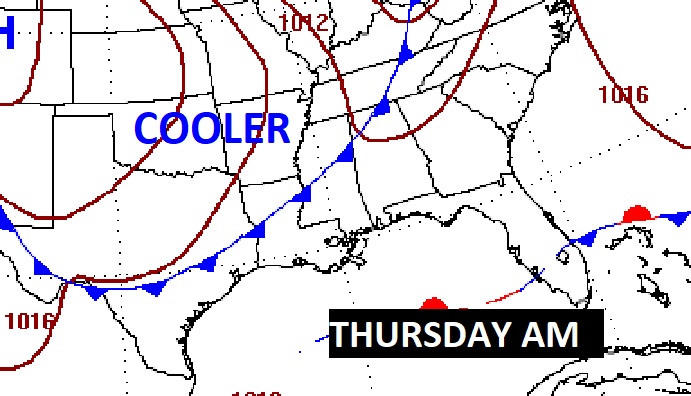
NEXT FEW DAYS: Our long string of dry, storm-free days will continue through Tuesday. Monday and Tuesday will be sunny and dry, and comfortable. But, finally, an approaching front will bring a risk of showers to the area as early as Wednesday, and especially Wednesday night into Thursday. Behind that front, expect the coolest air of the season, so far.
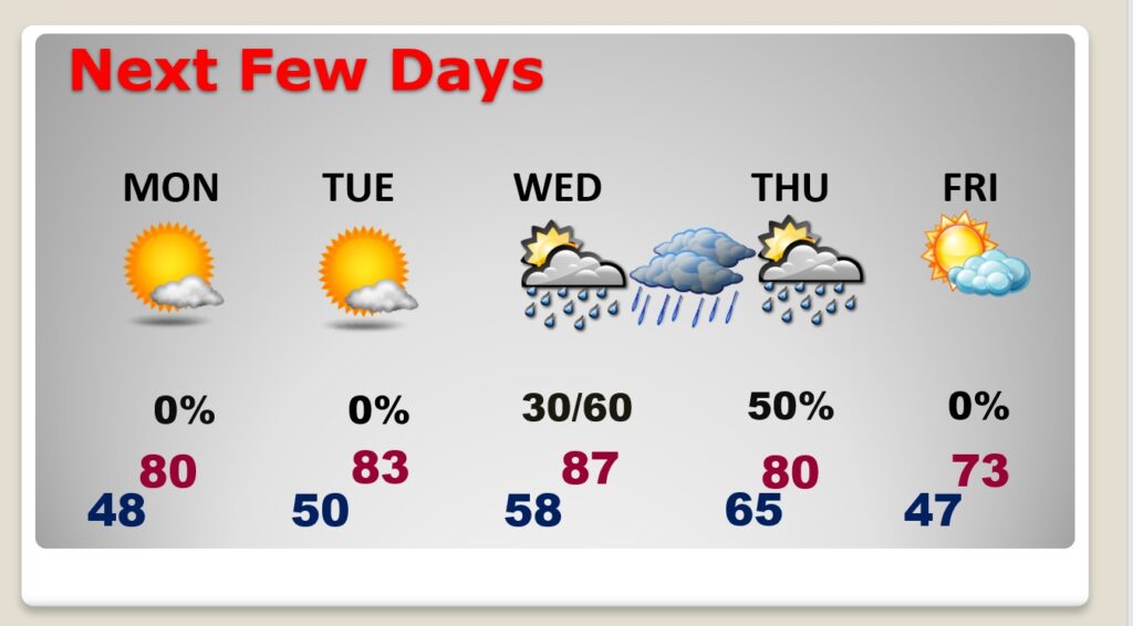
An important cold front will bring a risk of showers by Wednesday. The best chance of showers will be Wednesday night. The front will move across the state Thursday. Much cooler air will follow.
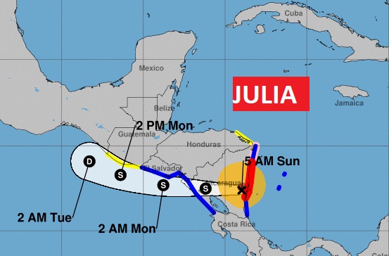
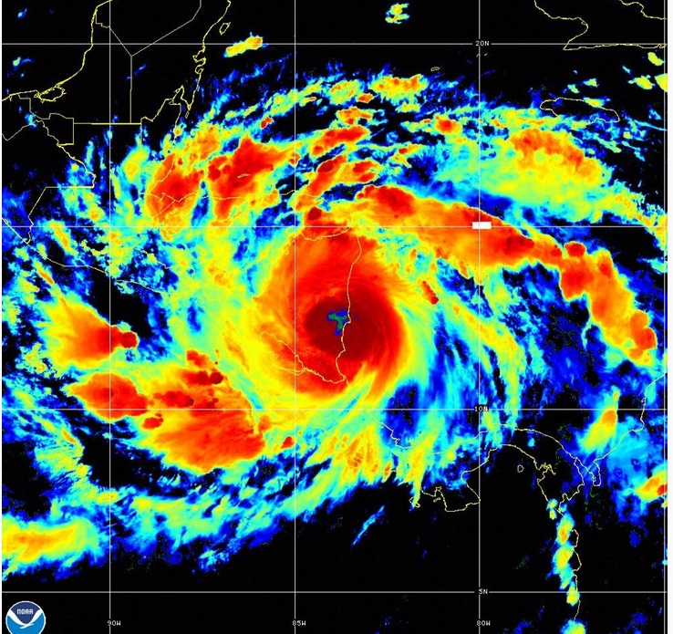
TROPICAL OUTLOOK: Hurricane Julia is about to make landfall on the coast of Nicaragua this morning. At 4AM, 30 miles from Bluefield, Nicaragua, moving west at 16 mph. Max winds 85 mph. Life threatening flooding is expected in Nicaragua today and tonight, as Julia heads toward the Pacific.
The rest of the tropical Atlantic is very quiet for now.
FULL MOON TONIGHT: Spectacular Full Hunter’s Moon tonight.

.
Thanks for reading this Blog this morning! I’ll have another update for you in the morning. Have a nice day!
–Rich