
Good Morning! It’s been 22 days today since we’ve had rain. But, finally rain is returning to the forecast very soon. Here’s my brief forecast discussion.
TODAY: Looks like one more nice day before some weather changes. Mostly sunny today. High in the mid 80’s. East wind 6 to 12 mph. Partly Cloudy tonight. Not as cool. Low in the lower 60’s.
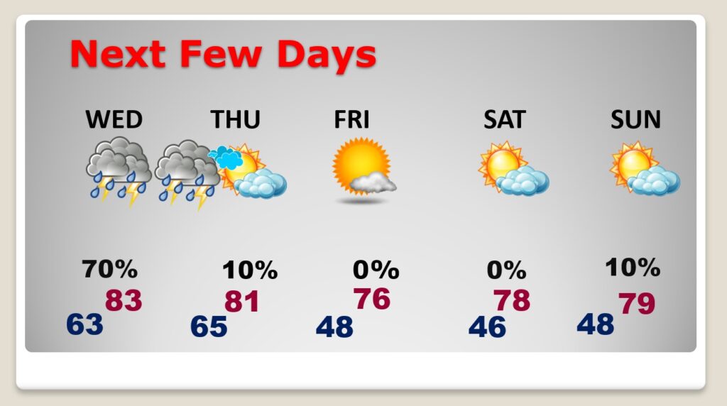
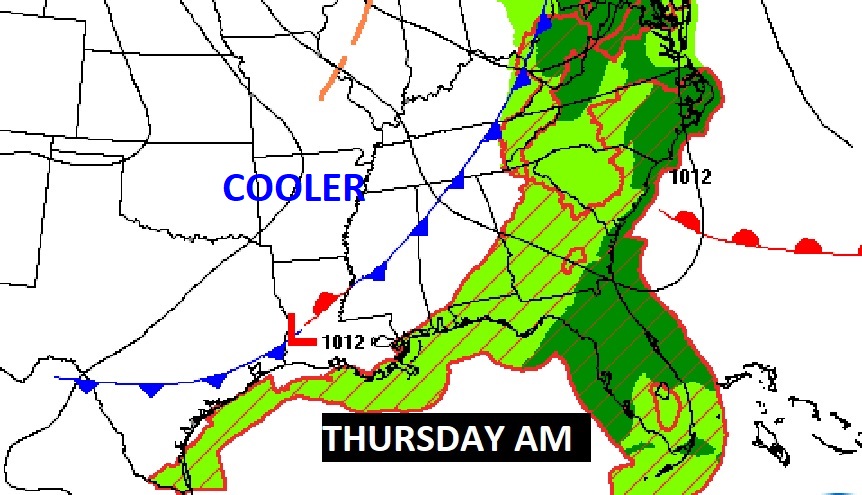
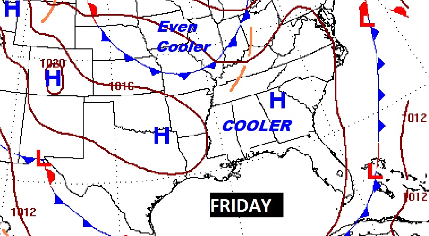
NEXT FEW DAYS: Finally, an approaching front will bring a risk of scattered to numerous showers & thunderstorms to the area by this afternoon, tonight, and through Dawn Thursday morning. Behind that front, expect cooler air. The nights will be quite chilly. It will be cool Friday through the following weekend. Right now I have Sunday dry. But, some models try to being in some showers as a front approaches. I’ll bet on a Monday arrival of the next showers.
Hopefully most towns will get wet with this approaching front. It appears the showers/storms will be rather widespread. Fingers crossed.
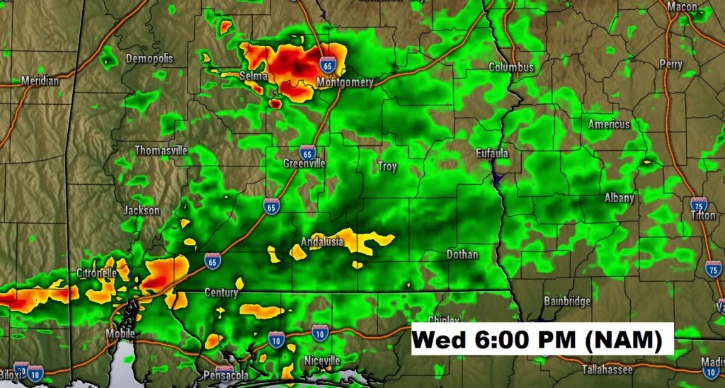
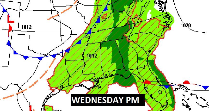
Here’s a Future Radar snapshot Wednesday evening, and the projected average potential rainfall.
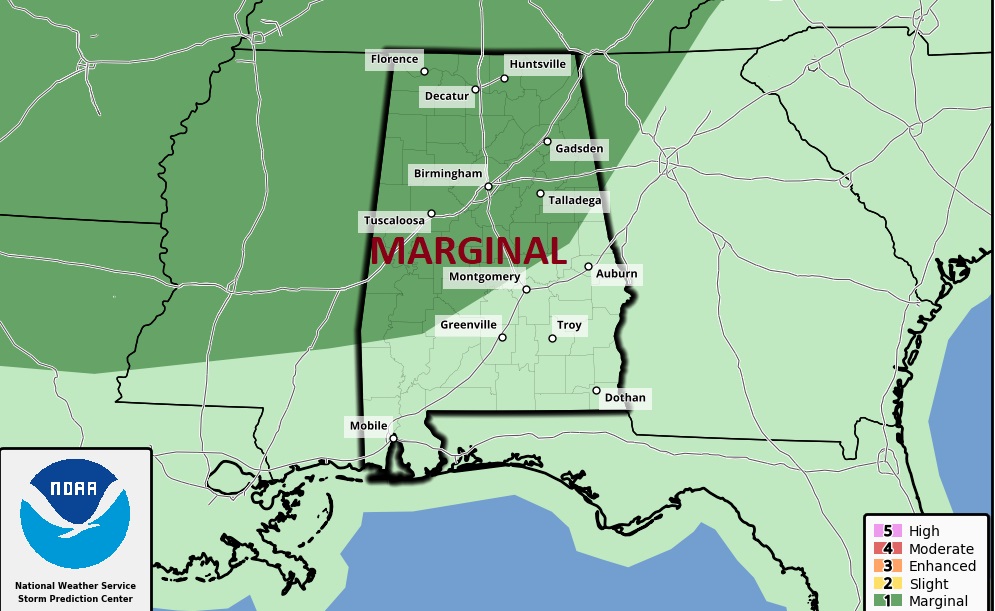
We haven’t seen this in awhile. SPC says some of the storms could be strong/severe across the northwest half of Alabama. Marginal Severe Risk. Damaging wind gusts are the main threat.
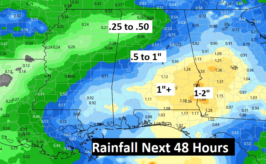
Here’s the potential AVERAGE rainfall across the region with the approaching front. This is just general guidance. Don’t take this literally.
The front will move through Thursday morning, ending the rain threat.
Friday will be sunny and cooler with highs in the 70’s.
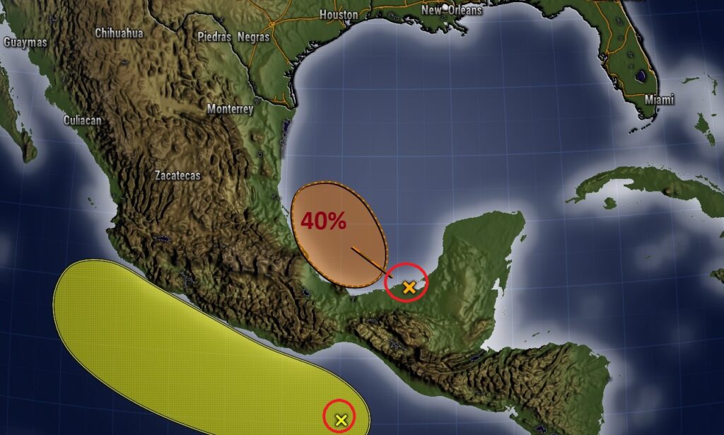
TROPICAL OUTLOOK: NHC is tracking an Area to Watch in the southwest Gulf. It has a 40% medium chance of development in the next 5 days. The rest of the Atlantic basin is quiet. The remnants of Julia are on the Pacific side of central America.
Thanks for reading this Blog this morning! I’ll have another update for you in the morning. Have a nice day!
–Rich