Good Morning! We have a beautiful weekend ahead of us. Warm & dry days. But get ready for a bit of a shocker next week, as the temperature plunges. Could we possibly tease the freeze mark by mid-week? Maybe. Here’s my brief forecast discussion.
TODAY: Really nice! Sunshine. Low humidity. Comfortable. High 85. South wind 5 to 10 mph. Clear and cool tonight. Jacket weather. Low 53.
Great Football weather around the Southeast U.S. today.

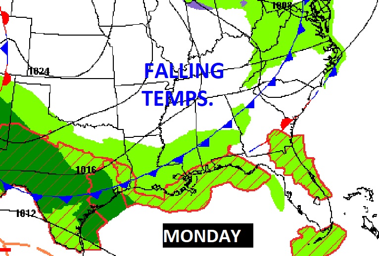
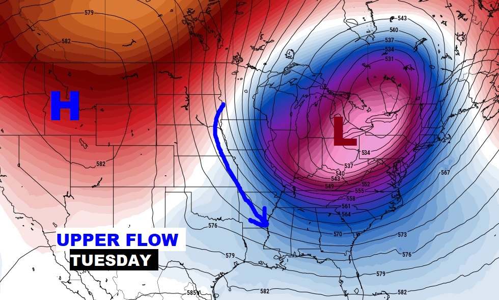
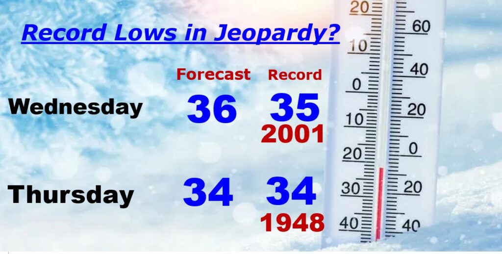
Get ready for an early season Cold Blast. A cold front sweeps through the state Monday, with a small risk of showers. Very Chilly air follows. Tuesday’s high temperature will struggle to reach 60. In fact, we’ll be teasing record lows by Wednesday & Thursday morning. We may even be close to the freeze-mark by Thursday morning.
Small chance of showers as the front sweeps through daytime Monday.
The air that arrives early next week will undoubtedly be the coolest of the season so far. Chilly. Kind of an early season shocker.
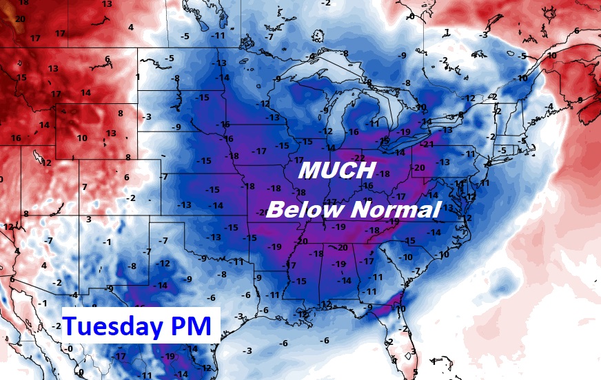
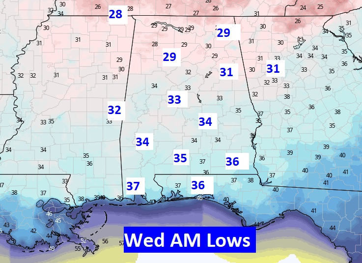
Here’s a sample of the potential lows on Wednesday morning. First freeze of the season for some towns? Maybe…. Average first frost is November 8th. Average first Freeze is November 18th. This is pretty amazing air. Are you ready?
RECORD LOWS IN JEOPARDY: Wednesday’s Montgomery record low of 35 and Thursday’s record low of 34 could be in jeopardy.
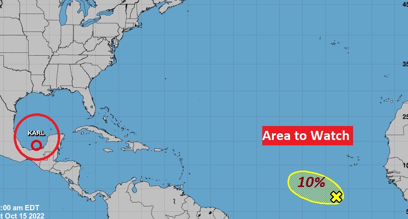
TROPICAL OUTLOOK: Karl is now just a Depression in the southwest Gulf is headed for Mexico.
NHC is still monitoring that Area to watch in the southwest Gulf with a 10% chance of development in the next 5 days. The rest of the Atlantic basin is quiet for now.
Thanks for reading this Blog this morning! I’ll have another update for you in the morning. Have a nice day!
–Rich