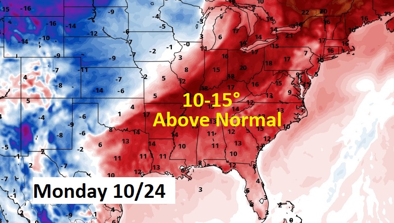
Good Morning! We have one more warm, dry day ahead of us today. But, get ready for a big temperature plunge this week. A cold front sweeps through the state Monday. Very Chilly air follows. In fact, we’ll be teasing record lows by Wednesday & Thursday. Here’s my brief forecast discussion.
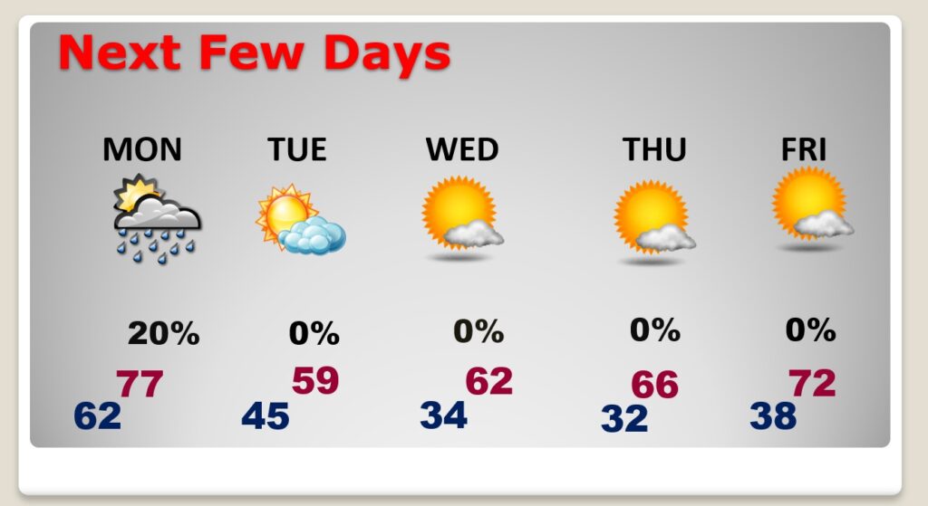
TODAY: Warm & dry. Sunshine. Low humidity. Comfortable. High 86. South wind 5 to 10 mph. Increasing clouds and not as cool tonight. Low 62.
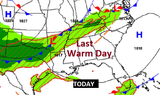
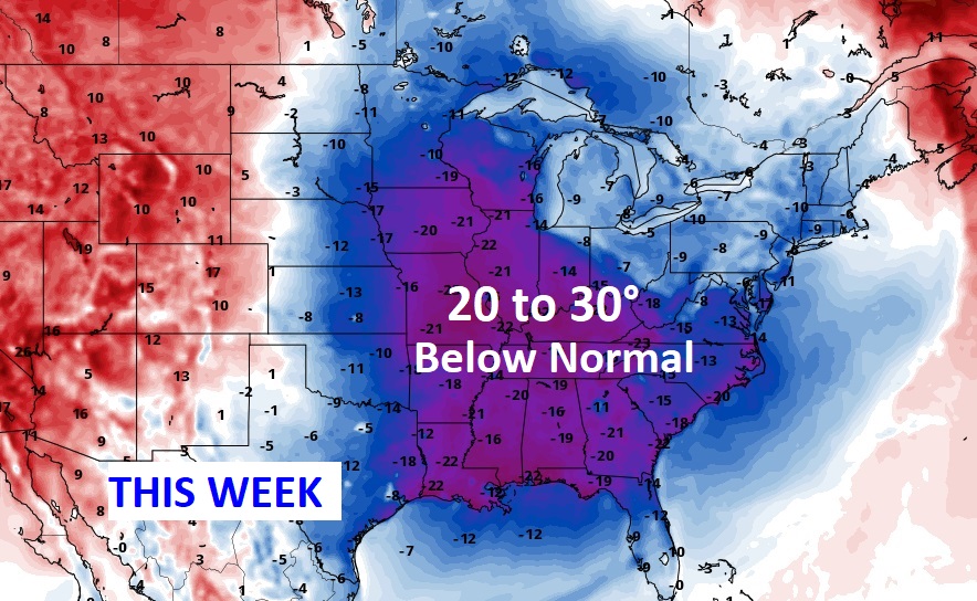
NEXT FEW DAYS: Get ready for an early season shocker Cold Blast. A cold front sweeps through the state Monday, with a small risk of showers. Very Chilly air follows. Tuesday’s high temperature will struggle to reach 60. (If we fail to reach 60 Tuesday, that will be a new record for coolest High) In fact, we’ll be teasing record lows by Wednesday & Thursday morning. We may even be close to the freeze-mark by Thursday morning.
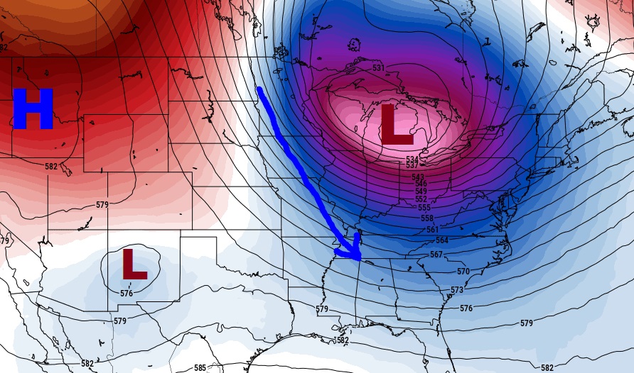
The air that arrives early next week will undoubtedly be the coolest of the season so far. Chilly. Kind of an early season shocker.
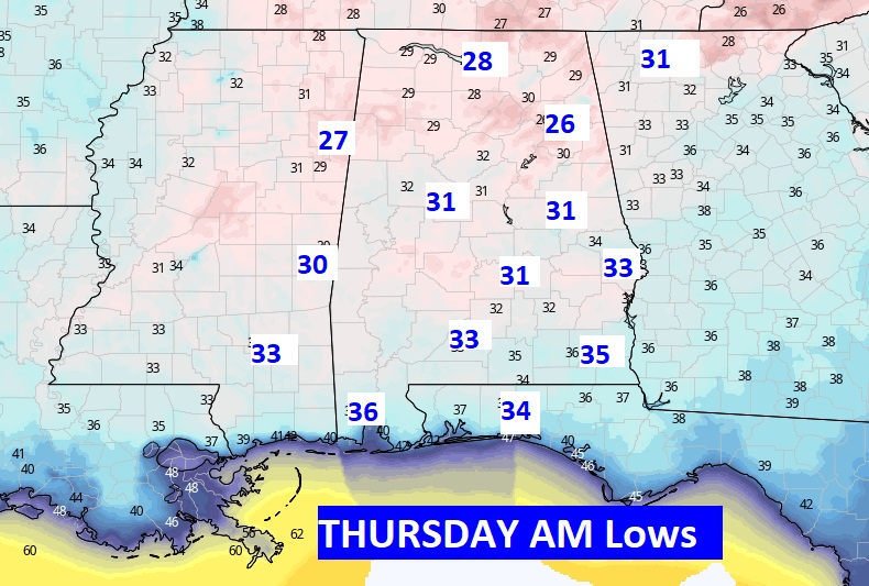
Here’s a sample of the potential lows on Thursday morning. First freeze of the season for many towns? Certainly could be. Average first frost is November 8th. Average first Freeze is November 18th. This is pretty amazing air. Are you ready?
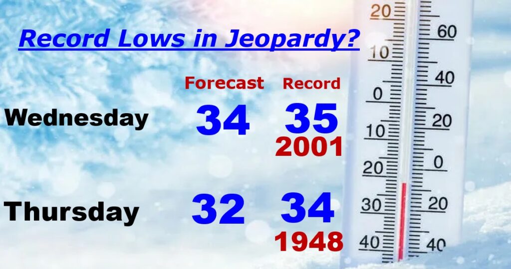
RECORD LOWS IN JEOPARDY: Wednesday’s Montgomery record low of 35 and Thursday’s record low of 34 are very much in jeopardy.
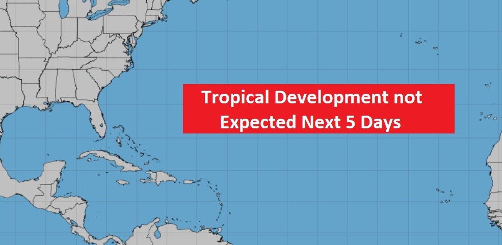
TROPICAL OUTLOOK: I’m happy to say the Tropics are completely quiet for now.
Thanks for reading this Blog this morning! I’ll have another update for you in the morning. Have a nice day!
–Rich
BUT….GOOD NEWS! There will be a nice warm temperature turn-around next week. Great news!