
Historic morning. UPDATED LOW: Montgomery did reach 32 this morning at 6:03 AM. That not only breaks the previous record of 34 set in 1948, but it now becomes the earliest freeze in Montgomery weather history. Records go back to 1872 — 150 years. #alwx
EARLY MORNING UPDATE:
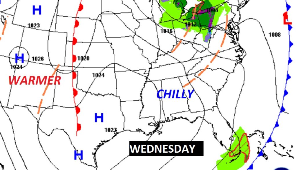
Good Morning! Our unusual, historic, early season Cold Blast continues. It’s a Frigid Record Cold Wednesday morning. Today will be well below normal by about 20 degrees. There’s another Freeze Warning for tonight. But, slowly, recovery is on the horizon. Here’s my brief forecast discussion.
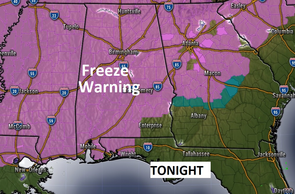
TODAY: After a frigid, historic morning, expect another chilly day for this early in the season. Sunshine but still a bit breezy. High today 61. (Yesterday’s high was only 58) Gusty north winds at 11 to 16 mph. Freeze warning again tonight. Clear and cold. Record low expected tonight. Low near the freeze mark by Dawn.
Freeze Warning again tonight for much of the region.
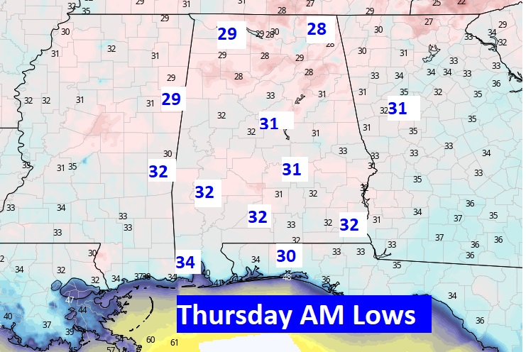
Here’s an update on expected tomorrow morning. Another record low is likely. Previous record 32 on October 20, 1989.
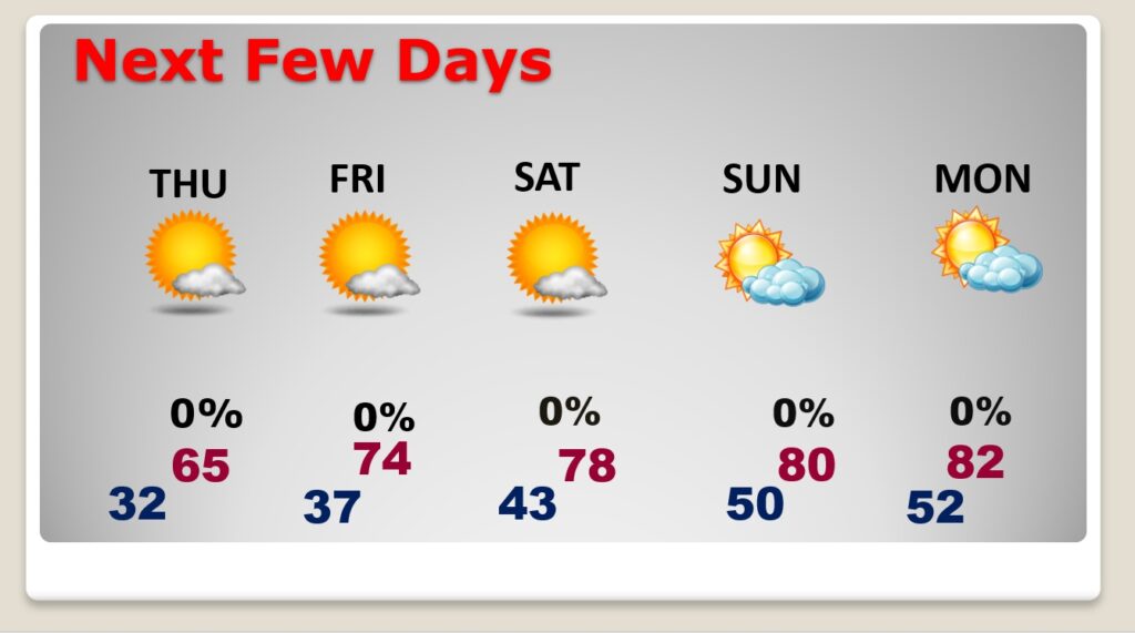
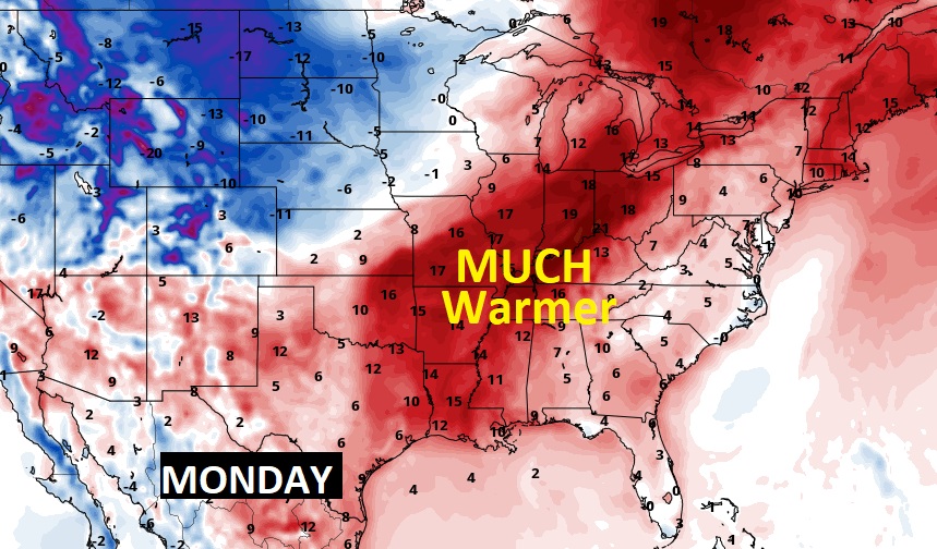
NEXT FEW DAYS: Sunshine, still cool Thursday. Highs in the mid 60’s Thursday. We’ll start to warm back into the low 70’s by Friday and the upper 70’s Saturday. Perhaps near 80 by Sunday and lower 80’s early next week. A dry, nice weekend. Lots of sunshine.
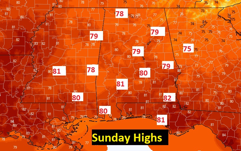
Nice warm-up over the weekend back into the 70’s. Lower 80’s early next week. Here’s a peek at the potential Sunday Highs.
Early next week looks nice and warm….fortunately.
Thanks for reading this Blog this morning! This morning we are LIVE on the radio from 6 to 9 on NewsTalk 93.1. Watch us on TV on CBS 8 and ABC 32. I’ll have another update for you in the morning. Have a nice day!
–Rich