
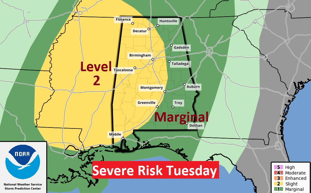
Good Morning! Our nice warm, dry weather continues through today. But, there’s there are weather changes on the way as a storm system approaches Tomorrow. All of the state is in a Severe Weather Risk. But, the western half of the state is in a Level 2 Risk. Damaging winds would be the main threat, but a tornado or two can’t be ruled out. Here’s my brief forecast discussion.
TODAY: It was a nearly perfect weekend. And, the news is very good again today. Sunshine, warm. High in the lower 80’s Light wind. Partly cloudy, not nearly as cool tonight. Low 57.
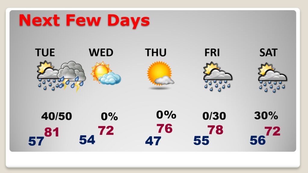
NEXT FEW DAYS: Showers & strong thunderstorms return to the forecast Tuesday, as a cool front approaches. High in the lower 80’s. Could be a couple of stronger storms are possible particularly in the evening. The air behind the next front is cooler, but not too cold. Low 70’s Wednesday. Another shower risk pops up around Friday Night and over the weekend,
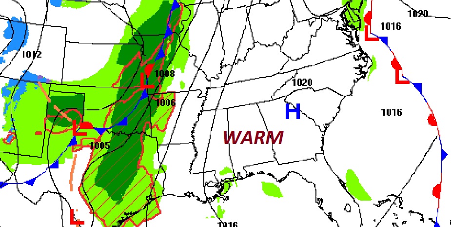
A rather robust storm system/cold front will bring showers and storms back to the forecast on Tuesday & Tuesday night. All of the state is in a Severe Weather Risk. But, the western half of the state is in a Level 2 Risk. Damaging winds would be the main threat, but a tornado or two can’t be ruled out.
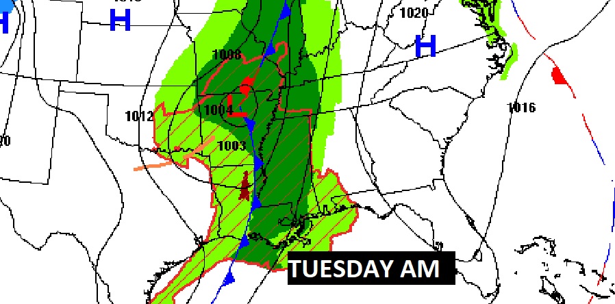
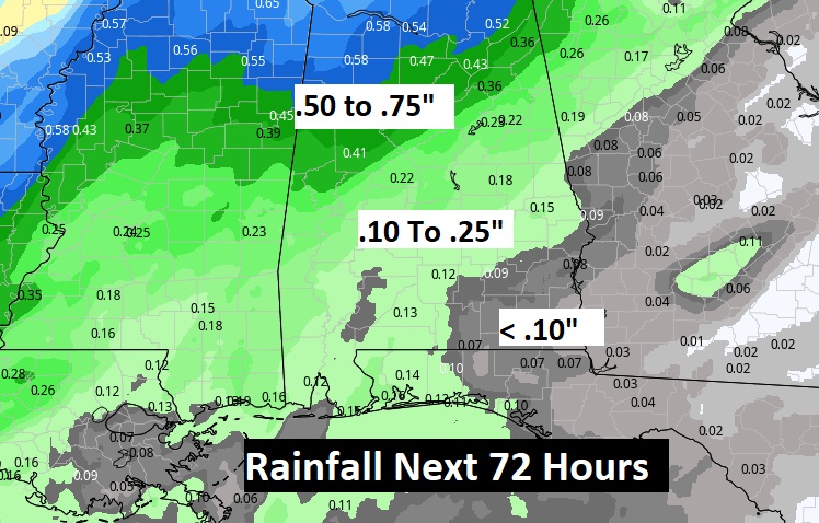
Here’s a couple of Future Radar snapshots showing the main action along a “squall line” Tuesday evening.
While some rain is a good bet, it does not appear to be enough to help out our abnormally, growing Drought profile.
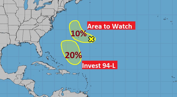
TROPICAL WEATHER: NHC is monitoring Invest 94-L in the central Atlantic with a 20% chance of development. Plus there is a Area to Watch in the central Atlantic with a 10% chance of development in the next 5 days.
Thanks for reading this Blog this morning! This morning we are LIVE on the radio from 6 to 9 on NewsTalk 93.1. Watch us on TV on CBS 8 and ABC 32. I’ll have another update for you in the morning. Have a nice day!
–Rich