
Good Morning! Looks like we’re in for a very nice couple of days to end this week. But, if you have outdoor plans for the weekend, be flexible. Our weekend could be quite wet at times. Here’s my brief forecast discussion.
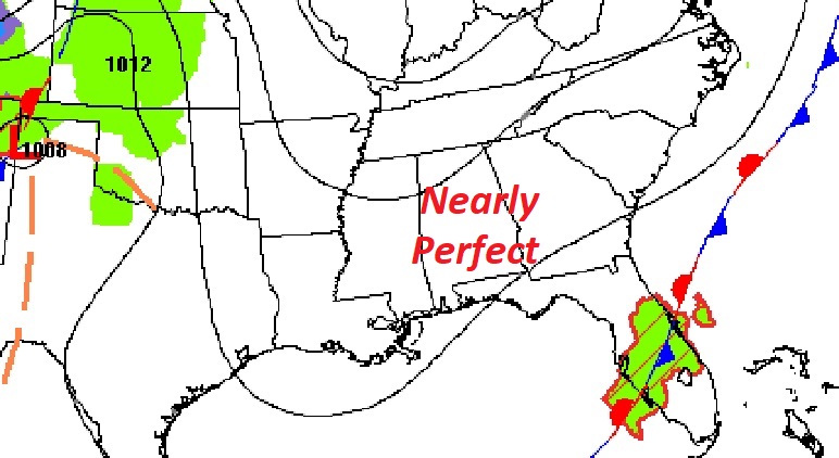
TODAY: Nice day today. Sunshine, comfortable. A little warmer than yesterday. High in the mid 70’s. Northeast wind at 5 to 10. Clear and cool tonight. Low 52.
High pressure is in control. Just a nice day.
NEXT FEW DAYS: Friday looks good. Sun/cloud mix A little breezy. High in the mid 70’s. Clouds increase Friday Night. The weekend looks wet at times. It won’t rain all weekend, but be flexible with your plans. Best chance of rain is Saturday night and first half of the day Sunday. Monday and Tuesday will be sunny & cooler.

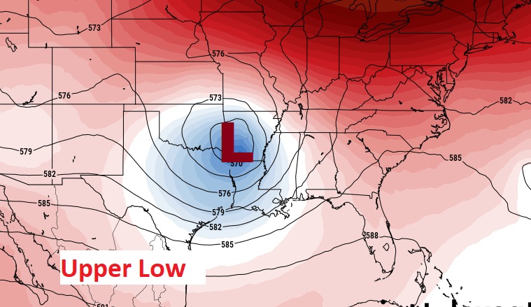
It’s a very slow moving storm system, powered by an Upper Low over Arkansas.
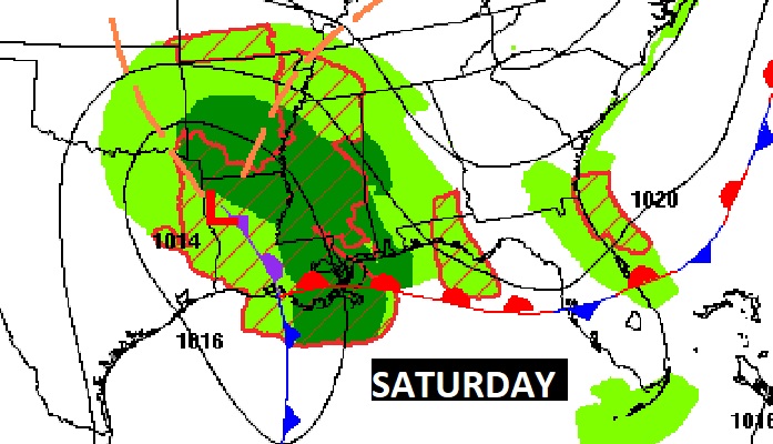

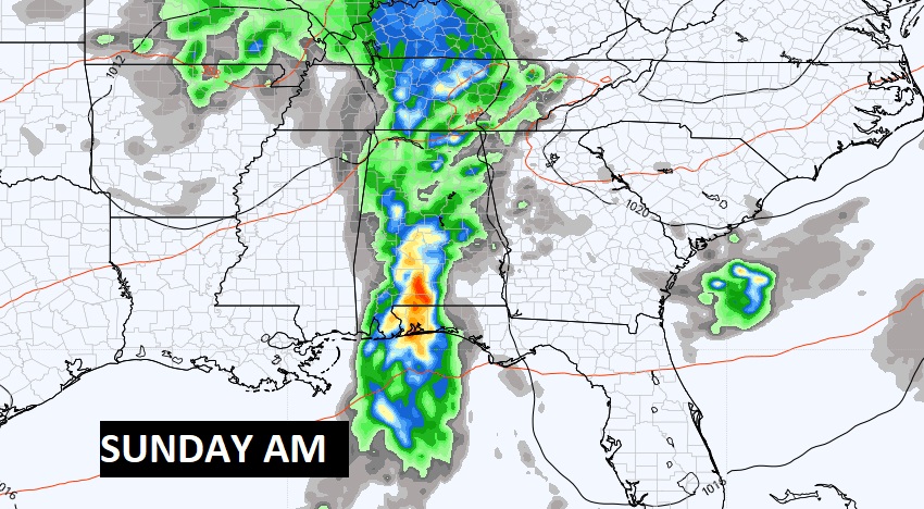
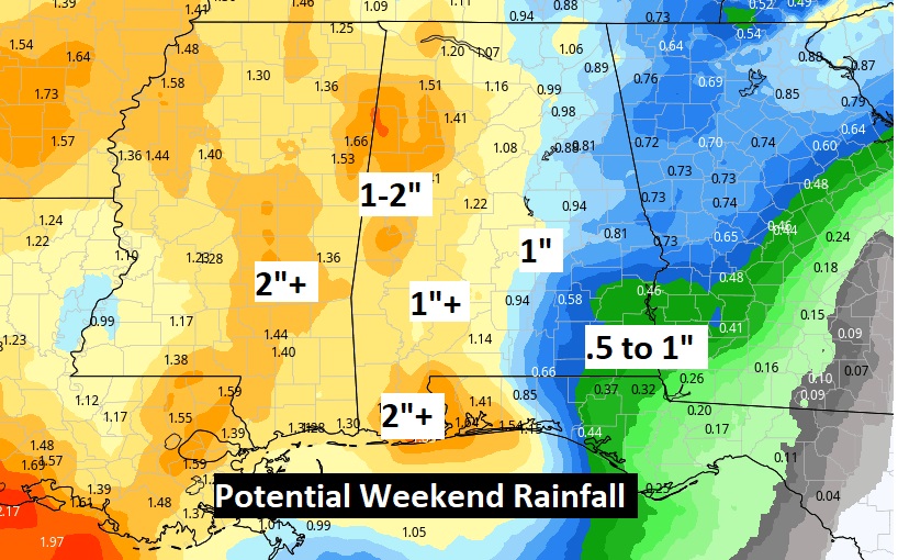
Best Rain chance is Saturday night and first half of the day Sunday.
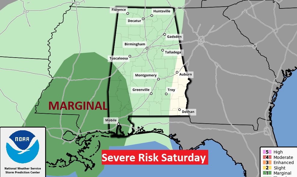
A few strong/severe storms perhaps in parts of southwest Alabama by Saturday afternoon & evening.
Here’s a computer model blend on potential weekend rainfall. We need the rain.
A NEW drought monitor map comes out later this morning. This is the old map from last Thursday. It will be interesting to see changes on today’s map.

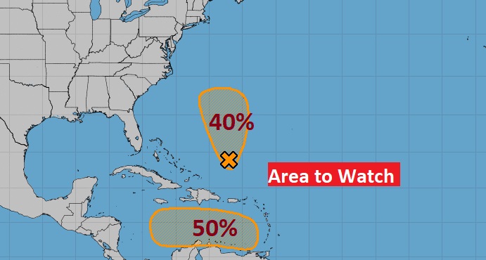
TROPICAL WEATHER: NHC is monitoring two Areas to Watch – one in the Atlantic and one in the Caribbean. That Caribbean system has a 50% chance of development in the next 5 days
Thanks for reading this Blog this morning! This morning we are LIVE on the radio from 6 to 9 on NewsTalk 93.1. Watch us on TV on CBS 8 and ABC 32. I’ll have another update for you in the morning. Have a nice day!
–Rich