
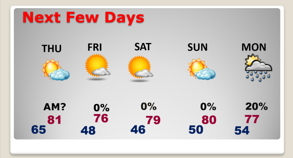
Good Morning! Good news if you have outdoor plans for today. The approaching storm system to the west of us has slowed down a bit. So, I have taken the rain chances very low for today and tonight. Sunday still looks quite wet. Dry weather returns on Halloween. Here’s my brief forecast discussion.
TODAY: Mostly cloudy today. The morning will be dry. Afternoon rain chance is only 20% at best. Most towns will stay dry. Scattered showers tonight, particularly late tonight. High today 77. Breezy today & tonight. East winds at 10 to 20 mph. Low tonight 63.
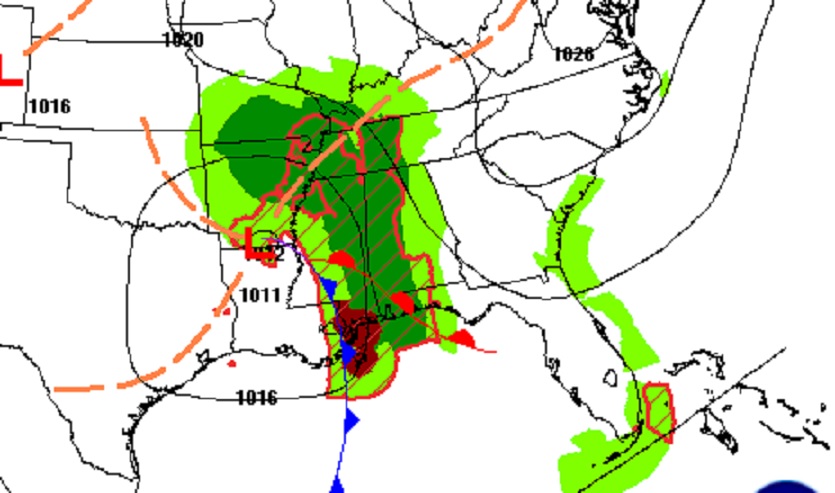
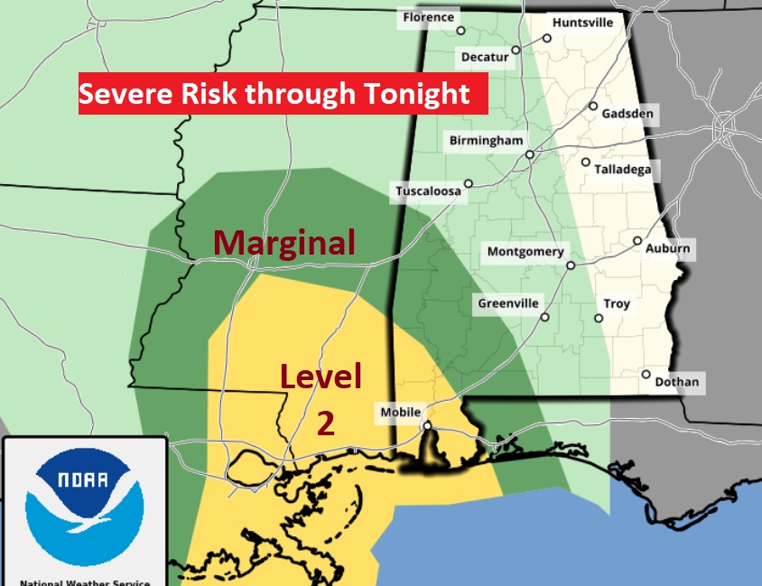
The Storm Prediction Center has the southwestern third of the state in a Severe Weather Risk. Level 2 in the coastal counties.
NEXT FEW DAYS: Sunday looks wet at times. Be flexible with your plans. Showers and thundershowers are quite likely. Cool, but nice weather is in the cards early next week. There should be substantial warming late week. But, the next best chance of rain would be that following weekend.
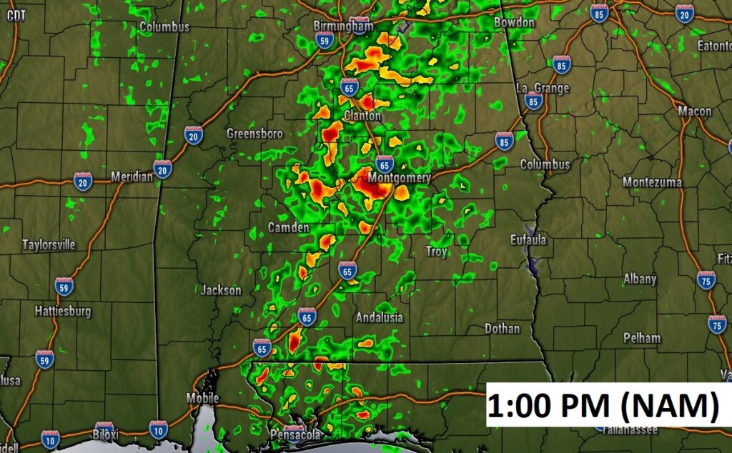
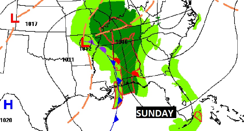
Here’s a Future Radar example early Sunday afternoon.
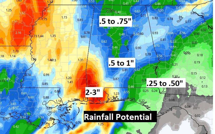
Here’s a computer model blend on potential rainfall. We need the rain.
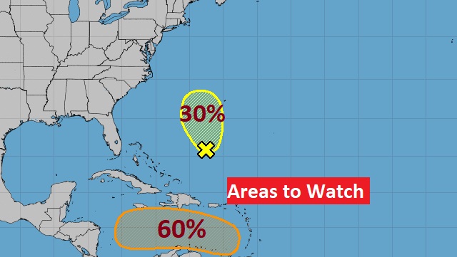
TROPICAL WEATHER: NHC is monitoring Invest 95-L in the Caribbean. It now has a high 70% chance of development in the next 5 days. Most of the models point this system toward Central America. There’s also an Area to Watch in the Atlantic.
Thanks for reading this Blog this morning! This morning we are LIVE on the radio from 6 to 9 on NewsTalk 93.1. Watch us on TV on CBS 8 and ABC 32. I’ll have another update for you in the morning. Have a nice day!
–Rich