
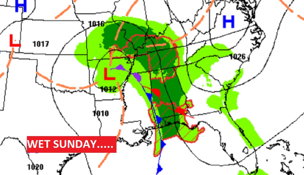
Good Morning! Risk of showers of showers just about anytime today, but particularly this afternoon and into the evening. No Severe weather is expected. Dry weather returns on Halloween. The week ahead looks nice.
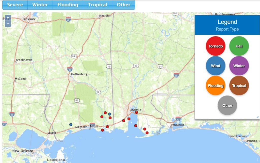
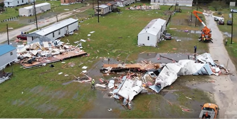
MULTIPLE TORNADOES IN THE MOBILE AREA SATURDAY: It was a wild Saturday evening in the greater Mobile area and across coastal Alabama. There were multiple tornado touchdowns that caused damage, but apparently no injuries. There were at least six confirmed tornadoes from about 5PM well through the evening and nighttime hours. The Severe threat is over now. But, there were more than a dozen tornado warmings issued. TWICE the National Weather Service personnel had to take cover. The Tallahassee weather office briefly took over warning responsibilities for MOB. It was a very localized severe weather threat area in extreme SE Mississippi and Coastal Alabama. Look all the tornado and wind damage reports.
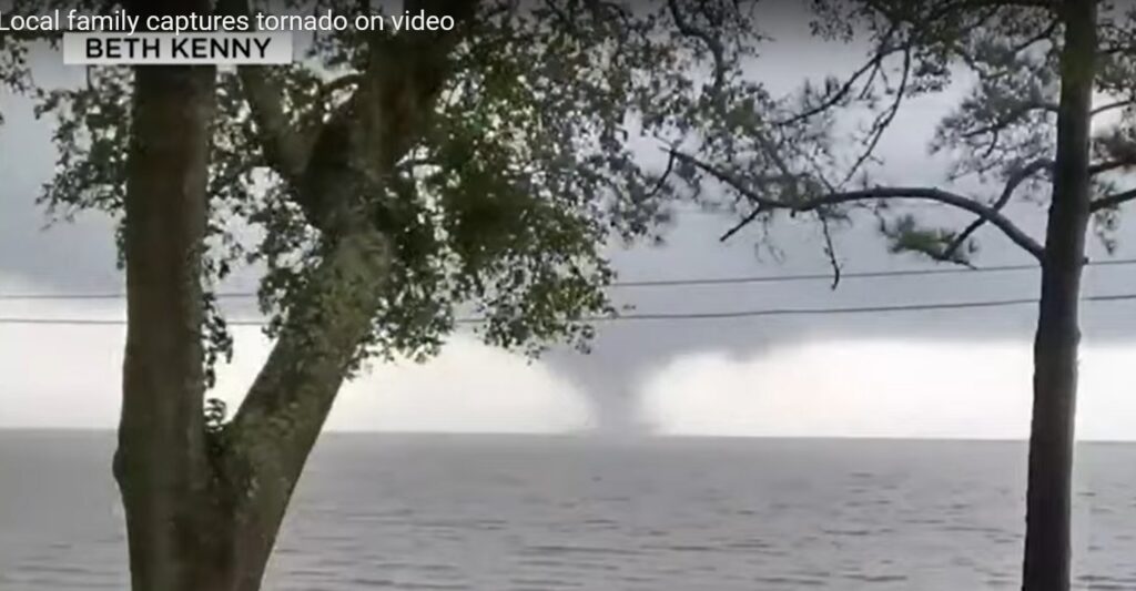
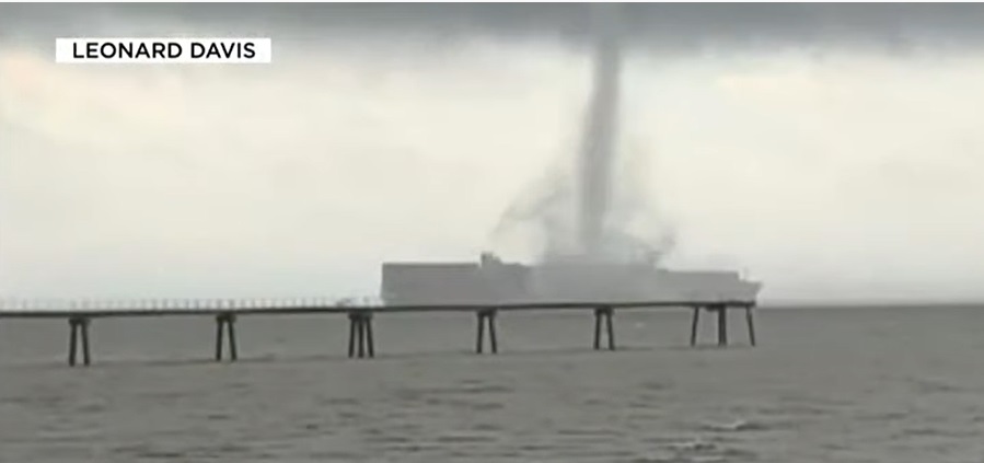
This You Tube Clip from Fox 10 in Mobile shows funnel clouds crossing the Mobile Bay. Pretty amazing stuff.
And a couple of snapshots of the Mobile Bay funnel clouds.
Here’s AL.COM coverage of the storms, which includes more pictures.
https://www.al.com/news/2022/10/powerful-storms-rip-through-coastal-alabama-4000-without-power.html
Lots of damage in spots. Hours of terror in coastal Alabama.
TODAY: Risk of showers of showers just about anytime today, but particularly this afternoon and into the evening. No Severe weather is expected. High today 73. Breezy today & tonight. East winds at 10 to 20 mph. Low tonight 58.
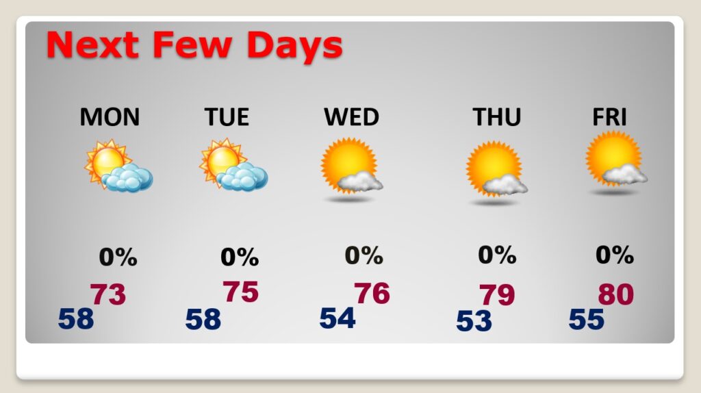
MONDAY FORECAST: The risk of rain ends before Dawn on Monday – Halloween. Cloudy in the morning partly sunny later. Cool. High 73. Dry for the tricker treaters with evening temperatures falling into the 60’s and then the 50’s.
NEXT FEW DAYS: Sunny and nice Tuesday through Thursday with highs in the upper 70’s We’ll be near 80 on Friday. Still dry.
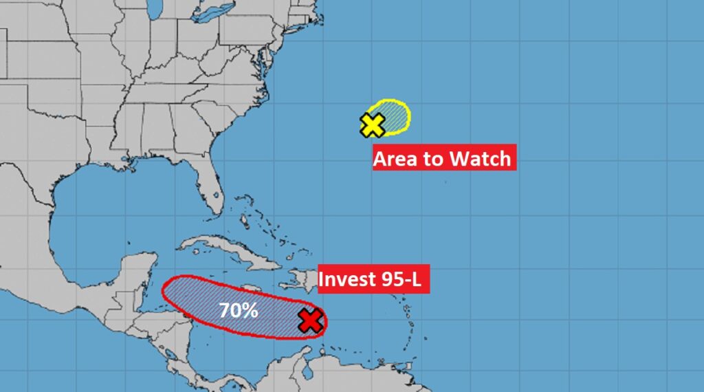
TROPICAL WEATHER: NHC is monitoring Invest 95-L in the Caribbean. It now has a high 70% chance of development in the next 5 days. Most of the models point this system toward Central America. There’s also an Area to Watch in the Atlantic.
Thanks for reading this Blog this morning! This morning we are LIVE on the radio from 6 to 9 on NewsTalk 93.1. Watch us on TV on CBS 8 and ABC 32. I’ll have another update for you in the morning. Have a nice day!
–Rich