
Good Morning! If you like comfortable, warm weather, the news is very good. But, we need some rain and the prospects are not good. Here’s my brief forecast discussion.
TODAY: Partial sunshine this morning will give way to a mostly sunny afternoon. Warmer. High 78. North wind at 5 to 10 mph. Mainly clear tonight. Low 55.
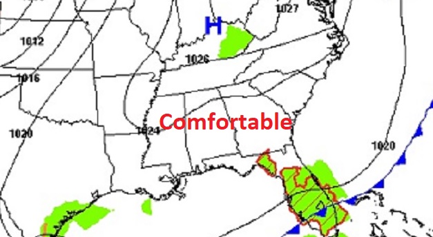
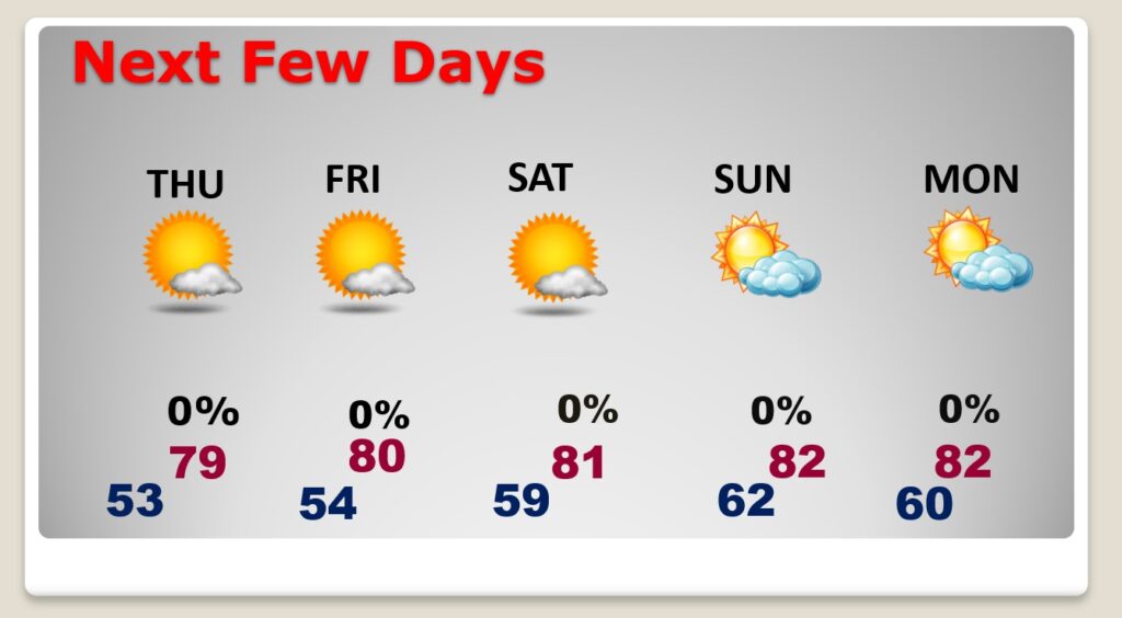
NEXT FEW DAYS: Our warm, comfortable pattern continues. There will be a good nit of sunshine. Highs in the upper 70’s Thursday. We’ll be near 80 on Friday. Perhaps lower 80’s Saturday and Sunday. Basically it’s a dry forecast. I’ll mention a tiny 20% chance on Saturday, but that’s very “iffy”.
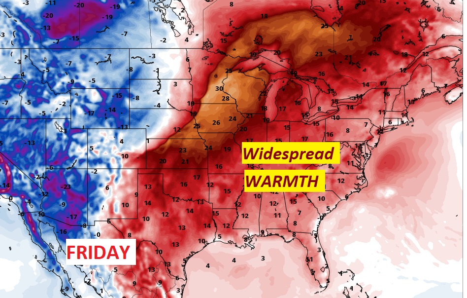
Call this Indian Summer. Widespread warmth will dominate the Eastern US and surge northward into Canada by late week.
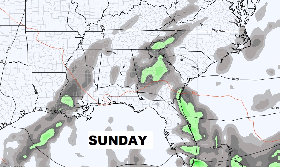
NEXT CHANCE OF RAIN?: Over the weekend a frontal system brings rain to Mississippi on Saturday. Showers may “tease” us Saturday PM. I’ll put in a 20% chance. But so far the GFS and EURO models show this system fizzling before it gets to Alabama. Our rain prospects for the next few days are not good.
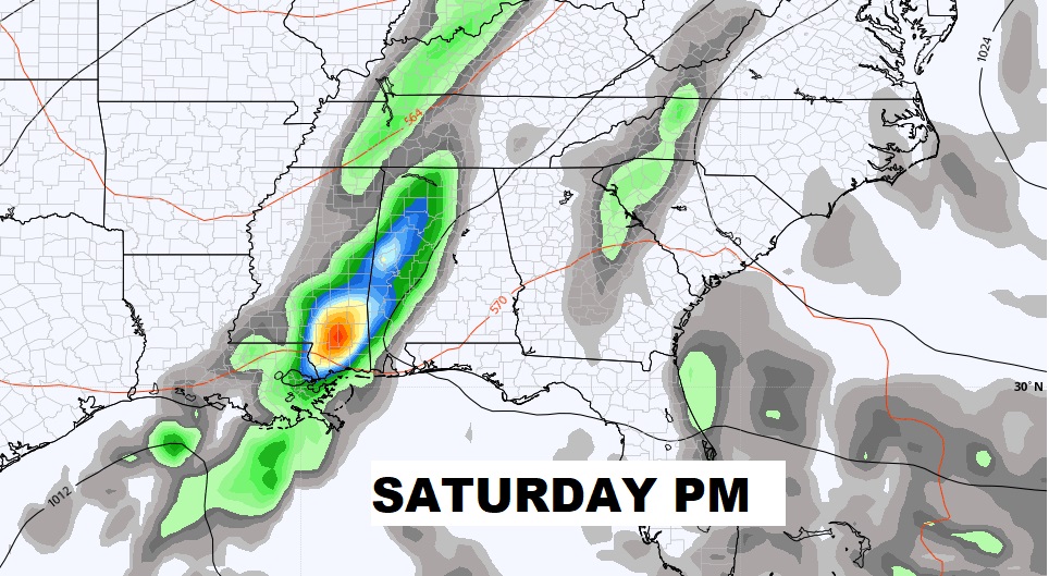
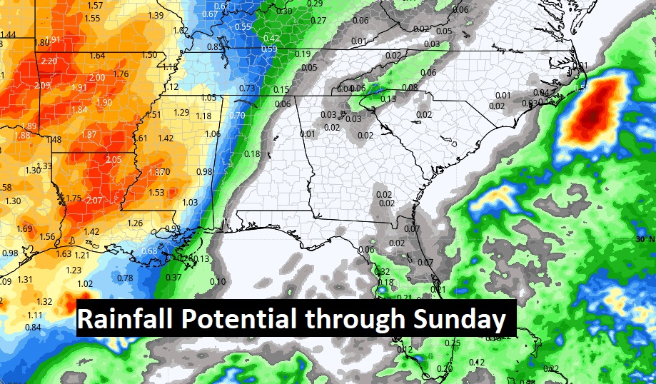
Here’s the model blend on projected rainfall through Sunday. Not good for us.
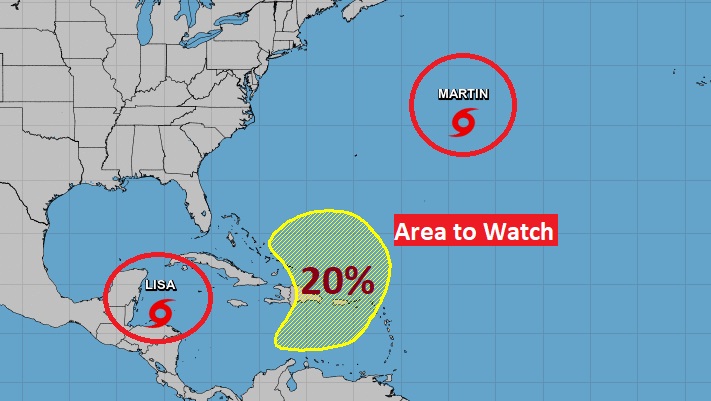
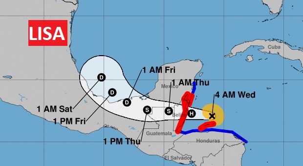
TROPICAL WEATHER: Tropical Storm Lisa is near the coast of Belize this morning, headed westward. Surprise in the mid Atlantic. NHC named Martin yesterday. A disturbance in the Bahamas has potentially interesting implications for the southeast United States next week. Stay tuned.
We’ll be watching the Future of Lisa. Could it curve into the SW Gulf in a few days. NHC says it could.
Thanks for reading this Blog this morning!
Just a personal note….I started broadcasting here in Montgomery, 45 years ago today. I started at WHHY, then 34 years as Chief Meteorologist at WSFA, and currently still very happy at Bluewater Broadcasting. Amazing. …A young 21 year-old boy from Sheffield Lake, Ohio, began broadcasting in Montgomery, Alabama forty-five years ago today.
–Rich