
Good Morning! Our near record warmth is over. Today will be a much cooler day. Meanwhile, we continue to watch the future movement of Nicole, currently aiming for the Florida east coast, before curving along the southeast coast. Could we see some of Nicole’s outer raindrops Thursday night into early Friday? It’s certainly possible. I’ll include the chance of some scattered rain. Here’s my brief forecast discussion.
TODAY: Mostly sunny, breezy & much cooler. High today 71. (Record high 87 from 1986) (Normal high 73) Northeast wind 10 to 20 mph, gusts to 25. Partly cloudy chilly tonight. Low 53. Sunrise this morning is 6:11 AM. Sunset is 4:50 PM.
We’re breezy and cool today, as we watch Nicole move toward the east coast of Florida. More on Nicole below.
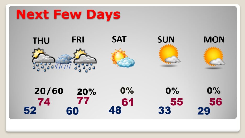
NEXT FEW DAYS:
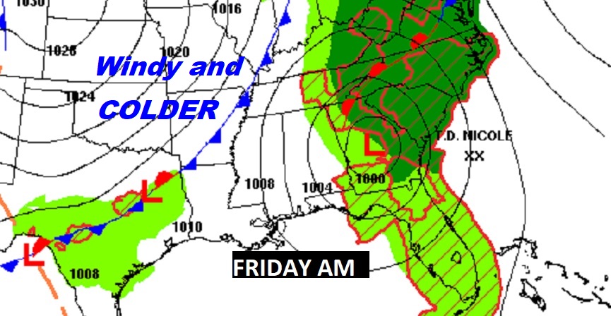
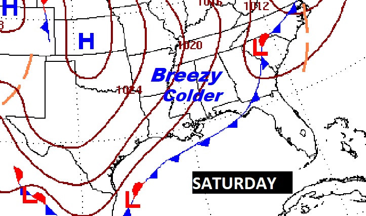
Thursday will be a dry/comfortable today, as we watch clouds increase ahead of Nicole’s landfall. Could we see some of Nicole’s outer raindrops Thursday night into early Friday? It’s certainly possible. I have increased the rain chance especially Thursday night. Friday’s high will be in the 70’s, but get ready for a big change. This weekend, we’ll see the coolest air of the season so far. Much cooler Saturday. Breezy. High near 60. We’ll fall to the lower 30’s by dawn Sunday. Sunday and Monday’s highs will only be in the mid 50’s. It’s possible we could fall below 30 by Monday morning.
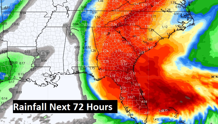
It will be a close call, but some of Nicole’s rainfall could spill into extreme east and perhaps central Alabama. Fingers are crossed. Take a look at the GFS and EURO Thursday evening at 9PM. Some of Nicole’s outer raindrops could reach westward into central Alabama.
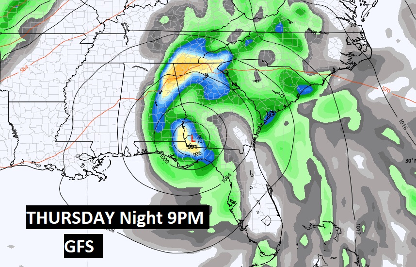
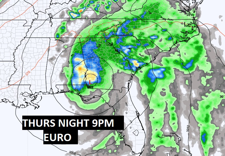
Here’s the model blend on potential rainfall.
On the way is another cold front which will bring in the coldest air of the season so far. Get ready for a change of wardrobe.
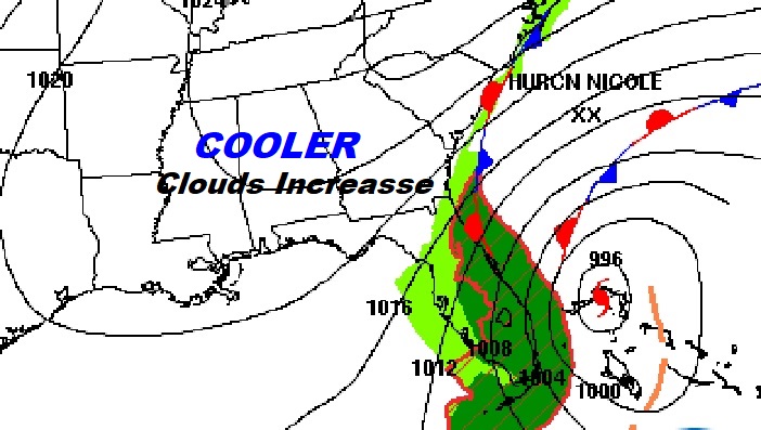
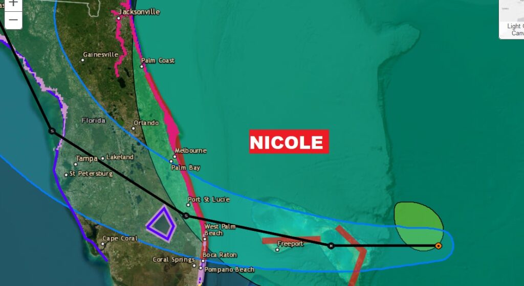
TROPICAL WEATHER: Tropical storm Nicole is not at hurricane status yet, but close, with winds of 70 mph. It’s 90 miles east of Great Abaco Island in the Bahamas, moving WSW at 13. Expected to me a minimal Cat 1 hurricane today. Expected to make landfall along the Florida coast late tonight, and then cross the state to the Gulf side, before making and extreme right turn toward the panhandle and then the Southeast Atlantic coast
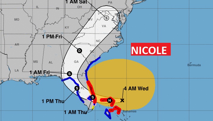
Hurricane Warning for portions of the Bahamas and the Florida east coast.
Thanks for reading this Blog this morning! This morning we are LIVE on the radio from 6 to 9 on NewsTalk 93.1. Watch us on TV on CBS 8 and ABC 32. I’ll have another update for you in the morning. Have a nice day!
–Rich