
Good Morning! A strong cold front moves through our state today. Behind it, much colder air will overspread the area. Get ready for a change of wardrobe. The normal hi/lo this time of year is 71/44. We will not see normal for the next 10 days, if not longer
TODAY: Today is little more complicated. A cold front in northwest Alabama pre-dawn will reach central Alabama by about lunchtime. A few isolated showers are possible ahead of the front. Most towns till stay dry. Today’s high temperature of 66 will happen by late morning. Expect falling temperatures this afternoon, reaching 53 by mid to late afternoon. Winds will be SW 5-10 ahead of the front, shifting to NW 10 to 20 mph behind the front this afternoon. Clear skies and much colder tonight. Low 34.


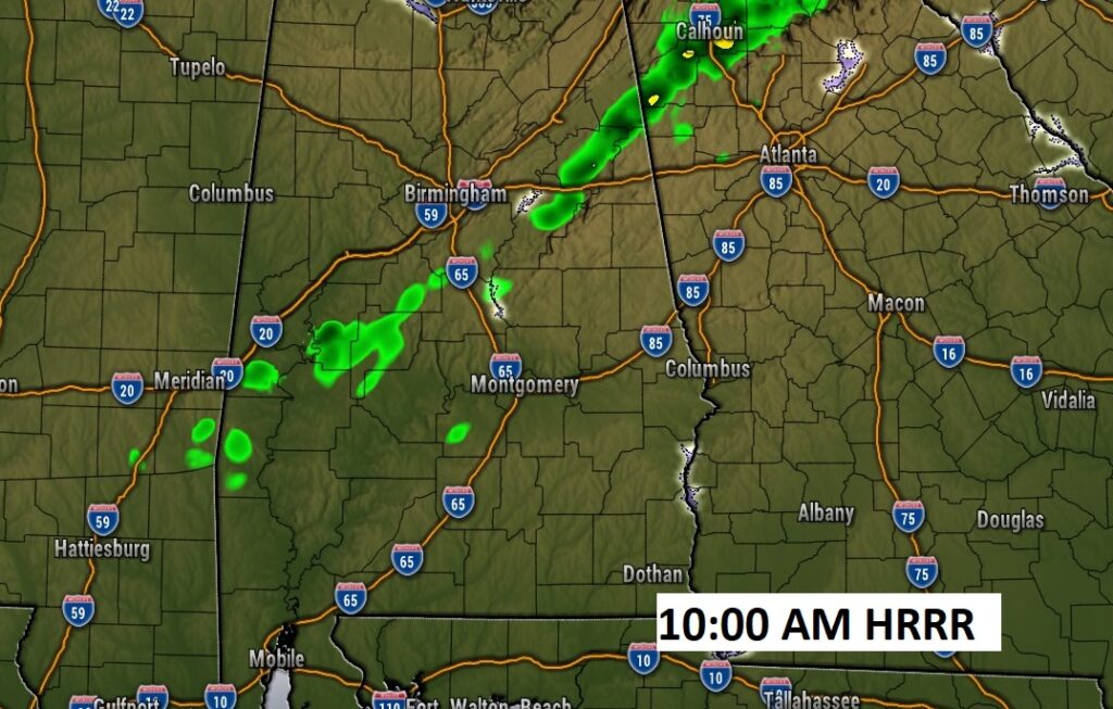
Here’s a Future Radar example at 10AM. A few isolated showers are possible ahead of the front. Most towns till stay dry.
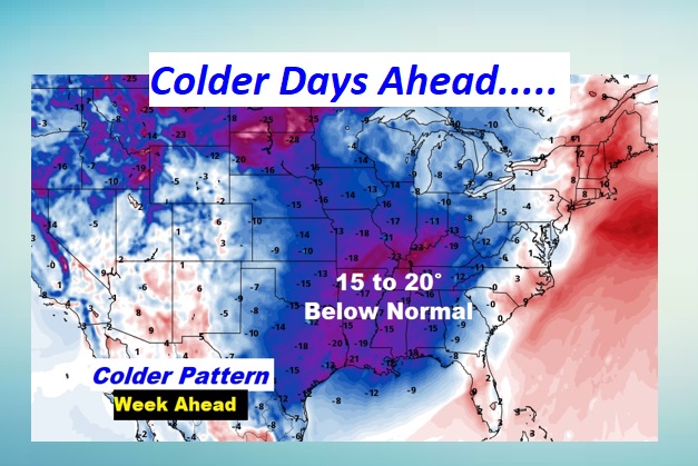
Behind the front, get ready for a big change. Temperatures will be running 15-20 degrees below normal.
NEXT FEW DAYS: Significantly cooler air is on the way. Sunday’s high will struggle to reach the mid 50’s. Monday morning we’ll be close to freezing at Dawn. We should be well below normal for the next several days. (Normal: 71/44)
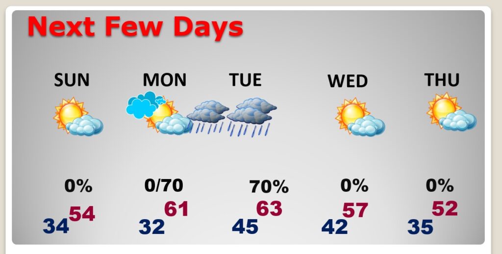
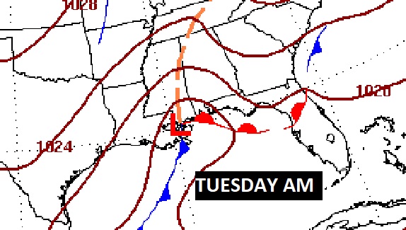
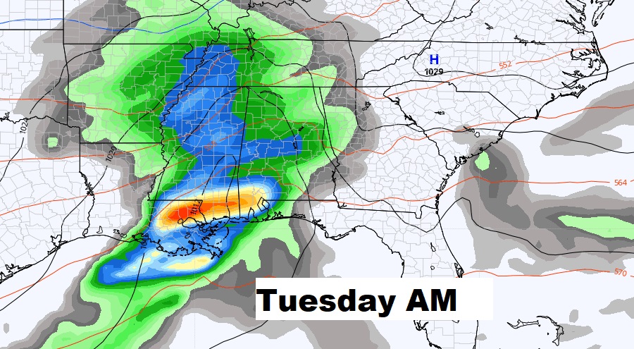
Another threat of rain returns to the forecast Monday night into Tuesday as a storm system moves eastward along the Gulf coast.
Here’s the model temperature blend for the next 10 days. If you like cold air, you’re in luck.

Thanks for reading this Blog this morning! I’ll have another update for you in the morning. Have a nice day!
–Rich