
8:00AM UPDATE:
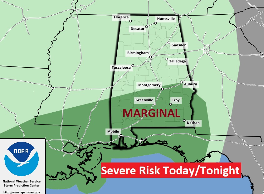
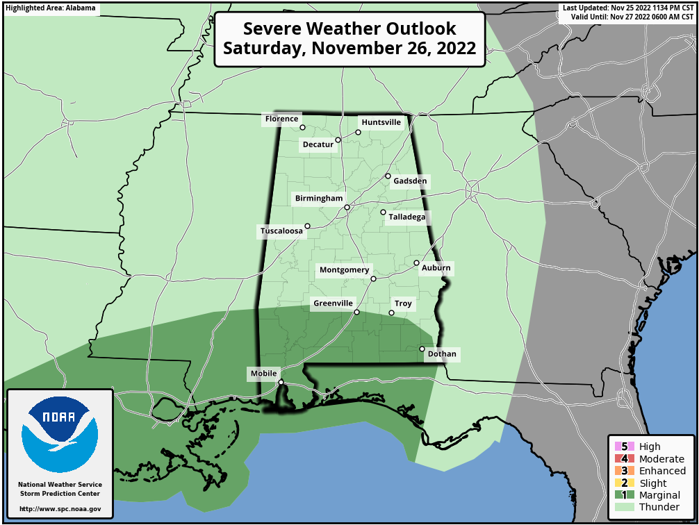
The Severe Weather Risk for today and tonight has been expanded northward. The Storm Prediction Center says there is a Marginal Severe Risk as far north as a Montgomery/Auburn line. Damaging wind gusts are the main risk. A brief tornado can’t be ruled out. #alwx
EARLY MORNING UPDATE:
Good Morning! Much of Saturday will be quiet. Expect a small chance of showers by late day. But, Saturday night will be quite stormy. Showers & storms will become numerous. A few strong storms are possible. Locally heavy rainfall is possible. Wind Advisory in effect for wind gusts up to 35 mph. There could be a more concerning storm system by Tuesday night into Wednesday. Potential severe weather threat. Here’s my very rare Saturday discussion video.
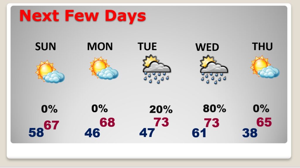
TODAY: Much of Today will be quiet. Expect a small chance of showers by late day. High today 67. But, tonight will be quite stormy. Showers & storms will become numerous. A few strong storms are possible. Locally heavy rainfall is possible. Wind Advisory in effect for wind gusts up to 35 mph. Low tonight 58.
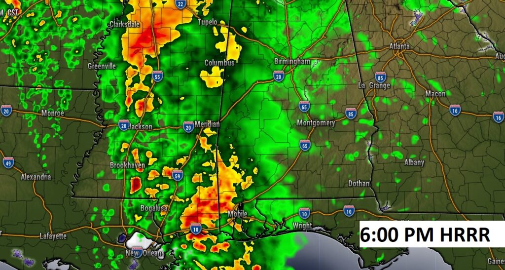
Here’s some Future Radar snapshots. Notice 6PM, showers covering much of west Alabama with the stronger storms still west of the Alabama border. So, for the Ironbowl in Tuscaloosa, the chance of showers will start to ramp up late in the game, but the BIG storms should hold off until after the storm. It’ll be a close call.
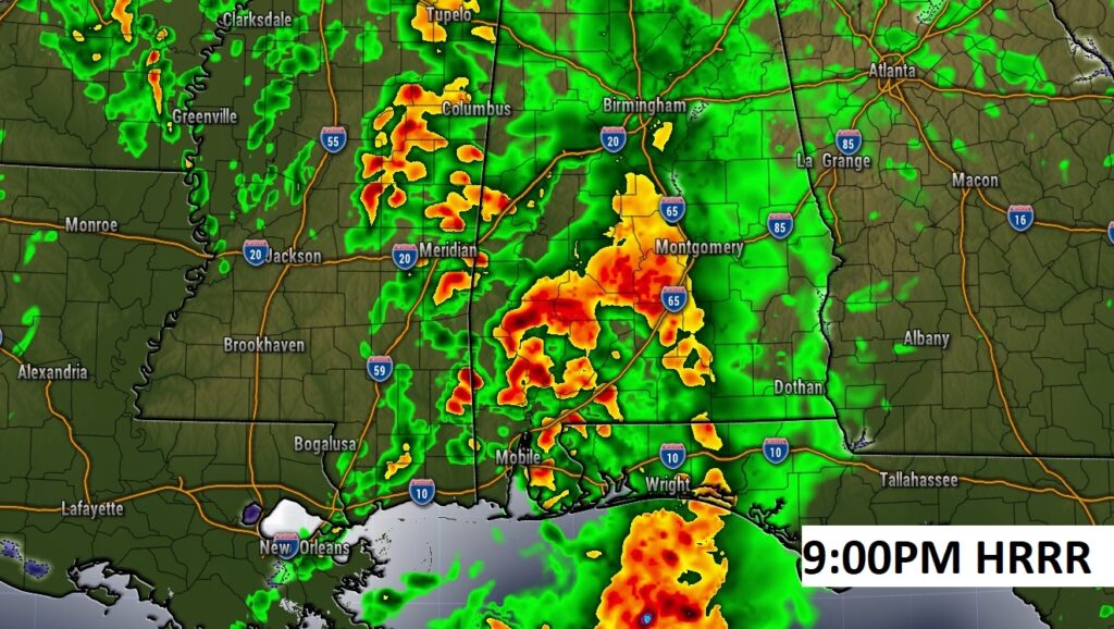
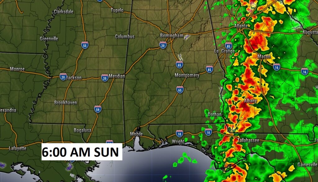
Notice at 9PM…rain and storms will be widespread across the area. Rainfall will be locally heavy. By 6AM Sunday, the rain shield should have exited the state.
SEVERE WEATHER THREAT covers much of South Alabama tonight. This Marginal Risk could be expanded northward if the warm front moves farther northward then expected.
NEXT FEW DAYS: Dry weather returns for Sunday, Monday. Becoming mostly sunny Sunday, and lots of sunshine Monday. Highs in the upper 60’s This could potentially be a Severe Weather Threat by Tuesday night into Wednesday.
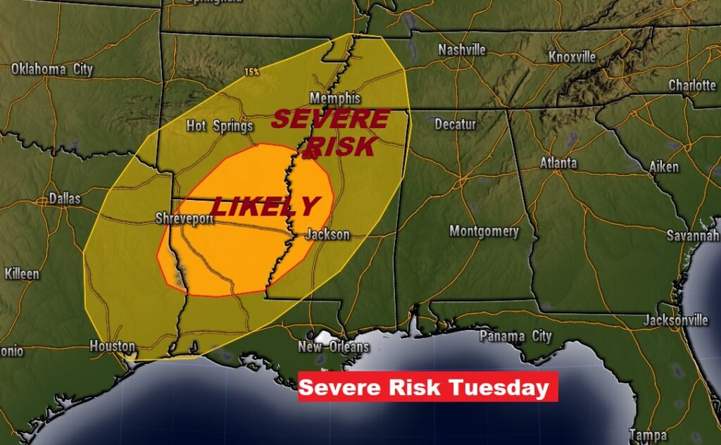
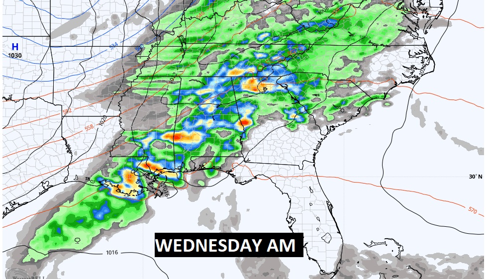
MID WEEK SEVERE THREAT: A significant storm system will affect Alabama Tuesday night into Wednesday. There’s a decent threat we will be under a Severe Weather Threat, including all modes of Severe Weather. In fact, it is interesting to note that SPC already has a rather significant severe threat already outlined just west of us on Tuesday.
We’ll know more and more about this storm threat as we get closer to the event.
Thanks for reading this Blog this morning! I’ll have another update for you in the morning. Have a nice day!
–Rich