
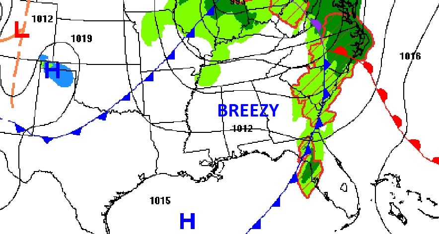
Good Morning! The storm system that brought drenching rains to the state last night has exited eastward. Skies will be mostly sunny today. It’ll be breezy, but near normal with highs in the mid to upper 60’s. Our new week will start quiet. Dry through at least mid-day Tuesday. Another storm system will bring another round of showers & storms to the state by Tuesday night into Wednesday.
TODAY: Windy at times today. Southwest winds gusting as high as 30 mph. Mostly sunny. High in the mid 60’s. Mainly clear tonight. Chilly, Low 46.
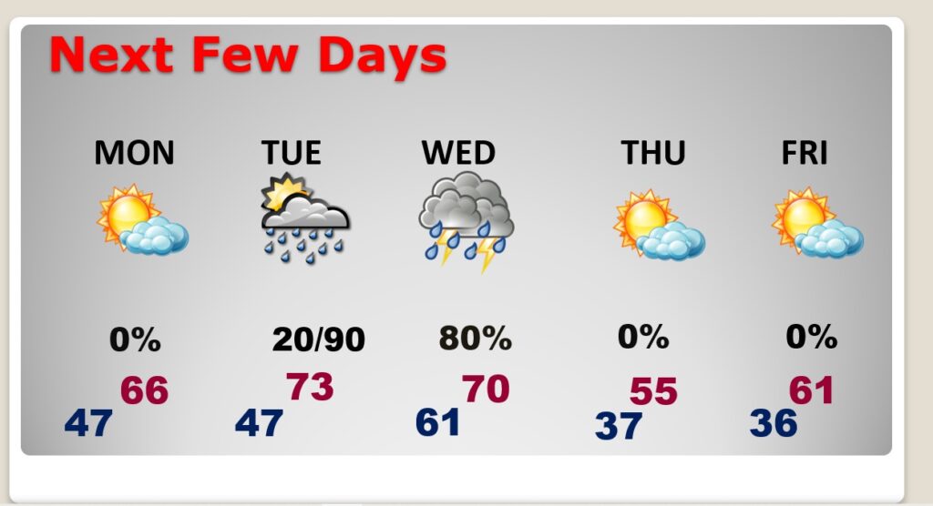
NEXT FEW DAYS: Good bit of sunshine Monday. High in the mid to upper 60’s. Warmer Tuesday…high in the low to mid 70’s. Small rain chance Tuesday afternoon. Increasing chance of showers and storms Tuesday night and through mid-day Wednesday. Breezy and much cooler Thursday. High barely near 60. Chilly Thursday night with lows in the 30’s. A little milder Friday.
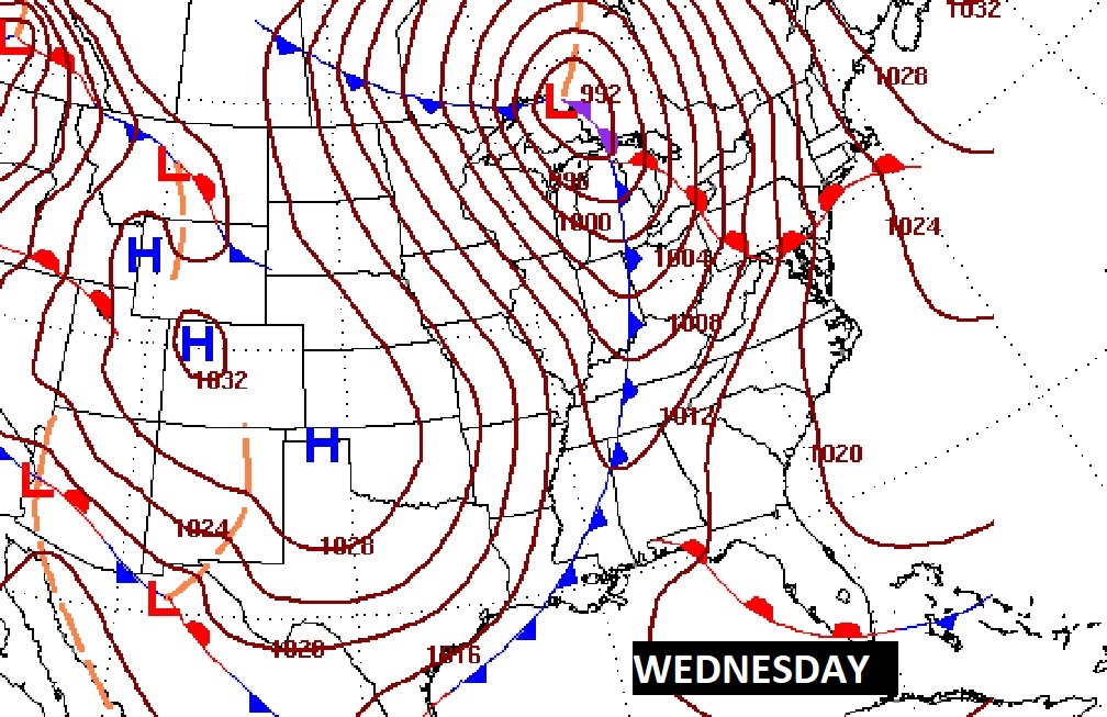
MID WEEK STORM SYSTEM: A significant storm system will affect Alabama Tuesday night into Wednesday. There’s a decent chance we will be under a Severe Weather Threat. SPC already has a rather significant severe threat already outlined just west of us on Tuesday. The extent of the severe weather threat when this system reaches Alabama is still up for debate. Some of the severe weather dynamics will start to pull away from the state to the north. So, there are big question marks about what the threat level will be here.

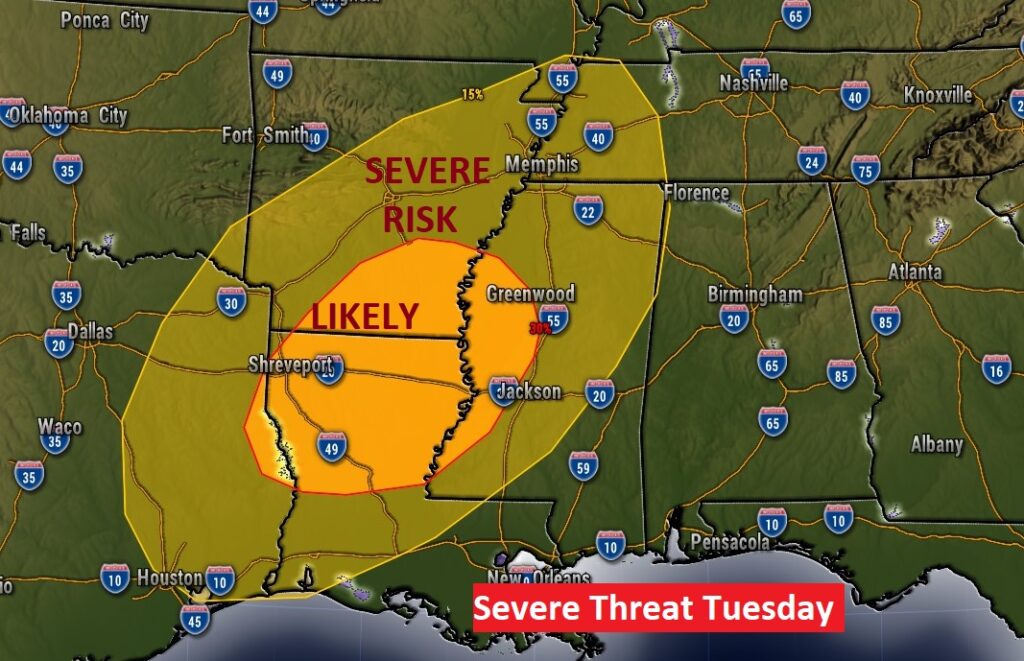
We’ll know more and more about this storm threat as we get closer to the event.
Thanks for reading this Blog this morning! I’ll have another update for you in the morning. Hope you have had a nice Thanksgiving weekend so far. Have a nice Sunday.
–Rich