
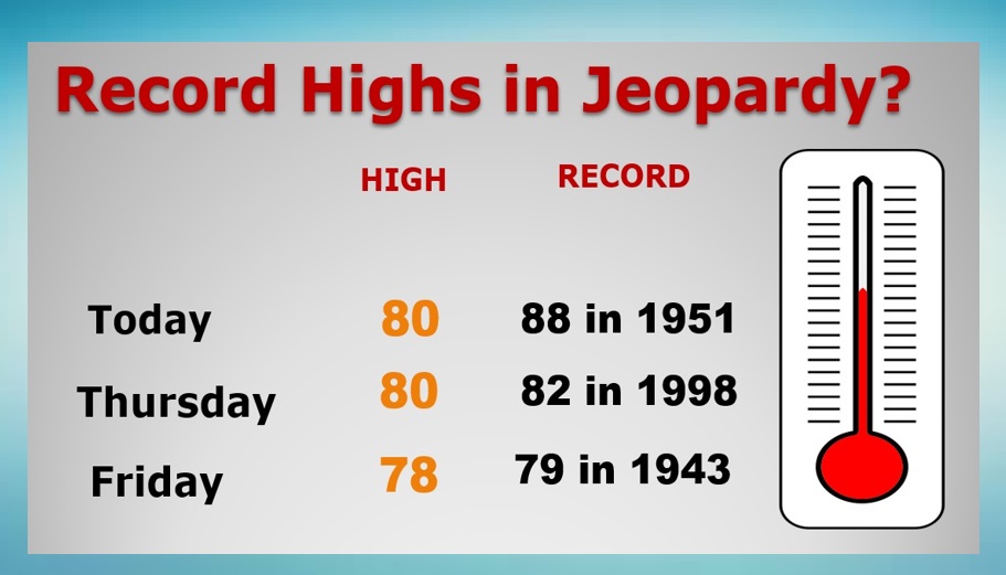
Good Morning! Our unusually warm December pattern continues. We’ll flirt with 80 again today and Thursday. Cool front approaches Friday. Small chance of showers. Somewhat cooler by Saturday but not by much. Here’s my brief forecast discussion.
TODAY: Variable cloudiness. Rain chances generally 20% or less. Usually warm for December. High near 80. SW wind 5 to 10 mph. Cloudy at times tonight. Very mild. Low 60.
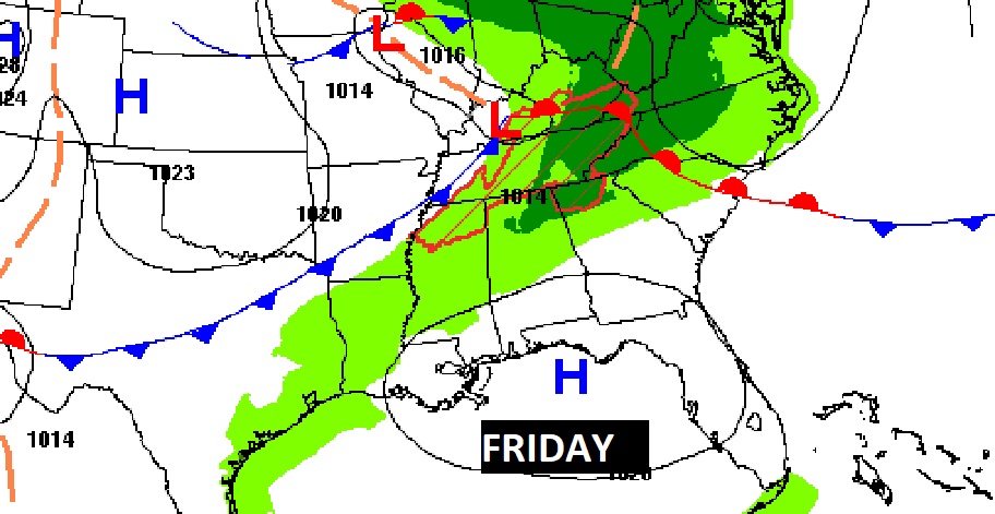
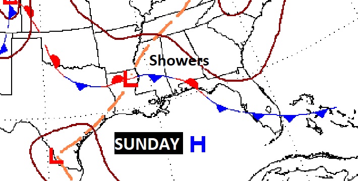
NEXT FEW DAYS: Spring-time in December continues. Near 80 again Thursday A Cool front approaches Friday. Small chance of showers. But, still near a record high. Cooler by Saturday. High near 70. Scattered showers return Sunday.
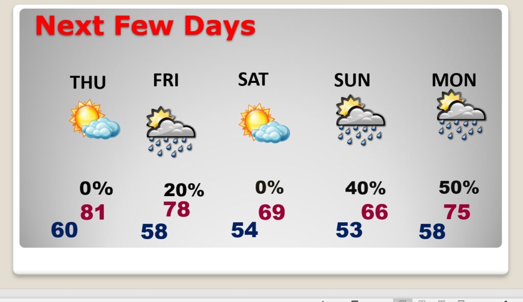
Over the next 5 day, the best chance of a few showers will be Friday and Sunday.
We could flirt with record highs perhaps by Thursday & Friday.
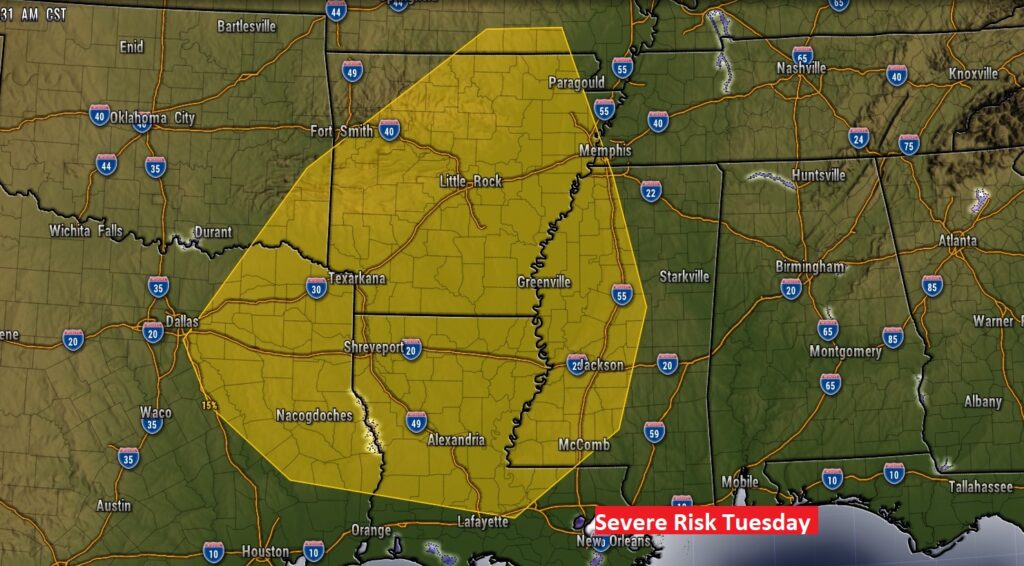
Looking ahead, it appears the next “big-ticket” weather event, could be by the middle of next week.
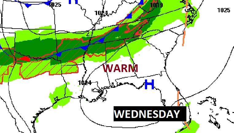
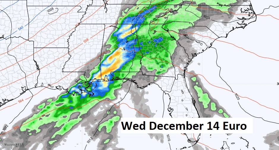
Right now, SPC has a Severe Risk over the lower Mississippi River Valley Tuesday. But, will this system still have a severe potential when it arrives in Alabama Wednesday?
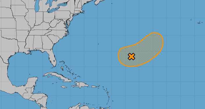
TROPICAL UPDATE: NHC is still monitoring Invest 99-L in the central Atlantic. Next available name is Owen.
Thanks for reading this Blog this morning! This morning we are LIVE on the radio from 6 to 9 on NewsTalk 93.1. Watch us on TV on CBS 8 and ABC 32. I’ll have another update for you in the morning. Have a nice day!
–Rich