
Good Morning! Our unusually warm December pattern continues. We’ll flirt with near record highs again today and Friday. We should be dry today through most of the day Saturday. Rick of showers returns by Saturday night into Sunday. The next significant weather system will affect the area by the middle of next week. Here’s my brief forecast discussion.
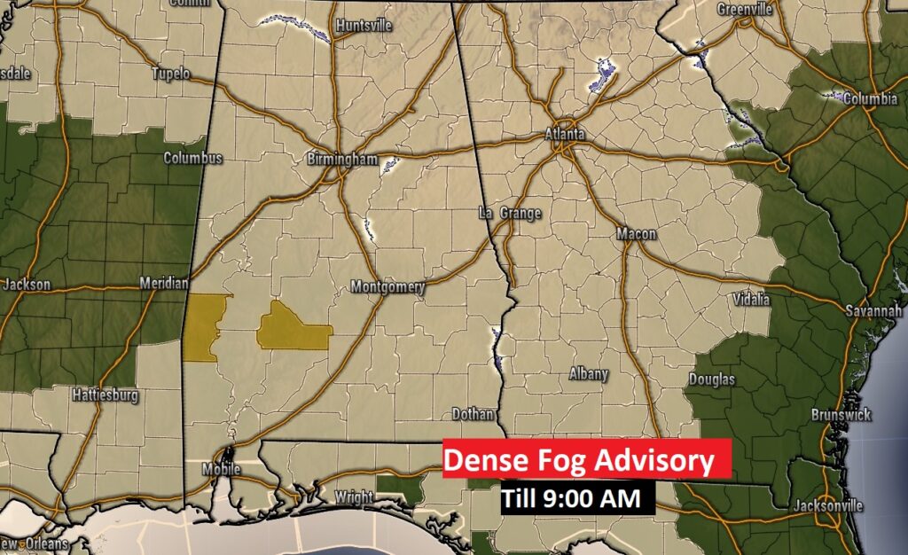
TODAY: Dense fog advisory this morning until 9AM. Visibility near or below ¼ mile in spots.
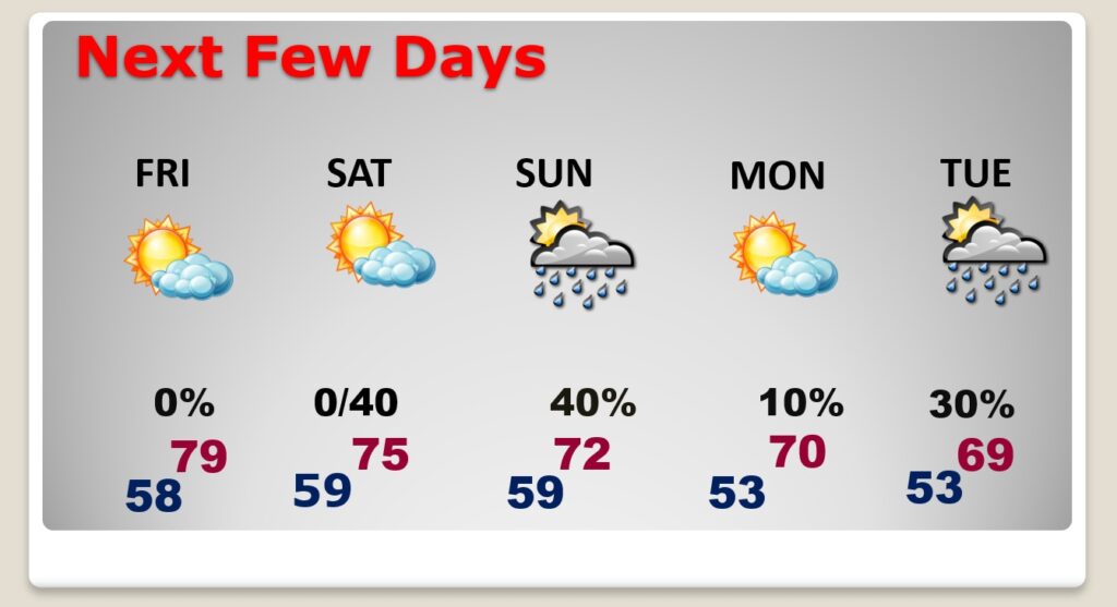
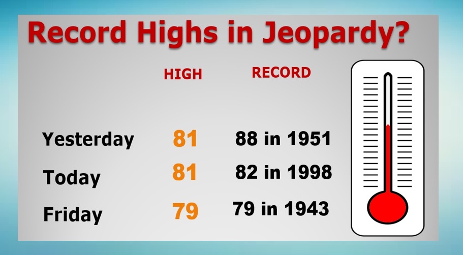
After the fog, we should see a good bit of sunshine today. Usually warm for December. High near 81. (record high 82 from 1998) West wind 5 to 10 mph. Partly cloudy tonight. Patchy fog late. Very mild. Low 59. Another risk of showers returns Tuesday.
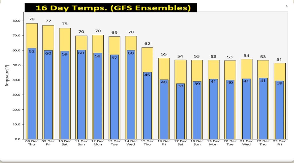
NEXT FEW DAYS: Spring-time in December continues. Near 79 again Friday Still very warm Saturday. High in the mid 70’s Scattered showers return Saturday night and Sunday.
We could flirt with record highs perhaps by Thursday & Friday.
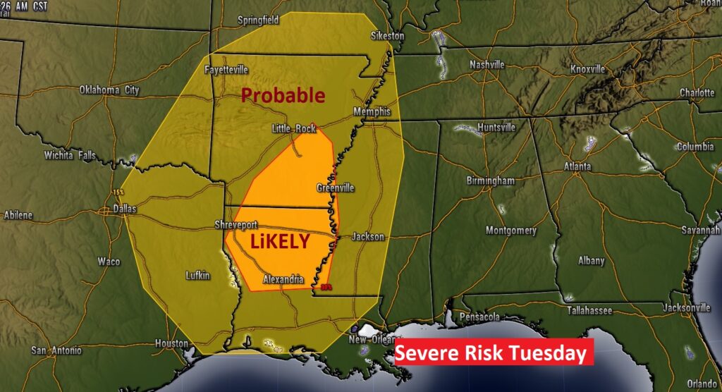
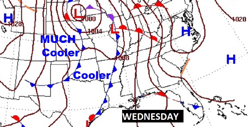
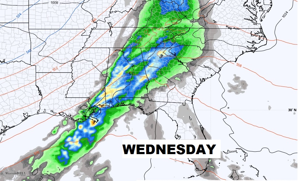
Looking ahead, it still looks like the next “big-ticket” weather event, could be by the middle of next week. Showers and maybe some stronger storms. In fact SPC has a rather significant Severe Risk west of us on Tuesday. Will severe weather translate eastward Wednesday.
Following the two cold fronts Wednesday and late Thursday, temperatures will turn sharply cooler from about Friday the 16th and beyond.
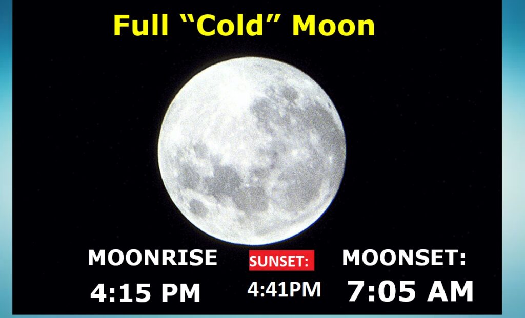
Full “Cold” Moon out there this morning.
Thanks for reading this Blog this morning! This morning we are LIVE on the radio from 6 to 9 on NewsTalk 93.1. Watch us on TV on CBS 8 and ABC 32. I’ll have another update for you in the morning. Have a nice day!
–Rich