
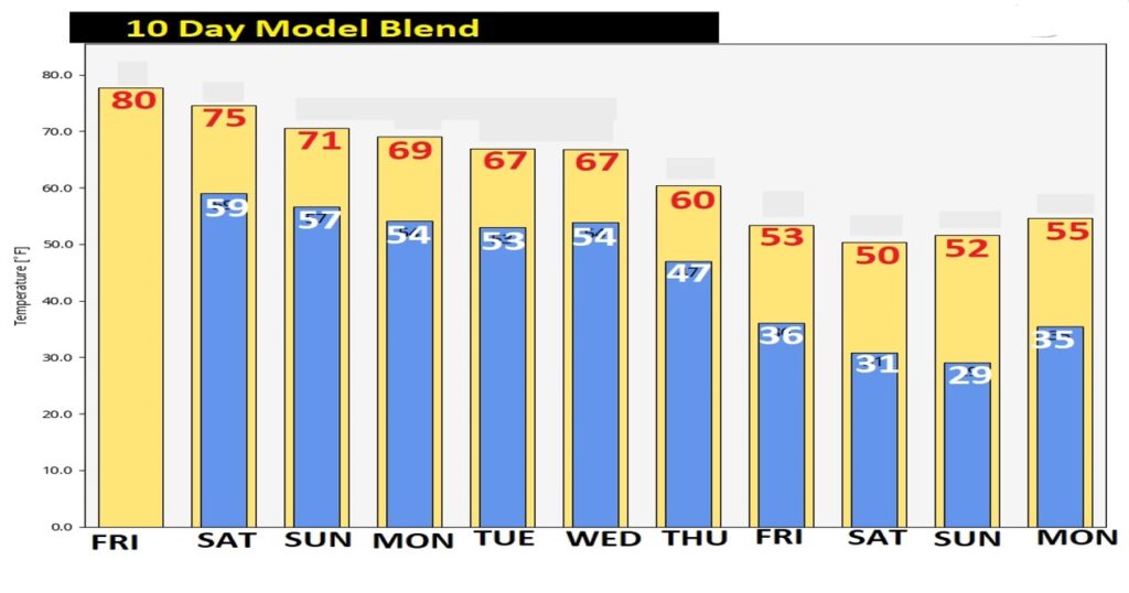
Good Morning! Our unusually warm December pattern continues. Looks like we have a good chance to break a 79 year-old record today. We should be dry today through most of the day Saturday. Rick of showers returns by Saturday night into Sunday. The next significant weather system will affect the area by the middle of next week. Will it involve Strong/Severe storms? And, attention cold weather fans. You’ll love seeing the 10 day temperature graph. Here’s my brief forecast discussion.
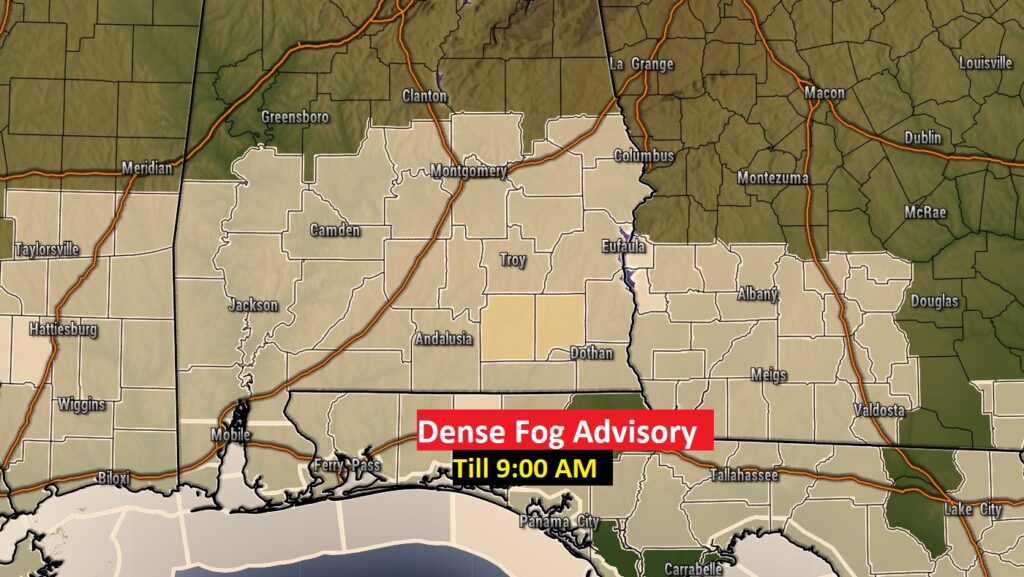
TODAY: Dense fog advisory this morning until 9AM. Visibility near or below ¼ mile in spots.
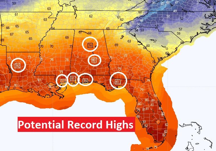
After the fog, we should see a good bit of sunshine today. Another very warm December day. High near 81. (record high 79 from 1943) West wind 5 to 10 mph. Partly cloudy tonight. Patchy fog late. Very mild. Low 61.
Several Record Highs could be broken across the Gulf South today.
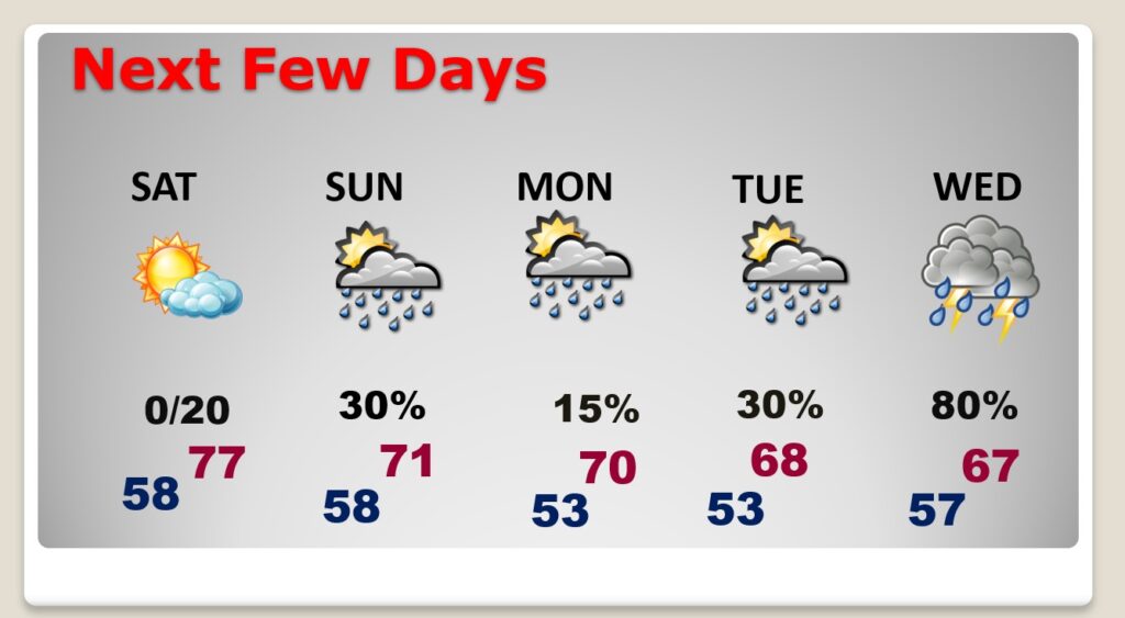
NEXT FEW DAYS: Still very warm Saturday. High in the mid 70’s Scattered showers return late Saturday night and Sunday. Small rain chance Monday through Tuesday. Showers and storms likely Wednesday.
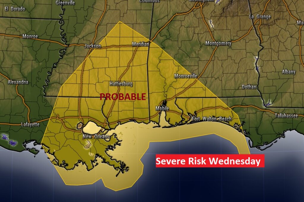
Still looks like the next “big-ticket” weather event, could be by the middle of next week, as the first of two cold fronts approaches. Showers and maybe some stronger storms. Will it be severe? Very possibly.
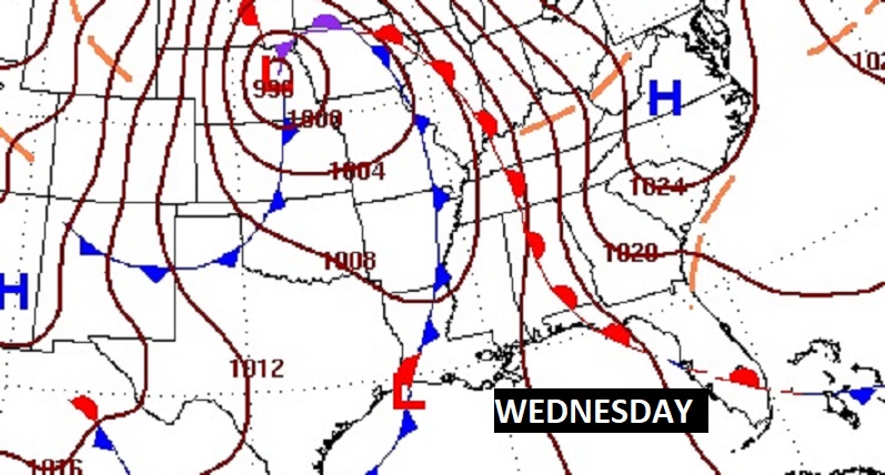

SPC already has outlined a significant Severe Risk just west of us Tuesday in the lower MS valley. Spreading eastward into much of SW Alabama on Wednesday. Stay tuned. This threat will be refined as we get closer to the event.

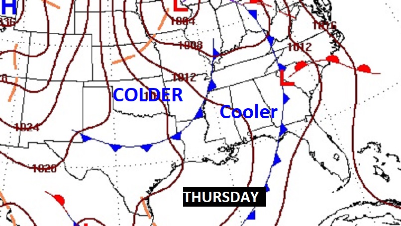
Following the two cold fronts late next week, temperatures will turn sharply cooler from about Friday the 16th and beyond.
Thanks for reading this Blog this morning! This morning we are LIVE on the radio from 6 to 9 on NewsTalk 93.1. Watch us on TV on CBS 8 and ABC 32. I’ll have another update for you in the morning. Have a nice weekend!
–Rich