
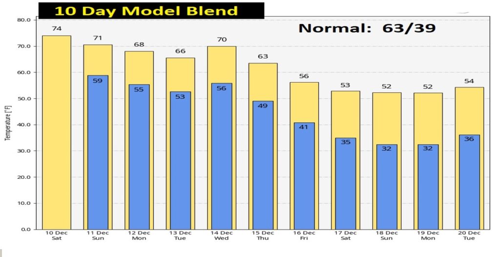
Good Morning! We have had an incredible string of usually warm days. Yesterday was the 4th day in a row of 81 degrees. It broke the record. Not quite as warm today, but still above normal. Widely scattered showers are possible late today/tonight. But, showers become likely Sunday. The main storm system this week arrives Wednesday. Much cooler air will follow the storm system, especially by next Friday and beyond.
TODAY: Dense fog advisory again this morning until 9AM. Visibility near or below ¼ mile in spots.
After the fog, we should see partial sunshine today. Comfortable….still above normal. . High near 76. West wind 5 to 10 mph. Isolated showers are possible late today and tonight, but the chance is very small. Very mild tonight. Low 59.
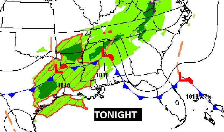
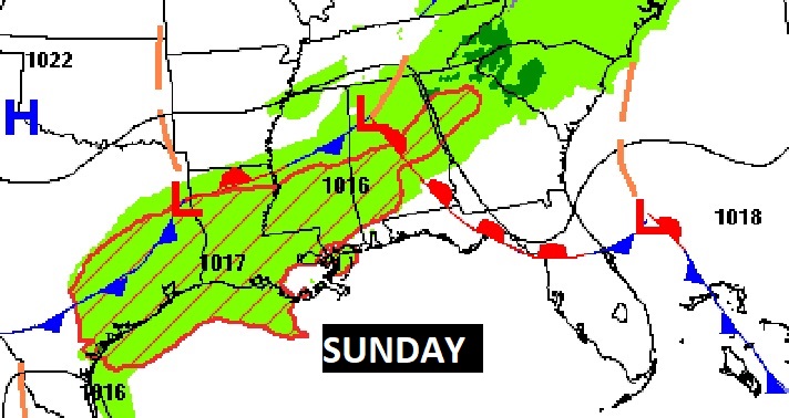
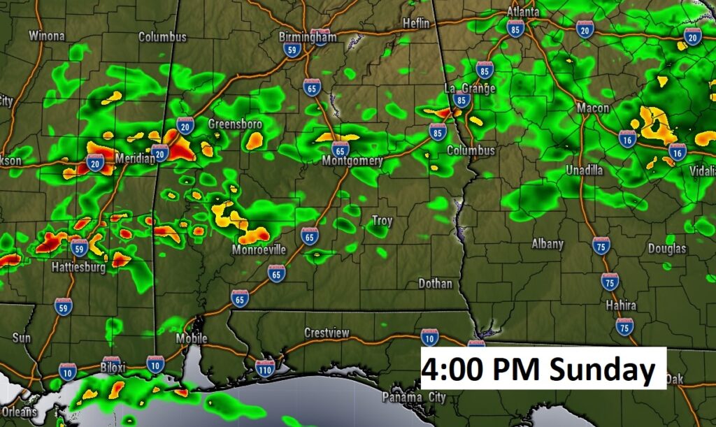
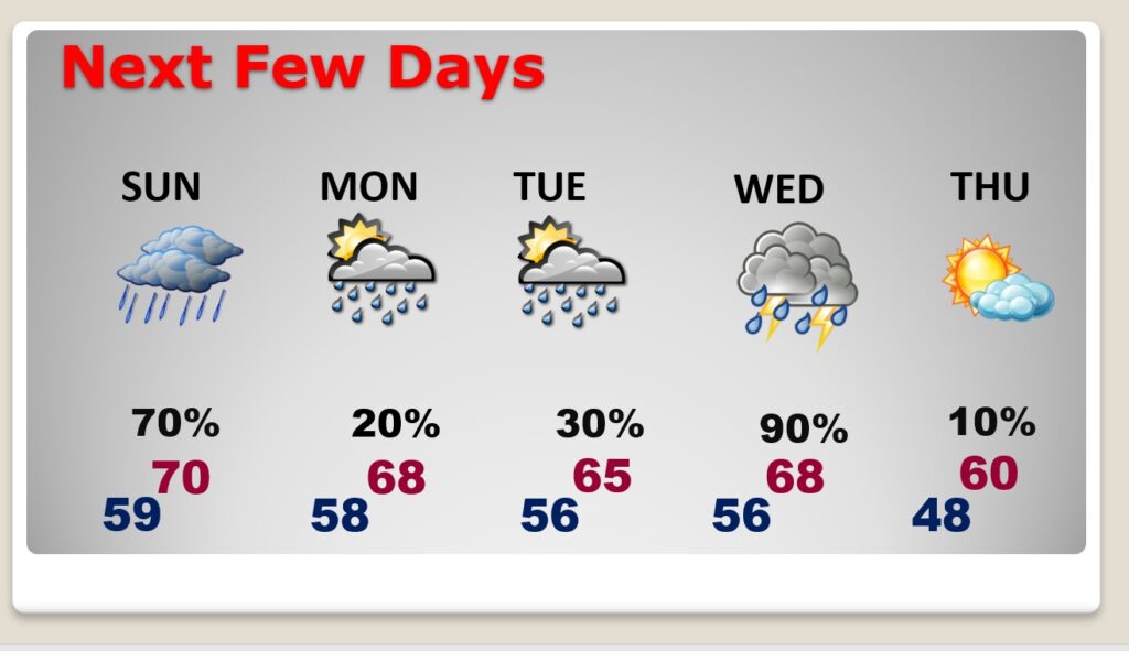
SUNDAY: Wet at times Sunday. Showers are likely. High near 70.
NEXT FEW DAYS: Small rain chance Monday through Tuesday. Showers and storms likely Wednesday. Cooler Thursday.
We’ve been talking about the next storm system for several days. There’s no doubt it. This will be a big deal storm system coast to coast. Across the South, this storm system will be the catalyst for severe weather.
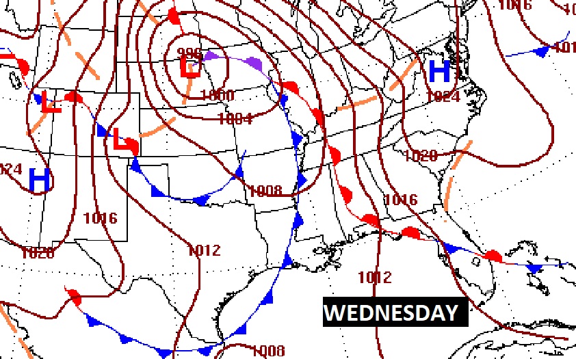
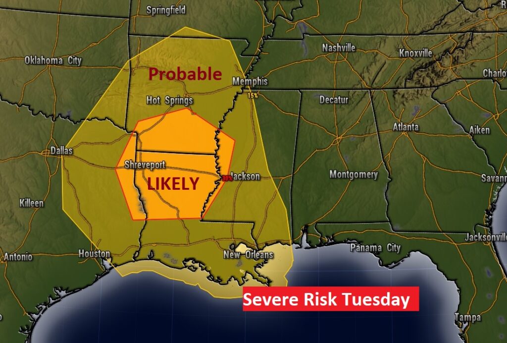
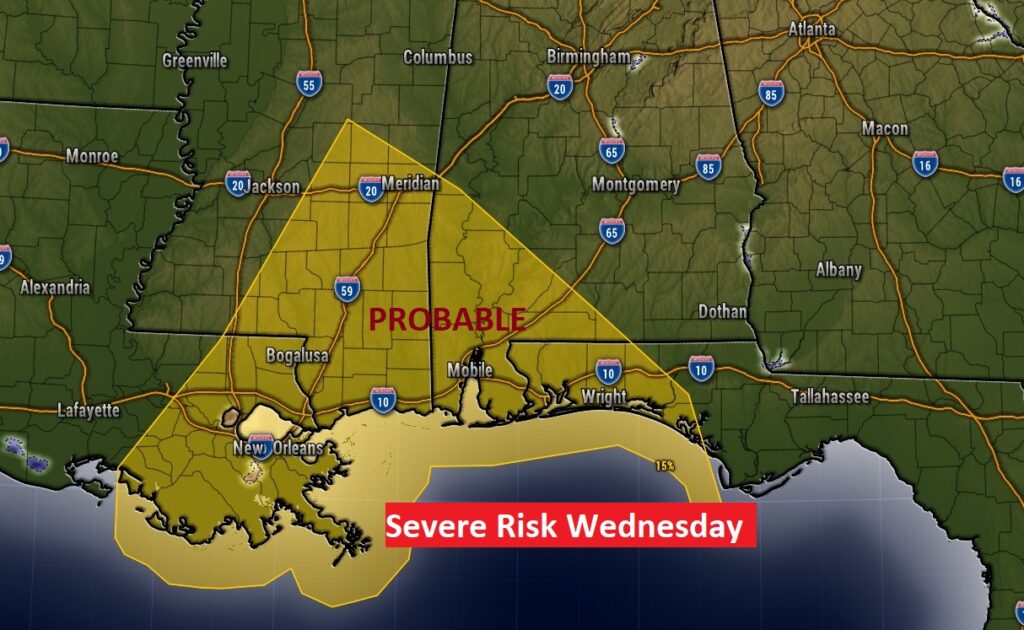
The Storm Prediction Center has outlined a rather significant Severe Risk west of us in Mississippi, Louisiana, Arkansas and Texas on Tuesday, including the threat of tornadoes. On Wednesday, SPC shows the strongest severe weather threat across SE Mississippi and SW Alabama. We’ll continue to watch for any changes in this threat level as we get closer to this event.
Following the two cold fronts late next week, temperatures will turn sharply cooler from about Friday the 16th and beyond.
Thanks for reading this Blog this morning! I’ll have another update for you in the morning. Have a nice day!
–Rich