
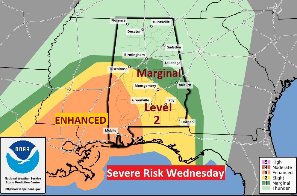
Good Morning! Today will be relatively quiet. But, hang on. We have a major storm system approaching. This system will bring severe weather to parts of Alabama, along with the threat of locally heavy rainfall. The Enhanced Risk noses into southwest Alabama. That’s concerning. The Level 2 threat has been expended to about Montgomery. The Marginal Risk covers the rest of the area. All modes of severe weather are possible including tornadoes and damaging wind gusts. Much cooler air will follow the storm system, especially by Friday and beyond. A complete change of climate. Here’s my brief forecast discussion.
TODAY: Expect another cloudy day today. Isolated showers are possible today and tonight. High today 63 East wind at 10 to 15 during the day, increasing to 15-20 mph , gusting to 25 tonight. Not too cool tonight. Low 54. (Normal low 39)
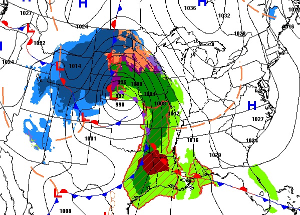
Meanwhile, look at the monster storm crossing from the west into the middle of the country. Look at that dangerous Severe Weather Risk, particularly across Texas through Louisiana into Mississippi with a Level 3 ENHANCED risk.
SEVERE WEATHER THREAT: The Day one threat (through 6AM Wednesday) shows the severe weather threat staying west of us.
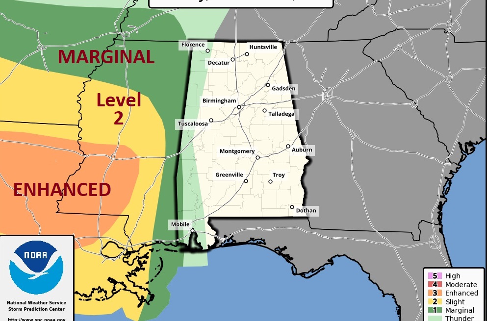
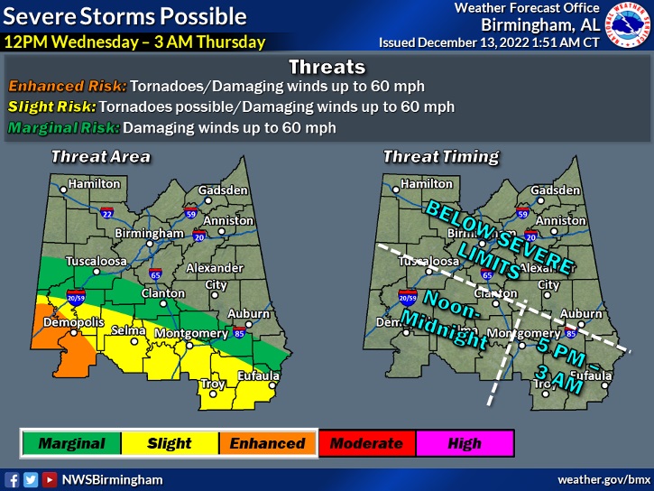
But, Day 2, Wednesday is a very different story. The Enhanced Risk noses into southwest Alabama. That’s concerning. The Level 2 threat has been expended to about Montgomery. The Marginal Risk covers the rest of the area. All modes of severe weather are possible including tornadoes and damaging wind gusts.
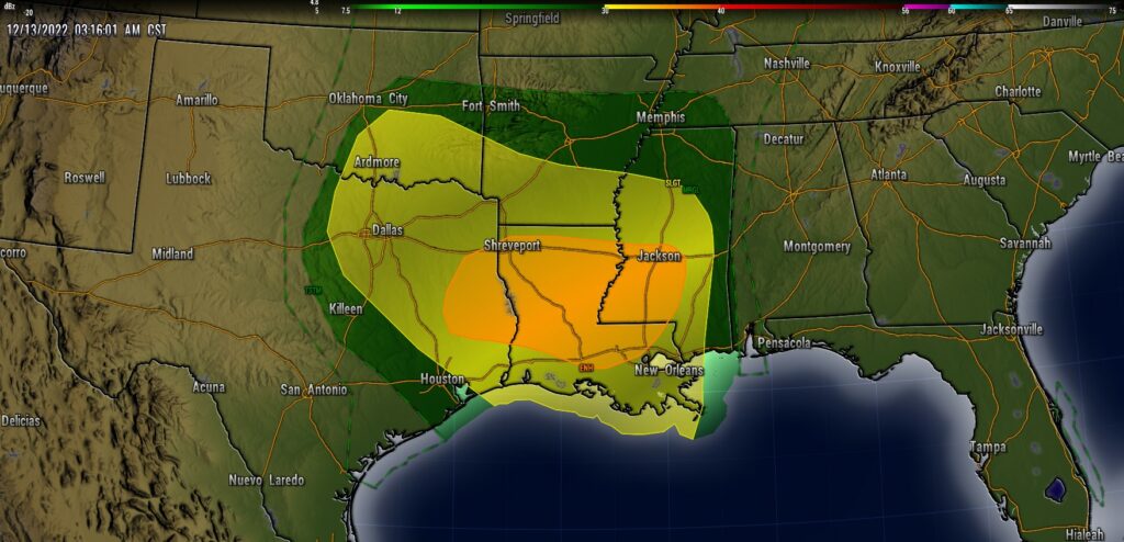
This map is helpful on timing. It’s a large window. As early as Noon in the far SW counties till as late as 3AM in the far SE counties.
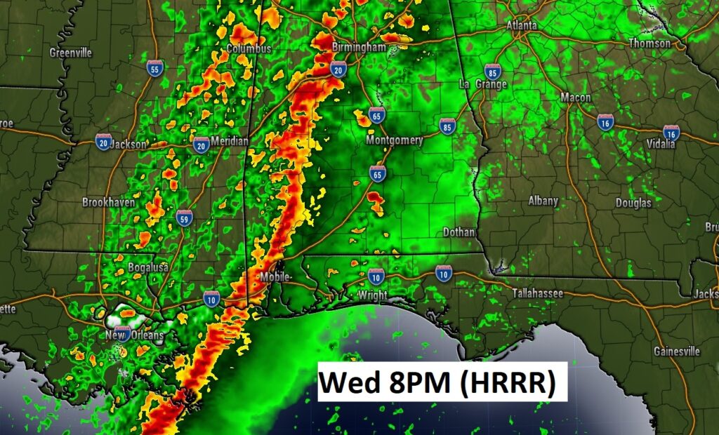
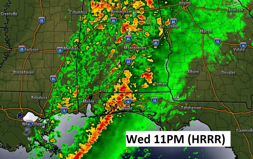
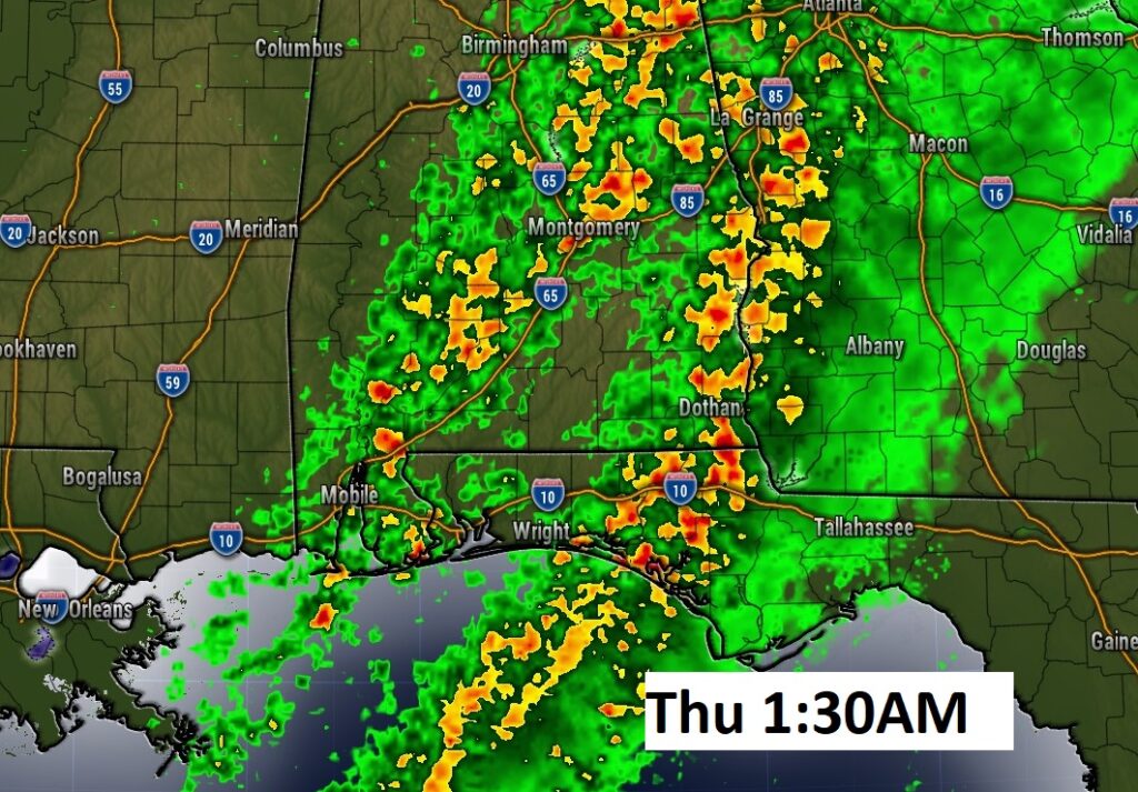
These future radar snapshots give you just a general idea on the potential timing of the main line of storms.
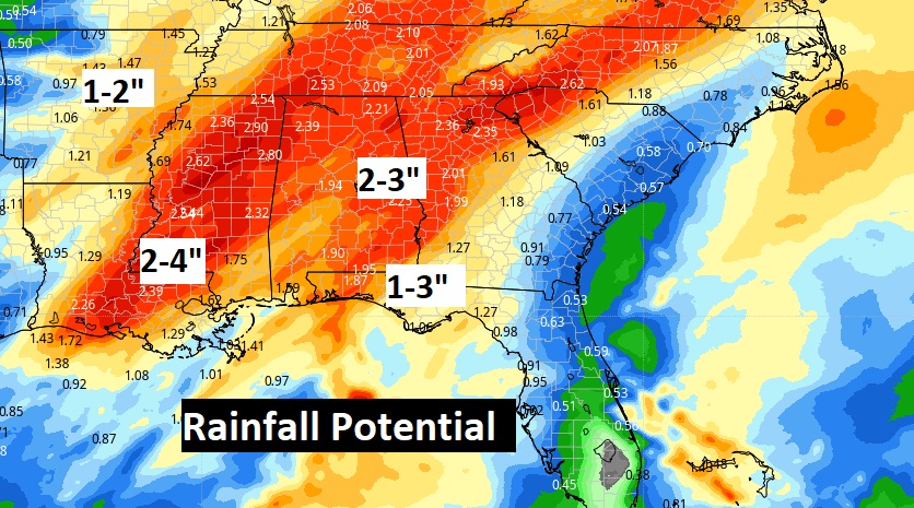
Locally heavy rainfall amounts are expected.
This storm system will be a HUGE snow storm for multiple state. It will be a major headline producer with blizzard conditions in spots.
NEXT FEW DAYS:
Expect MUCH cooler air by late week. A BIG change of climate.
Thanks for reading this Blog this morning! This morning we are LIVE on the radio from 6 to 9 on NewsTalk 93.1. Watch us on TV on CBS 8 and ABC 32. I’ll have another update for you in the morning. Have a nice day!
–Rich