Good Morning from Montego Bay! Are you sitting down? Perhaps you should. The story I have to tell on this Blog Update is borderline shocking. Today and chilly, but much of the week will be cold & wet at times. But, the big story involves a Arctic Blast Temperature Plunge Shocker ahead for Christmas Weekend. The forecast numbers keep getting colder, and wind chill numbers could be kind of brutal. Check out the new details, including the timing and numbers on this Blog update. Here’s my brief forecast discussion.
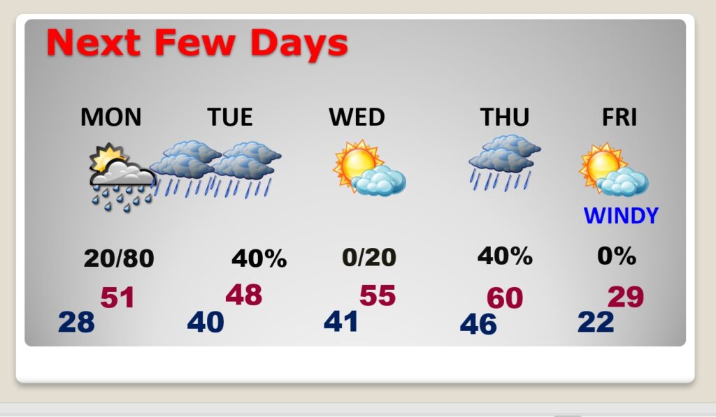
TODAY: Sub-freezing this morning. (Upper 20’s at Dawn) Very CHILLY Day, again. Yesterday’s high was only 49. I have us near 50. Mostly sunny. Breezy. West wind 10 to 15. Mostly clear and cold tonight. Low, by Dawn Sunday, in the upper 20’s. NOTE: With the sunshine today…this day will be one of the nicest days of the week. Much of the week (forgive me) will suck.
NEXT FEW DAYS: A Gulf coast disturbance will increase the clouds Monday. Small chance of rain daytime, but a better chance Monday night in through much of the day Tuesday. A COLD miserable rain. We get a little break Wednesday. Wednesday’s high of 55 will seem like a heatwave. Rain returns late Wednesday night into Thursday and a STRONG Arctic Cold Front Approaches. Rain at times Thursday into Thursday evening. Windy and COLD late Thursday night. Friday’s forecast is FRIGID. High of 29. Mid teens Friday night. Wind chill by Saturday morning, perhaps near ZERO as Montgomery.
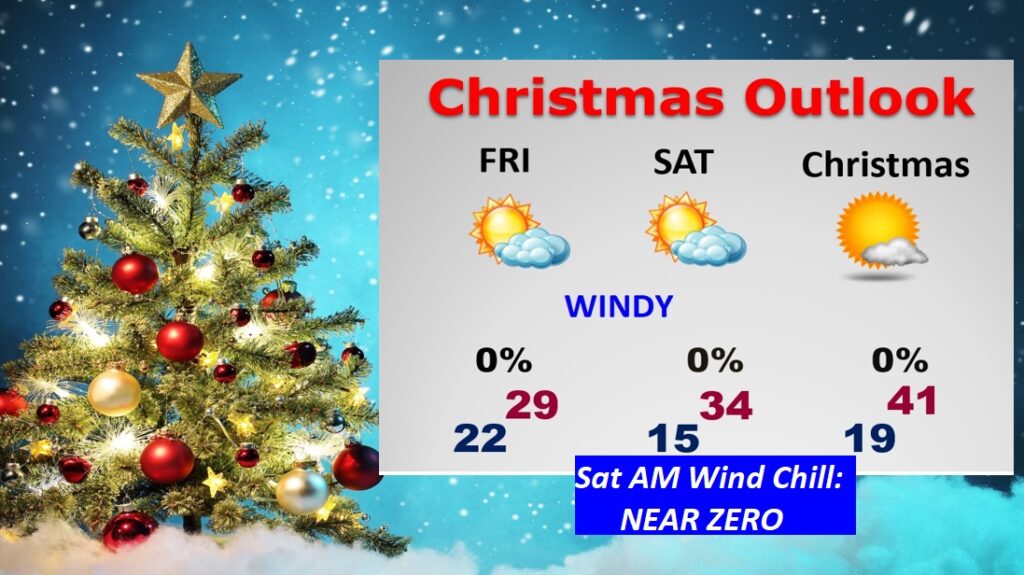
Attention Cold Weather Fans…get ready for a Late Christmas Week Temperature Arctic Blast SHOCKER. TAKE A LOOK AT THE NUMERS BELOW! Starting Friday and through Christmas weekend. GULP.
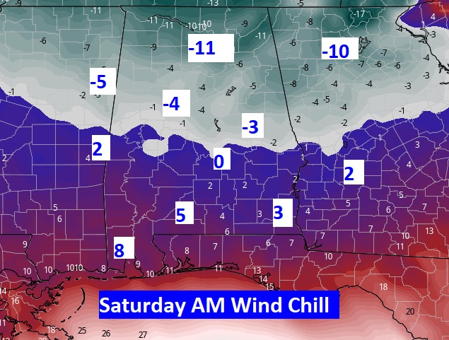
Good God. Check out the potential wind chill numbers by Dawn Saturday. I’m not joking. This is serious Arctic COLD. Get ready.
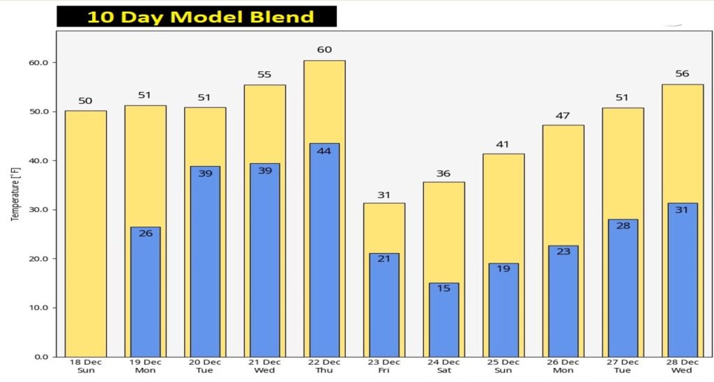
Here’s the 10 day Model Temperature Blend. Temperatures will be slow to recover after Christmas weekend.
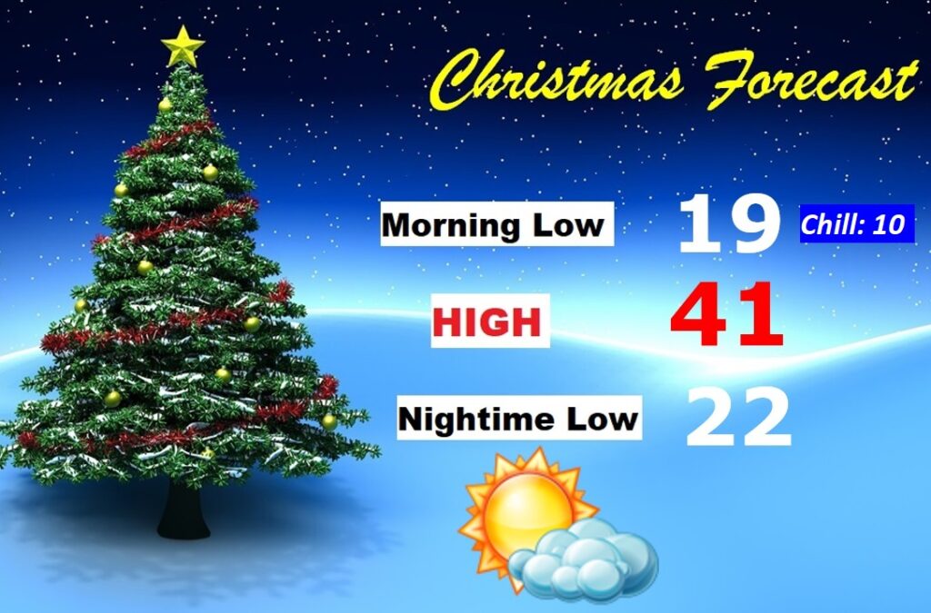
CHRISTMAS DAY OUTLOOK?: Last Christmas we had a high of 77 degrees! This Christmas will be very different. Arctic COLD. I’ve lowered the numbers. Morning low in the upper teens. AM Wind Chill near 10. Daytime high near 40. Mostly sunny. Nighttime low 20 to 23. (Normal 62/39)
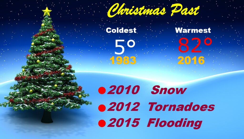
CHRISTMAS PAST: I covered 45 Christmas Days for you. Some wilder than others…
Thanks for reading this Blog this morning, from Jamaica! I’ll have another update for you in the morning from back in Montgomery. Have a nice day! Stay warm. CHASE…Daddy is coming home tonight!
–Rich
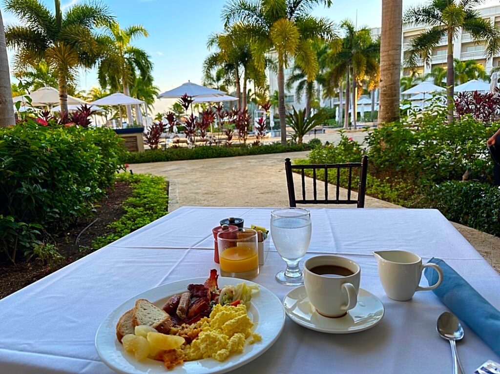
My final morning in paradise. Here’s my breakfast view!