
Good Morning! First…today. Get ready for a Cold Rain by this evening, tonight and much of Tuesday. We get a little break Wednesday. More rain late Thursday and Thursday night ahead of an Arctic Cold Front. You probably know this by now. We have a Bitterly Cold Arctic Blast on the way for Christmas Weekend. I keep lowering the expected temperature numbers. (See below). For instance, Friday’s High may not make it out of the 20’s. Very windy. Wind chill by Saturday morning could reach the lower single digits. Saturday’s high may struggle to reach freezing. Christmas Day will be quite cold. The updated numbers are below. Here’s my brief forecast discussion.
TODAY: Increasing clouds today. Much of the day will be dry & cold. High 51. Risk of rain by late afternoon. A cold miserable rain tonight. Low 41. East wind 6 to 12 today, becoming northerly tonight.
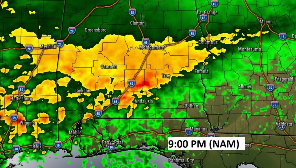
Future Radar snapshot at 9PM. A Cold Rain Soaker….
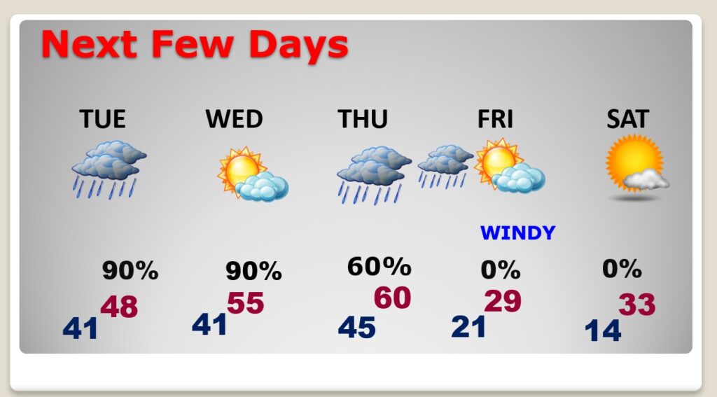
NEXT FEW DAYS: The COLD Rain will continue through much of the day Tuesday, before ending. . We get a little break Wednesday. Wednesday’s high of 55 will seem like a heatwave. Rain returns late Wednesday night into Thursday and a STRONG Arctic Cold Front Approaches. Rain at times Thursday and especially Thursday night. Windy and COLD late Thursday night. Friday’s forecast is FRIGID. High of 29. VERY WINDY. Low Mid-teens by Dawn Saturday. Wind chill by Saturday morning, perhaps lower single digits for many of us. Saturday’s high not too far from freezing.
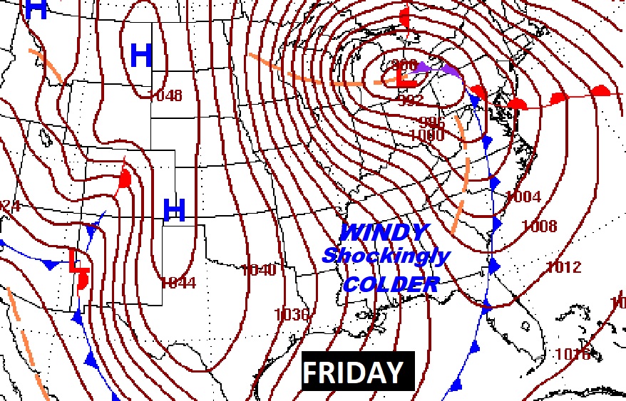
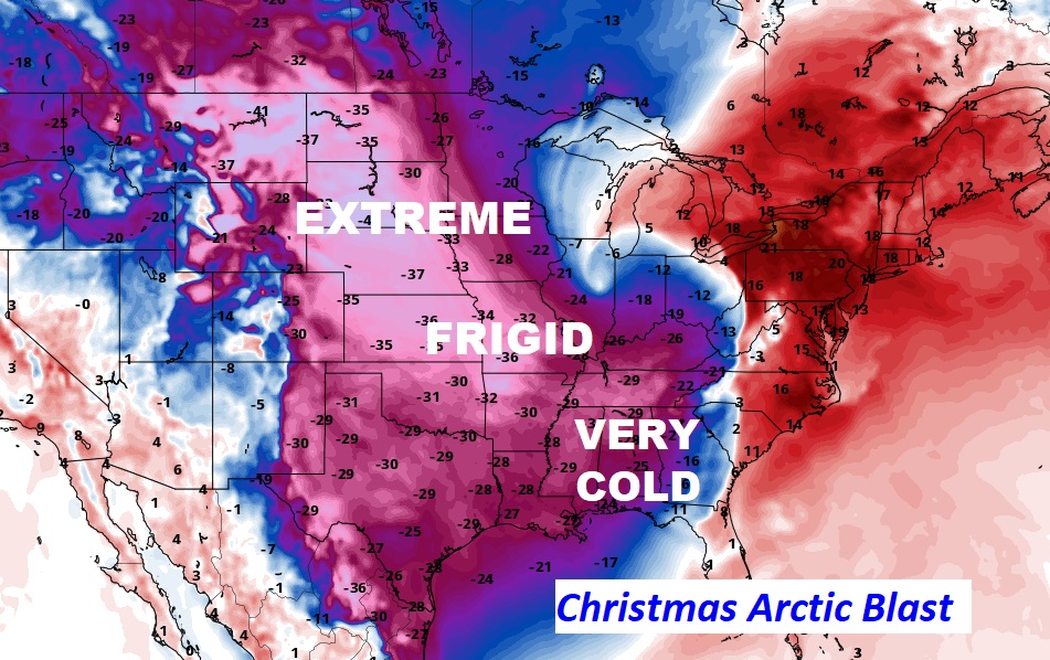
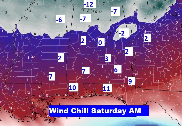
Attention Cold Weather Fans…get ready for a Late Christmas Week Temperature Arctic Blast SHOCKER. This Friday Map shows the extent of the Arctic Blast Covering much of America.
As Cold as it will be HERE, some states to the north of us will experience ridiculous cold numbers.
Here’s your updated Christmas Weekend Forecast. At least we won’t have to deal with any snow nonsense. That’s the best news.
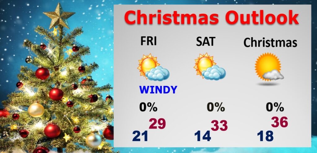
It will be VERY WINDY Friday and Friday night, especially. The potential wind chill numbers by Dawn Saturday cold easily be in the lower single digits for MOST of us. Below ZERO wind chill for much of north Alabama. This is serious Arctic COLD. Get ready.
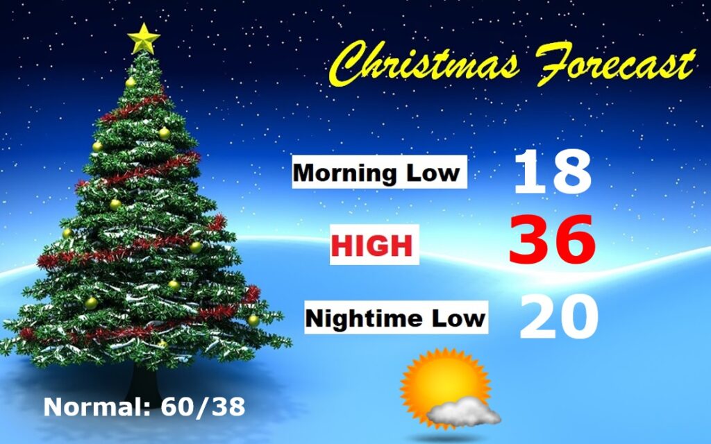
CHRISTMAS OUTLOOK: Last Christmas we had a high of 77 degrees. This Christmas will be very different. Arctic COLD. I’ve lowered the numbers. Morning low in the upper teens. AM. Wind Chill near 10. Daytime high perhaps mid 30’s. Mostly sunny. Nighttime low near 20 (Normal 60/38)
Thanks for reading this Blog this morning! I’ll have another update for you in the morning. Tomorrow everything is normal, including Live on the radio and Live on TV. Have a nice day! Stay warm.
–Rich