
Good Morning! Welcome to winter. We are now just hours away from a huge temperature plunge. We have a Bitterly Cold Arctic Blast Shocker on the way for Christmas Weekend. By Friday morning: Low 19, Wind Chill 5. For instance, Friday’s High near 28 would be a record. It will be very windy. Wind chill by Saturday morning could reach ZERO. Saturday’s high will struggle to reach freezing. Christmas Day will be quite cold. It’ll be the coldest Christmas since 1989. The updated numbers are below. Here’s my brief forecast discussion.
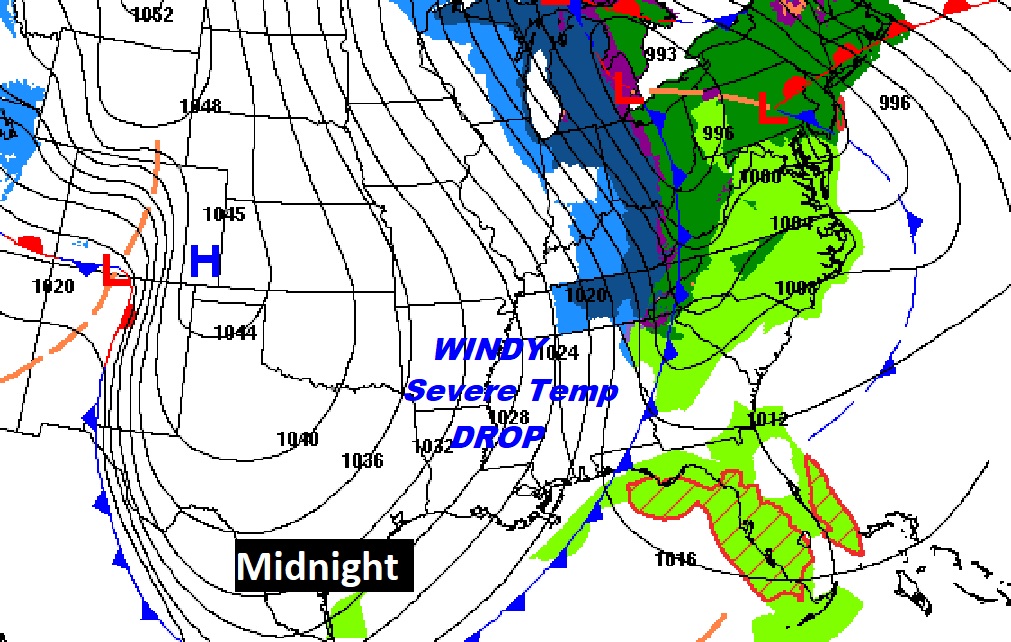
TODAY: Mostly cloudy. Close to average on today’s high. High near 60. Scattered patches of rain tonight, ending before Midnight. Then, windy and dramatically colder overnight. Near freezing by 2AM. Morning low near 20. Northwest winds at 15 to 35 mph will produce a Friday morning wind chill around 5. Cold Front Arrives tonight before Midnight.
NEXT FEW DAYS: Hard Freeze Warning. Wind Chill Advisory.
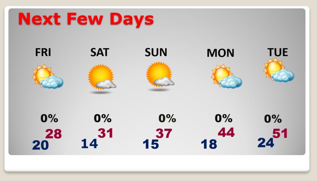
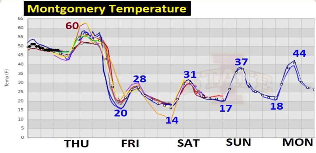
Friday’s forecast is FRIGID. Morning low 20, wind chill 5. (winds gusting as high as 35 mph) High of 28. VERY WINDY. Low 14 by Dawn Saturday. Wind chill by Saturday morning, near ZERO for many of us. Saturday’s high not too far from freezing. A COLD Christmas day. Roughly 30 degrees colder than last year. Monday: Sunny and dry. Teens in the morning, and the high will only reach 44. Not quite as cold Tuesday. High 51 is moving in the right direction.
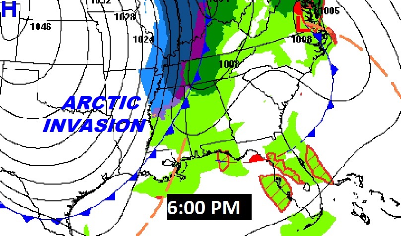
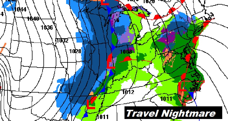
BAD news for holiday travelers. A Blizzard will be underway across the Midwest and Great Lakes. Wind will be a big story with this historic Severe Arctic Invasion.
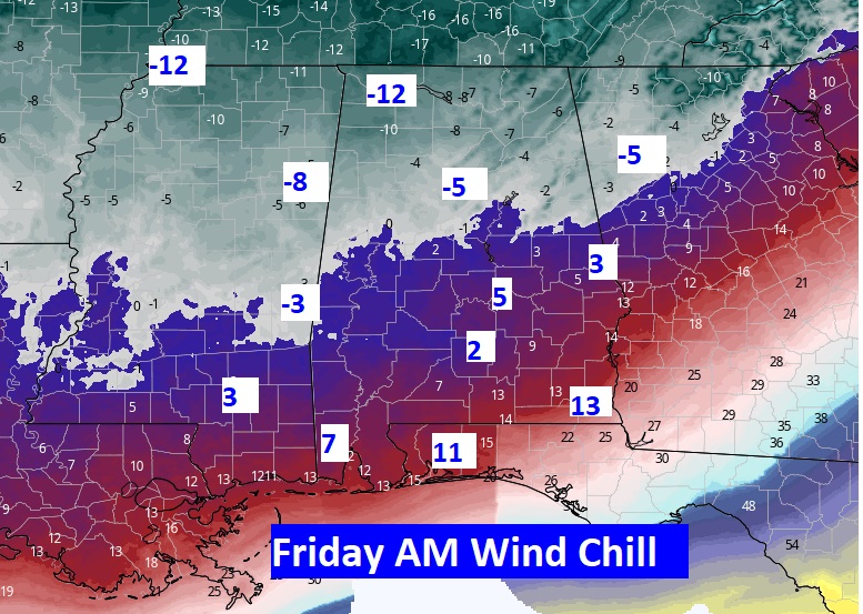
Take a look at projected Wind Chill numbers across the South on Friday morning. Closer to Zero Saturday AM. Crazy numbers. Shocking. This is serious, dangerous Arctic COLD. Get ready.
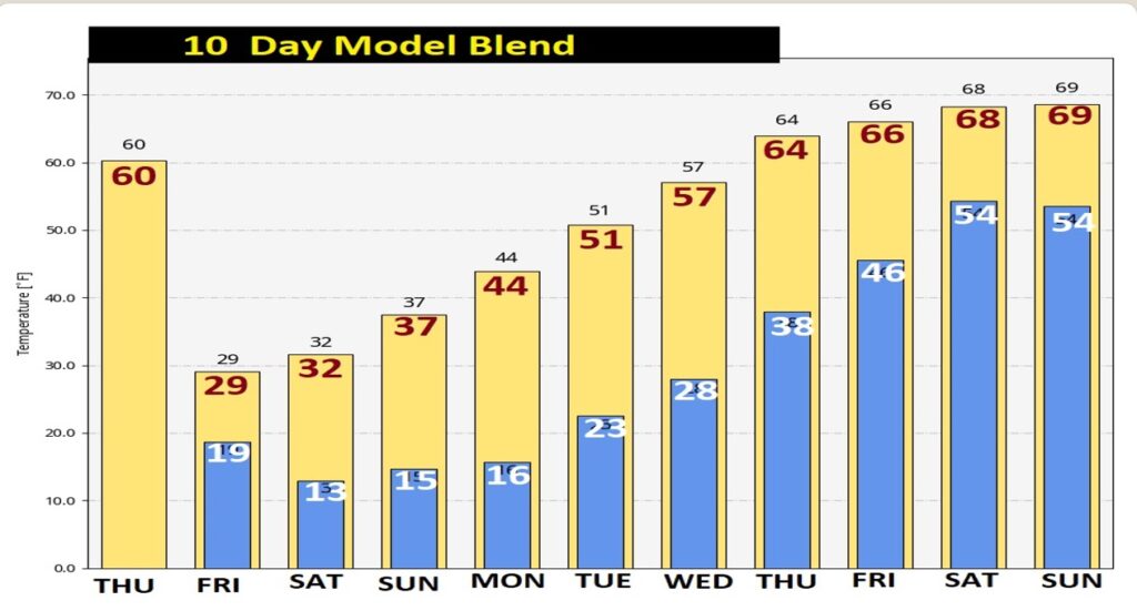
I like what I’m seeing on the 10 day model temperature trend. By late next week, highs recover to the upper 60’s. We could flirt with 70 degrees on New Years Day 2023. That will be a NICE turn-around.
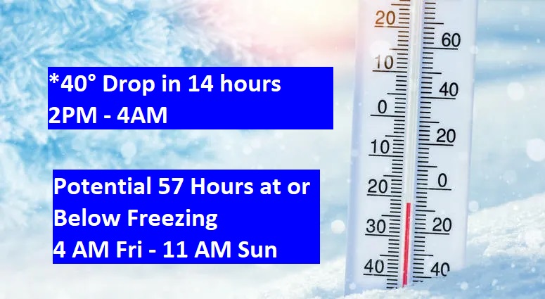
SHOCKING ARCTIC PLUNGE: Just using Montgomery as an example, there could be a 40 degree temperature drop between 2PM this afternoon and 4AM tomorrow morning.
If we do not make it past the Freeze Mark on Saturday, Montgomery’s temperature could be at or below freezing for perhaps 57 hours, from about 2AM Friday till about 11AM Christmas Day. That is an extremely rare duration here in the Deep South.
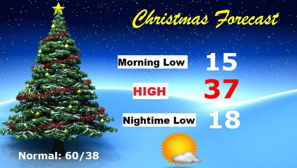
CHRISTMAS OUTLOOK: Get ready for Christmas in the Arctic. Morning low in the upper teens. AM. Wind Chill near 10. Daytime high perhaps mid 30’s. Mostly sunny. Nighttime low near 20. Normal of 60, and last year’s 77! No snow or ice to worry about, though, so travel will not be a problem.
Thanks for reading this Blog this morning! This morning we are LIVE on the radio from 6 to 9 on NewsTalk 93.1. Watch us on TV on CBS 8 and ABC 32. I’ll have another update for you in the morning. Have a nice day! –Rich