
Good Morning! Bitter cold arctic air is funneling into Alabama. At 11PM in Montgomery the winds shifted and increased. Midnight wind gusts to 36 mph. Looks like a long-term extended freeze that could last perhaps 57 hours until mid-day Christmas day. Temperatures will be extremely cold and wind chill will be brutal. Friday and Saturday’s high will likely be below freezing. Nights/mornings will be in the teens. Wind chill early today and again Saturday morning will be -2 to 3 above. Here’s my brief forecast discussion.
TODAY: Today will be Blustery. Extremely cold & Windy. Normal high 60. Today, we’ll be lucky to reach 28. But, gusty northwest winds as strong as 30 mph, will produce AM wind chill zero to 5. Even this afternoon, we’ll be dealing with wind chill in the teens. It will be mostly sunny today and mostly clear tonight. Wind Chill Advisory and Hard Freeze Warning. Low tonight 13. Wind chill by morning potentially -2 to 3 above.
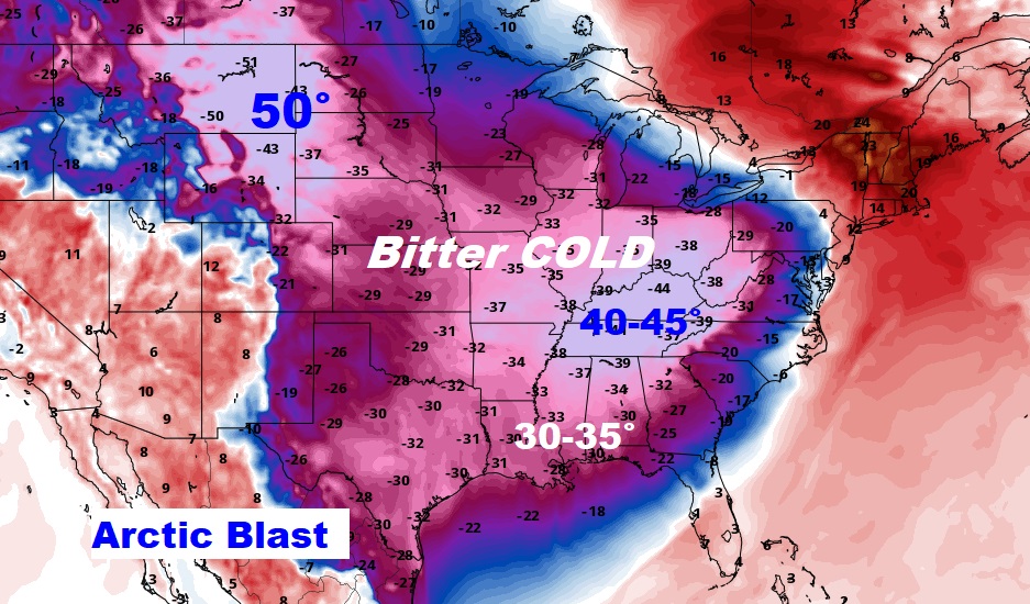
Take a look at this winter assault. Temperatures in the Gulf South are running 30 to 35 degrees below normal today. Farther north, in the Ohio and Tennessee valley 40 to 45 degrees below normal. Strong winds are adding insult to injury with brutal wind chill values.
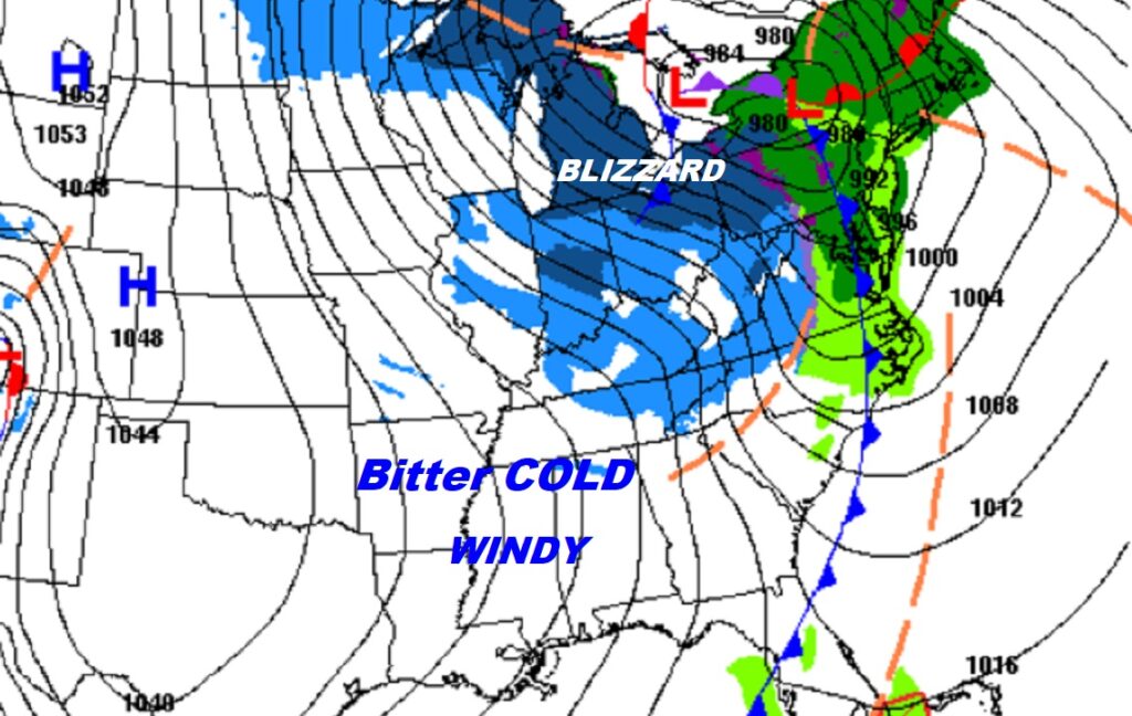
Farther to the north, the Great Lakes is dealing with blizzard conditions.
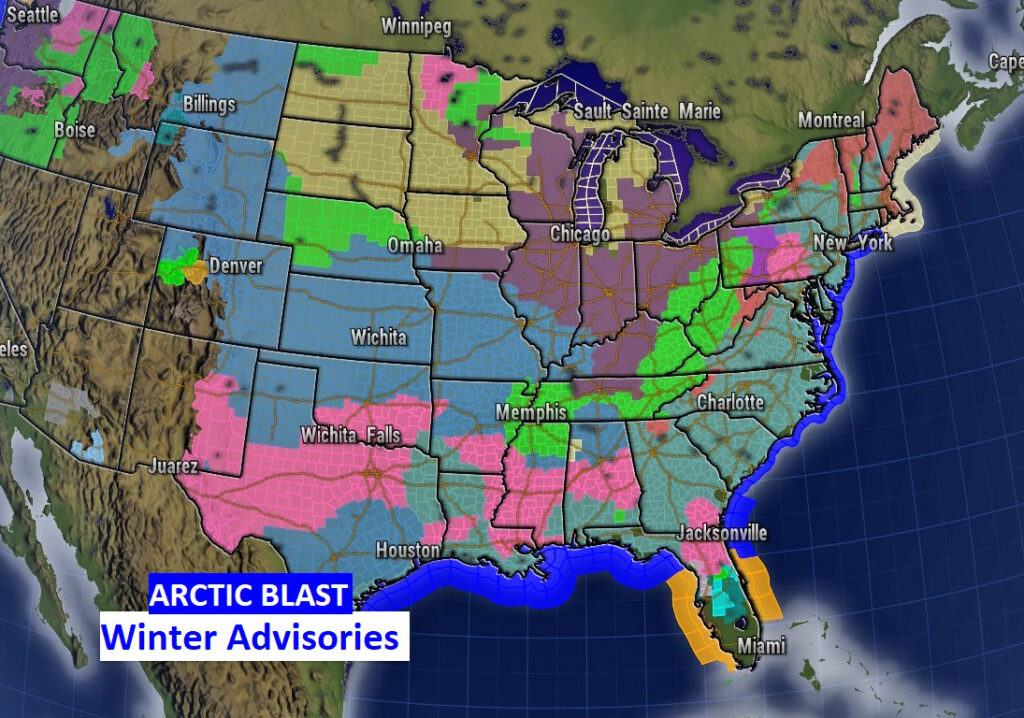
Look at this colorful map. These are the various Winter Advisories in effect nationwide. For us, Hard Freeze Warning and Wind Chill Advisory. Even deep into Florida, in Orlando, Freeze warning and wind chill advisory.
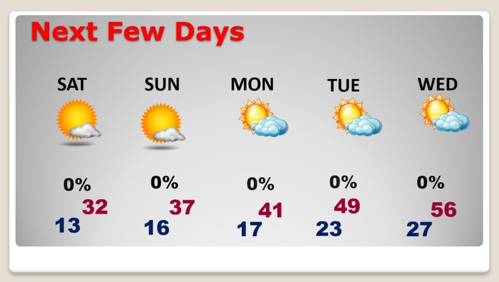
NEXT FEW DAYS:
Wind chill by Saturday morning, near or below ZERO for many of us. Saturday’s high not too far from freezing. A COLD Christmas day. Roughly 30 degrees colder than last year. Monday: Sunny and dry. Teens in the morning, and the high will only reach 44. Not quite as cold Tuesday. High 51 is moving in the right direction. Looks like at least mid 50’s by Wednesday.
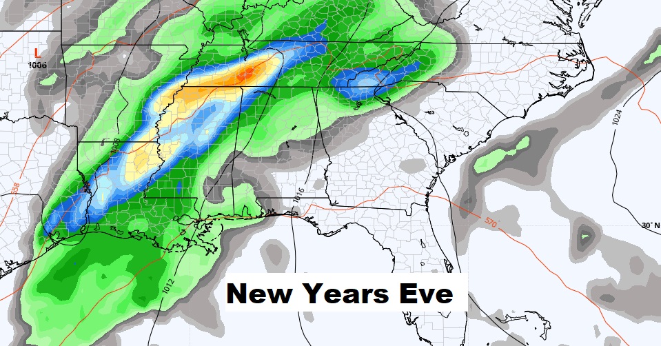
I like what I’m seeing on the 10 day model temperature trend. By late next week, highs recover to the upper 60’s. We could flirt with 70 December 31 through January 2.

But we also may have to deal with showers and thunderstorms.
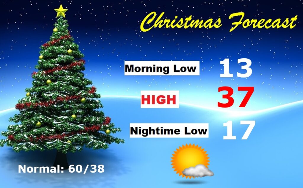
CHRISTMAS OUTLOOK: Get ready for Christmas in the Arctic. Morning low in the mid teens. Morning Wind Chill near 10. Daytime high perhaps upper 30’s. Mostly sunny. Nighttime low in the mid teens. Normal of 60, and last year’s 77! No snow or ice to worry about, though, so travel will not be a problem.
Thanks for reading this Blog this morning! This morning we are LIVE on the radio from 6 to 9 on NewsTalk 93.1. Watch us on TV on CBS 8 and ABC 32. I’ll have another update for you in the morning. Have a nice day!
–Rich