
Good Morning! The Arctic Cold will soon start to fade. Today will be not as cold as Christmas Day. Our high will probably reach the mid 40’s That’s still 15 degrees below normal, but it’s a start. Each day this week will be a little Warmer. We’ll be into the lower 60’s by Wednesday and the upper 60’s on Thursday. Showers and thunderstorms will return to the forecast on Friday and Saturday. Spring-like temperatures are on the way soon, as the Arctic Cold finally retreats.
CLIMATE DATA: On Christmas day at 11 AM, Montgomery warmed to above freezing for the first time in 53 hours. The morning low was 18. The afternoon high was 41. (Normal 60/38)
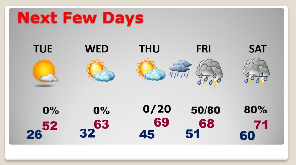
TODAY: Early morning temperatures in the upper Teens. Today will be not as chilly as Christmas Day. Our high will probably reach the mid 40’s That’s still 15 degrees below normal, but it’s a start. Clouds will increase during the day as a disturbance approaches from the north. It will be mostly cloudy tonight. Low tonight in the mid 20’s. Normal of 60/38.
NEXT FEW DAYS: Each day this week will be a little Warmer. We’ll be into the lower 60’s by Wednesday and the upper 60’s on Thursday. Showers and thunderstorms will return to the forecast on Friday and Saturday.
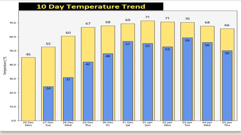
Nice turn-around ahead. By late next week, highs recover to the upper 60’s Thursday through Saturday. We’ll be near or above 70 January 2 and 3.
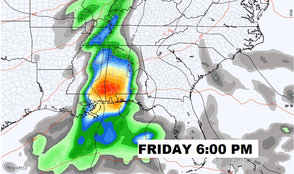
But, we also may have to deal with showers and thunderstorms, starting Friday. Here’s the map for Friday Night at 6PM. (GFS model).
Thanks for reading this Blog this morning! I’ll have another update for you in the morning Have a great day!
–Rich