
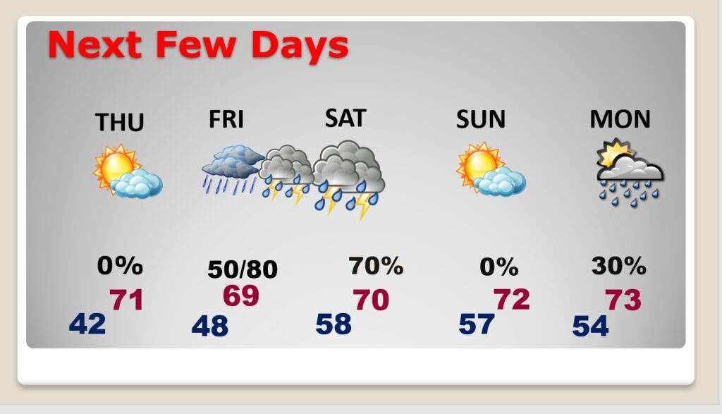
Good Morning! Our temperature recovery continues. Each day this week will be a little Warmer. We’ll be into the lower 60’s today and perhaps 70 or above on Thursday. Showers and thunderstorms will return to the forecast on Friday and Saturday. If you plan to ring in the New Year outside Saturday night, it looks like the storm should be long gone. New Years Day is looking nice. Another significant storm system arrives early next week. Here’s my brief forecast discussion.
TODAY: The warm-up continues. There will be a sun/cloud mix. High 58. That’s almost normal. Southeast wind at 5 to 10. Not as cold tonight. Low tonight in the lower 40’s. Normal: 60/38.
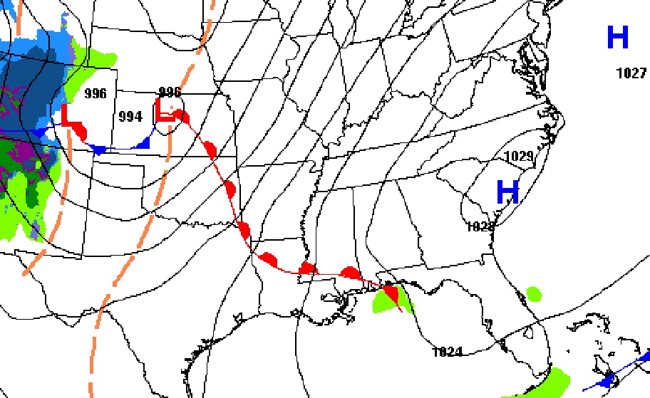
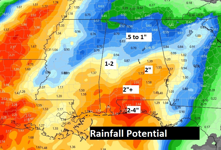
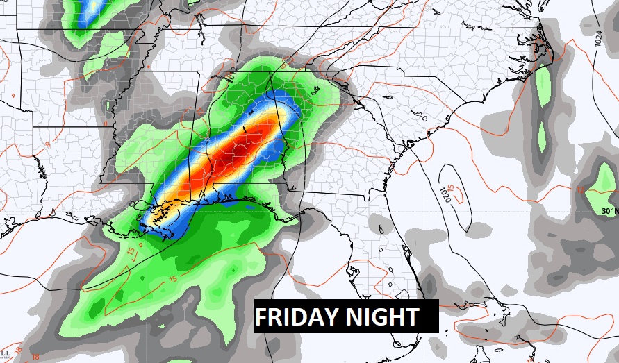
NEXT FEW DAYS: Each day this week will be a little Warmer. We’ll be near or above 70 on Thursday. Showers and thunderstorms will return to the forecast on Friday, Friday night and into Saturday.
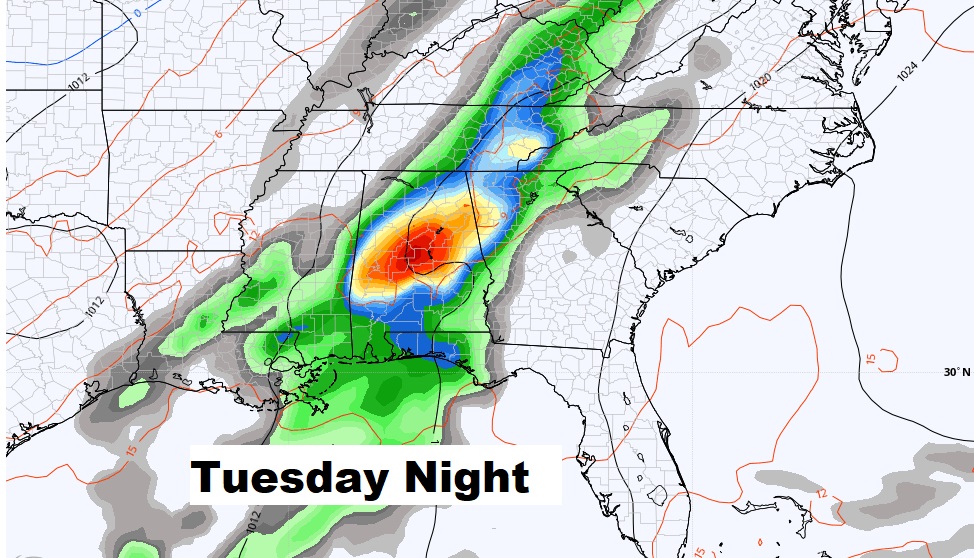
New Years Day looks dry and mild right now. Another significant storm system will affect the area early next week. Perhaps some stronger storms? Possibly.
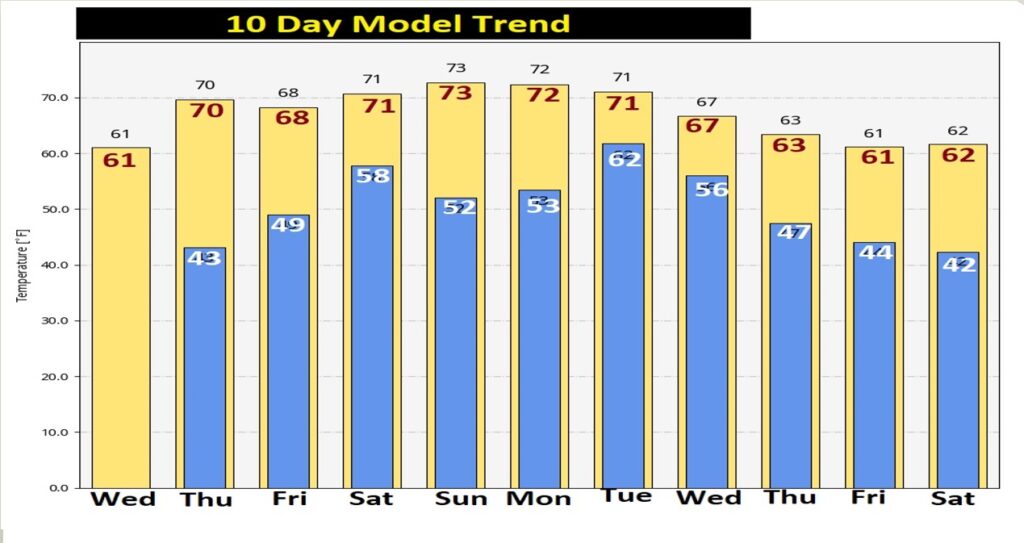
Here’s the 10 day Model Temperature trend. There’s NO freezing temperatures in the next 10 days. Finally, the Arctic Floodgates are closed for now.
But, we also may have to deal with showers and thunderstorms, starting Friday, through Saturday. Looks like another storm system will affect our area early next week. Potentially strong storms.
Thanks for reading this Blog this morning! This morning we are LIVE on the radio from 6 to 9 on NewsTalk 93.1. Watch us on TV on CBS 8 and ABC 32. I’ll have another update for you in the morning. Have a nice day!
–Rich