
Good Morning! Last week on this day, the temperature was crashing. We were plunging into the Arctic Abyss. What a difference. Yesterday we had a Beautiful Spring-like Perfect 76 degrees. And, we have a spring-like storm system approaching – the first of two in the next 5 days. Showers and storms become likely, especially this evening & tonight, through mid-day Saturday. Timing is everything. It looks like New Years Eve night and New Years Day should be fine. But, get ready. Another significant storm system arrives early next week. Next week will be rather unsettled from Monday night through Wednesday. Rainfall amounts could be quite heavy. Showers & storms could be strong, possibly severe. Here’s my brief forecast discussion.
TODAY: Dry though the morning. Scattered showers by this afternoon. Showers and thunderstorms tonight. Locally heavy downpours. High today 71. Low tonight 59.
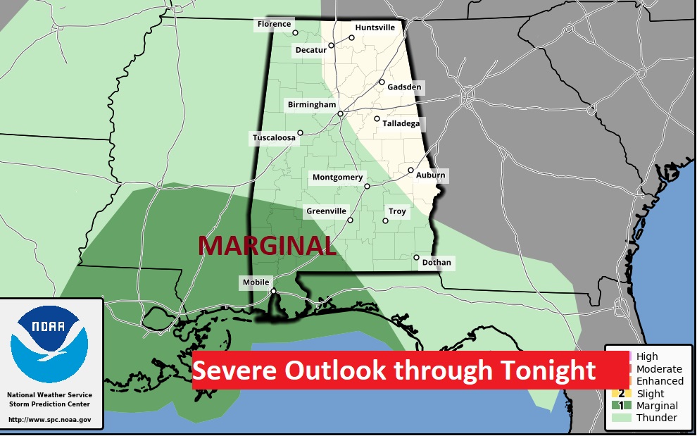
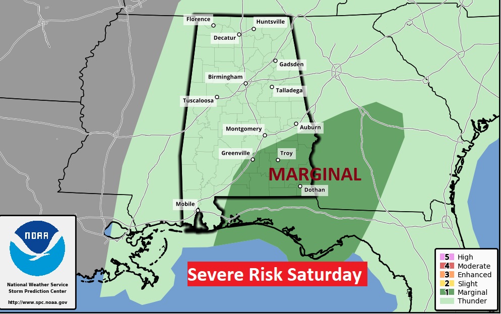
Storm Prediction Center has a Marginal Severe Risk covering southwest Alabama tonight through 6AM, and the Marginal Risk shifts to southeast Alabama Saturday.
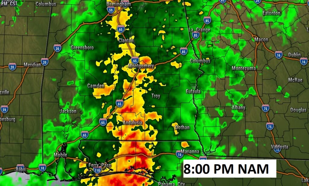
Future Radar shows a healthy round of showers and storms tonight, and another round mid-day tomorrow, before the precipitation shield exits the state early Saturday afternoon.

NEW YEARS EVE: Showers and thunderstorms through mid-day tomorrow, before the precipitation exits the state early Saturday afternoon. Dry Saturday evening and night for New Years festivities. Midnight temperature 56. Overnight low 51.
NEXT FEW DAYS: Timing is everything. New Year’s Day should be fine. Dry, comfortable. Sun/cloud mix. High near 70. Sun/cloud mix. But, get ready. Another significant storm system arrives early next week. Next week will be rather unsettled from Monday night through Wednesday. Tuesday will will be stormy. Rainfall amounts could be quite heavy. Showers & storms could be strong, possibly severe.
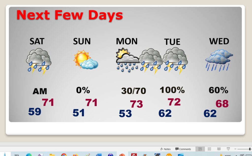
New Year’s Day looks dry and mild right now. Another significant storm system will affect the area early next week. Next’s week system will be a two-parter Monday night through Wednesday.
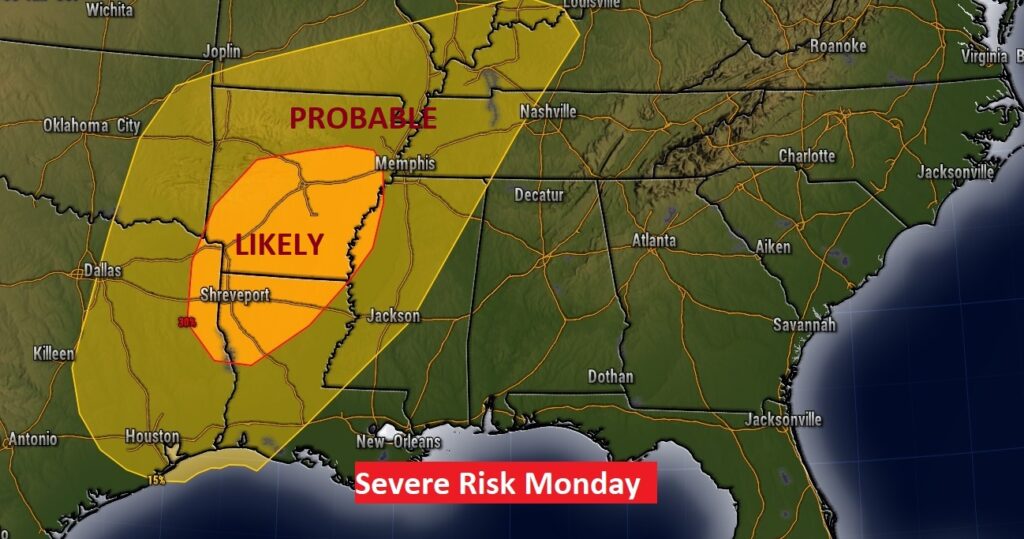
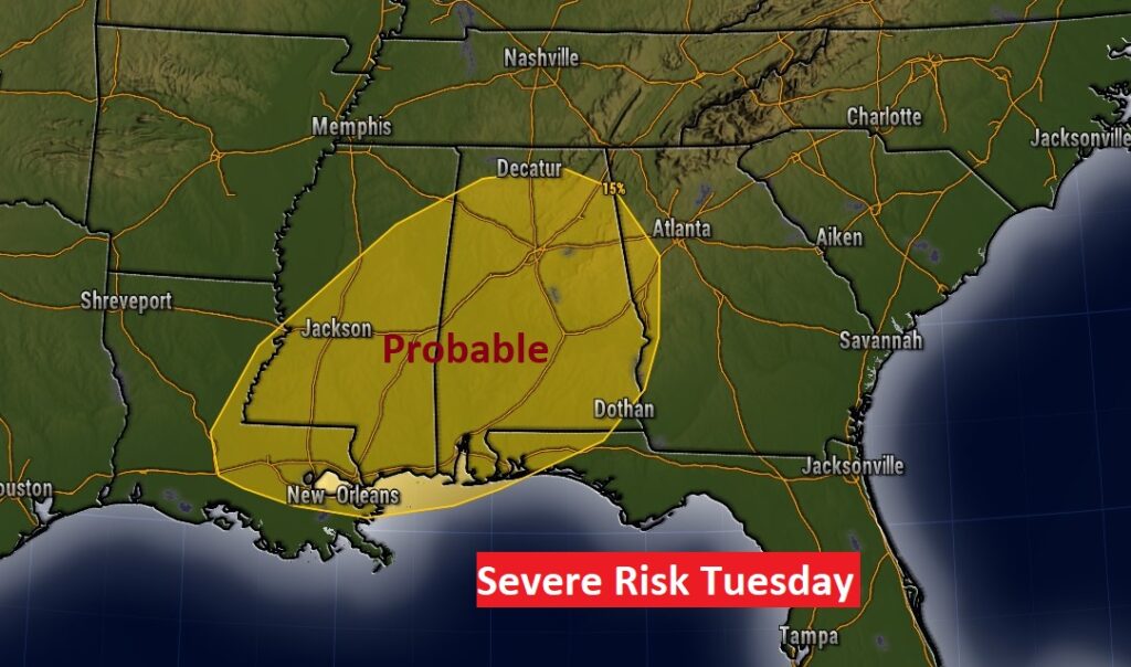
SPC Severe Outlook Monday looks ominous. Significant threat in the ArkLaTex region, spreading eastward to Alabama Tuesday. All modes of severe weather including tornadoes.
Flooding could be an issue next week. Locally heavy rainfall is possible across the Gulf South.

Rainfall amounts could be quite excessive. Flooding rainfall is possible. This outlook includes the next two storm systems. The Monday night through Wednesday storm system will be the wettest.
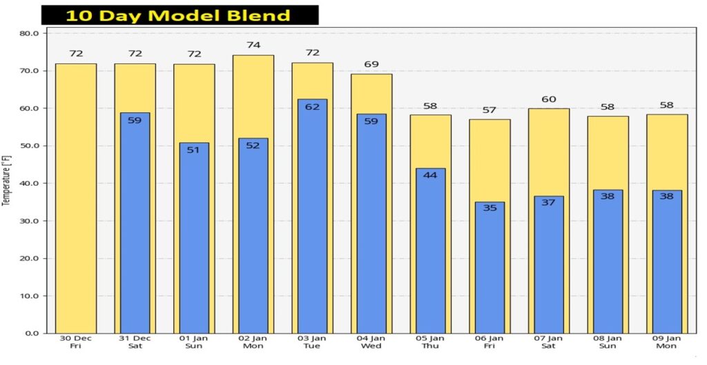
Here’s the 10 day Model Temperature trend. It turns much cooler behind the mid-week storm system next week…But, there’s no sign of Arctic Air at this point.
Thanks for reading this Blog this morning! This morning we are LIVE on the radio from 6 to 9 on NewsTalk 93.1. Watch us on TV on CBS 8 and ABC 32. I’ll have another update for you in the morning. Have a nice day!
–Rich