
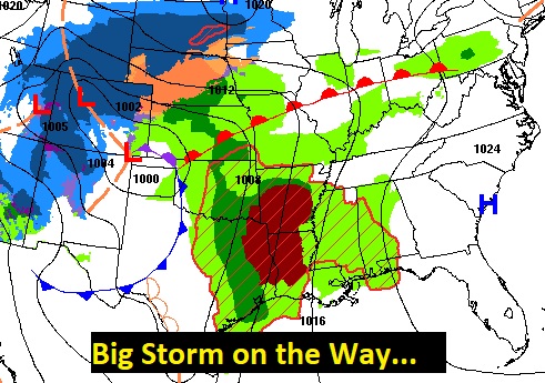
Good Morning! Dense fog is an issue early this morning. Otherwise, today will be mild with a risk of showers at times today and tonight. But, concern continues to grow for Severe Weather Tuesday. The Storm Prediction Center has elevated threat for much of the area to Level 3 Enhanced. All modes of Severe Weather are possible including damaging winds and tornadoes. The action could start early, perhaps by early afternoon, and will continue through much of the afternoon and into the evening hours. It will turning much cooler late week behind the storm system. Here’s my very brief forecast discussion.
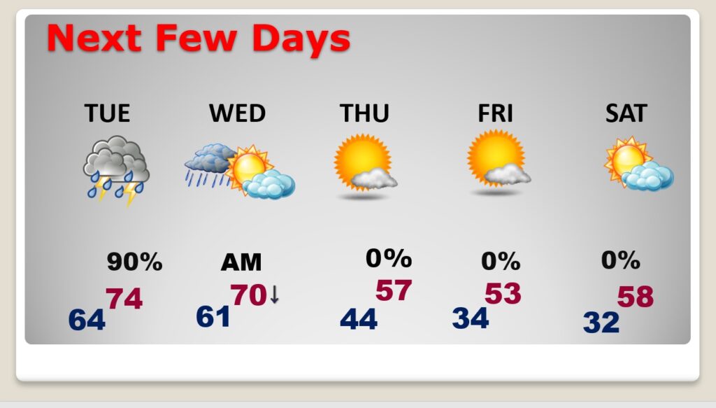
TODAY: Dense Fog Advisory until 9:00AM. Once again today, locally dense fog will be a problem. Spotty showers at times today. Mild. High 74. SE wind 6 to 12 daytime with gusts to 20 mph tonight. Very mild tonight. Low 64.
SEVERE WEATHER THREAT TUESDAY: Today, the focus will be west of Alabama in the ArkLaTex region. There is an Enhanced severe weather threat including a concerning Level 3 Enhanced Severe Risk. All modes of severe weather are possible including tornadoes.
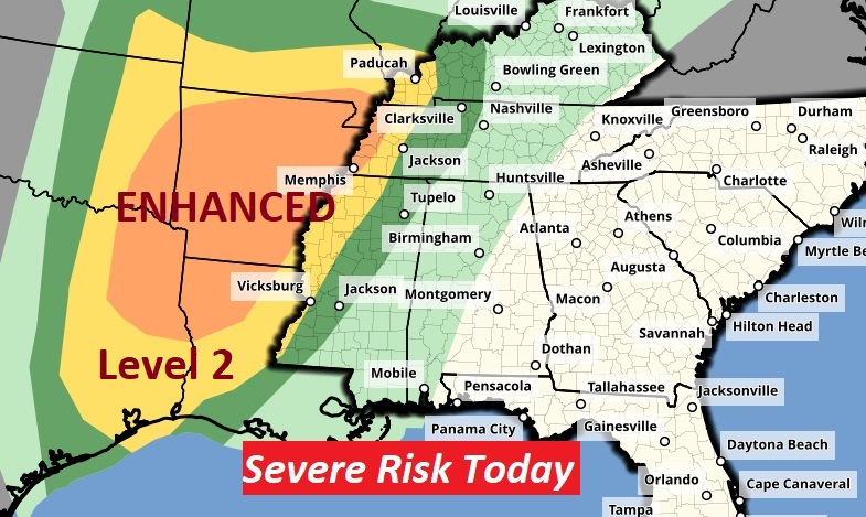
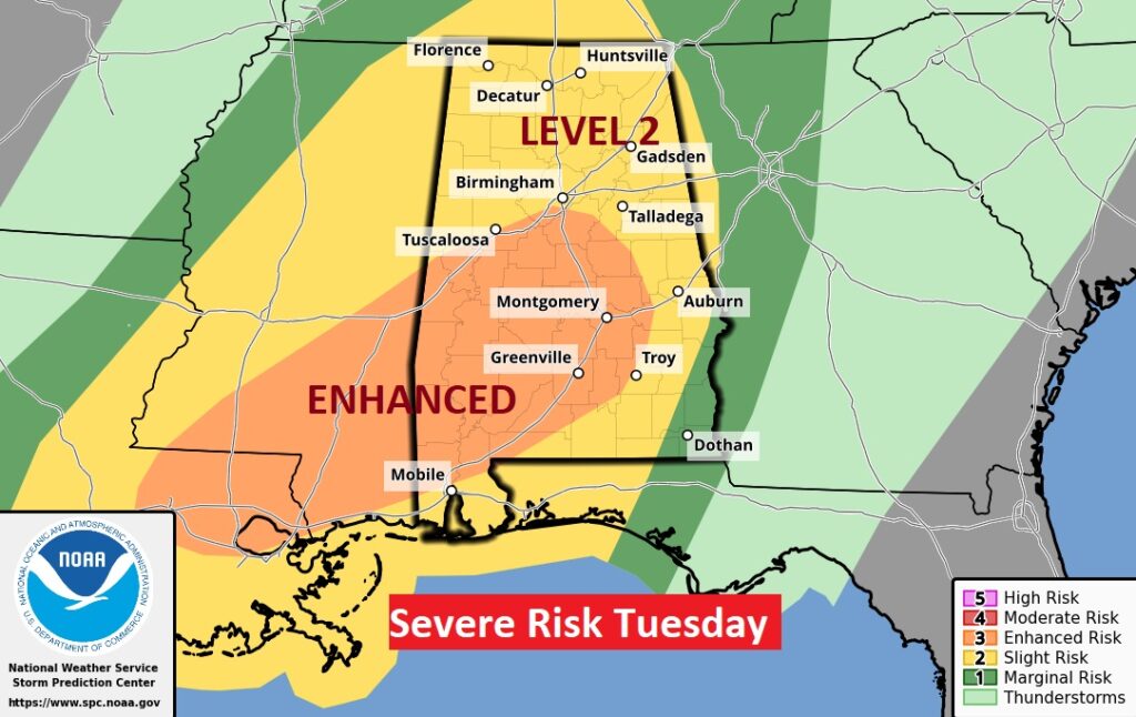
Tomorrow the severe threat spreads eastward to Alabama. The greatest threat will be in the afternoon and evening hours. All modes of severe weather are possible including tornadoes. Unfortunately, the risk for the development of discrete Super Cells in a warm moist environment has increased the threat for tornadoes. SPC has now increased our Tuesday threat to Level 3 Enhanced. This is concerning.
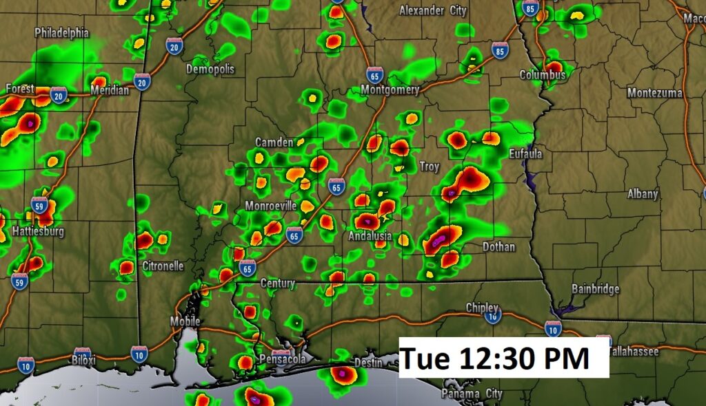
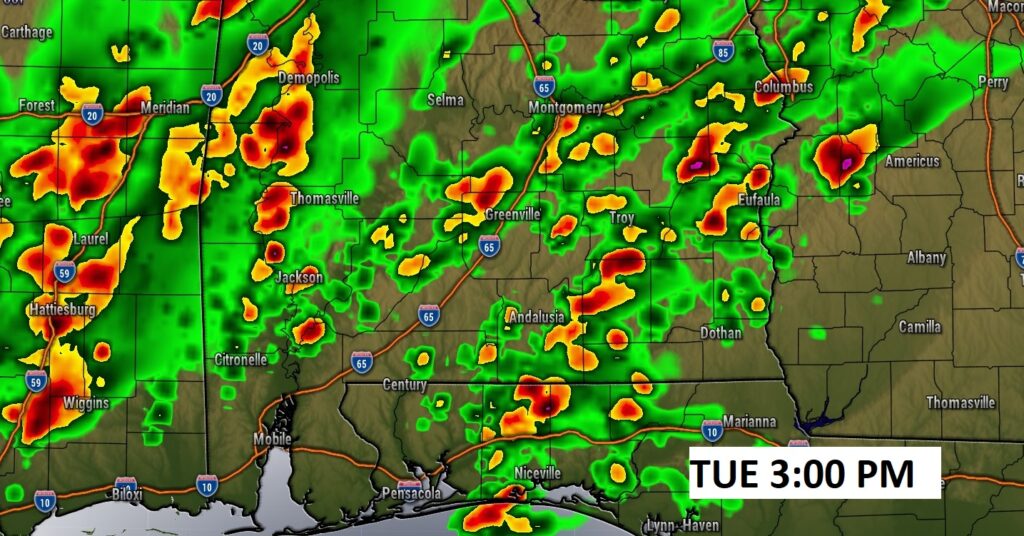
Here is a couple of Future Radar snapshots tomorrow afternoon. It clearly shows the possibility of discrete Super Cells as early as lunchtime and much of the afternoon. There, will also be an additional risk well into the evening hours, with the main band/line of storms ahead of the frontal system. We’ll continue to monitor this increasing threat level closely.
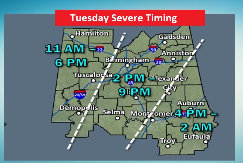
This map will help you with the potential Time Line on Tuesday.
NEXT FEW DAYS: The risk of showers will continue through the early part of the day Wednesday. Wednesday afternoon will be dry and a little cooler. It will be quite a bit cooler Thursday through Saturday with highs in the 50’s and lows in the 30’s.
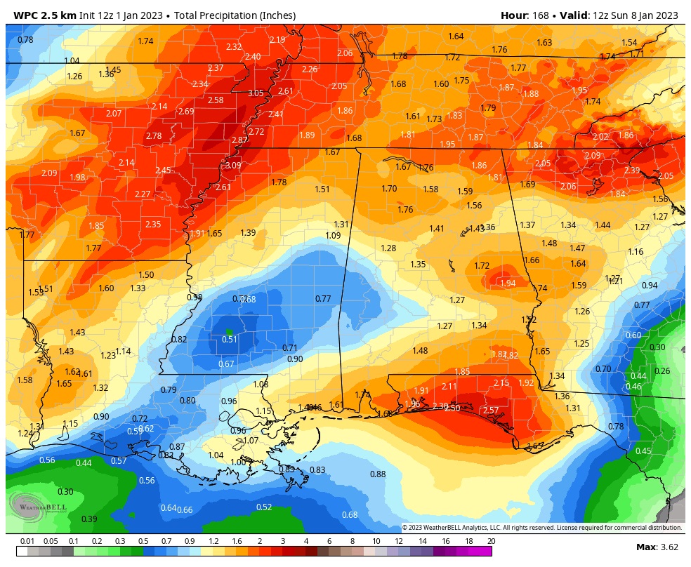
Locally heavy rainfall is possible across the Gulf South, especially closer to the coast.
Thanks for reading this Blog this morning! I’ll have another update for you in the morning. We’ll keep a close watch on this developing severe threat. I’ll have a FULL Video and Blog update in the morning. Have a nice day!
–Rich