
Good Morning! This is definitely a day to stay weather aware. We are in an ENHANCED Severe Weather Risk. Level 3 out of 5. All modes of Severe Weather are possible, including damaging winds up to 70 mph, large hail, and tornadoes. The Storm Prediction Center says conditions are favorable for a few strong tornadoes, EF-2 or higher. Unfortunately, this threat could be long term, starting around lunchtime and perhaps lasting into the wee hours of Wednesday morning. Stay weather aware. We’ll keep you up to date as much as possible on social media, on the radio, on TV and of course, on your weather app. Stay Weather aware.
Here’s my very forecast discussion video.
TODAY: Very warm for January. High in the mid 70’s. Showers and thunderstorms become likely by late morning into the afternoon and tonight. Some storms Severe. Watches and warnings are almost a certainty. More about the Severe Threat in the paragraphs below. South wind today at 10 to 20 gusting 25+ mph.
SEVERE WEATHER THREAT TODAY & TONIGHT:
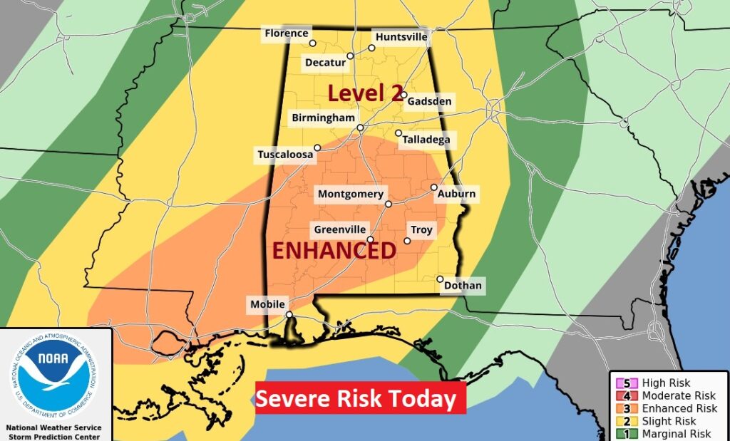
The Enhanced (Level 3 out of 5 Risk) covers a huge area from Birmingham to Andalusia east to Auburn. The greatest threat will be in the afternoon and evening hours. All modes of Severe Weather are possible, including damaging winds to 70 mph, large hail, and tornadoes. The Storm Prediction Center says conditions are favorable for a few strong tornadoes, EF-2 or higher.
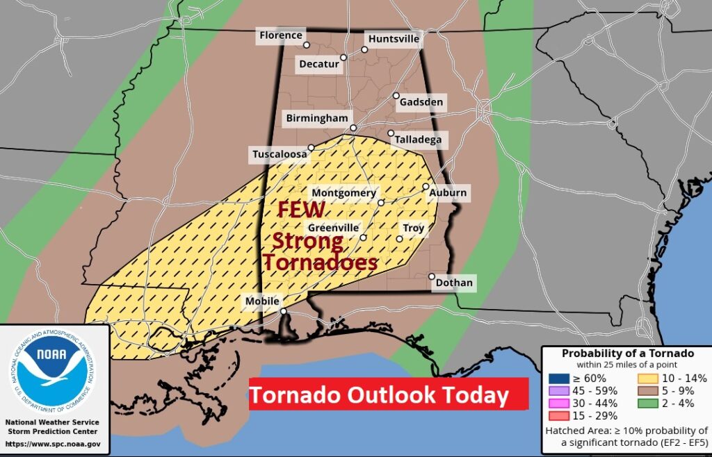
SPC has underlined the Tornado Risk with this map. That yellow hatched area shows the area with the greatest threat of STRONG tornadoes, EF-2 or higher.
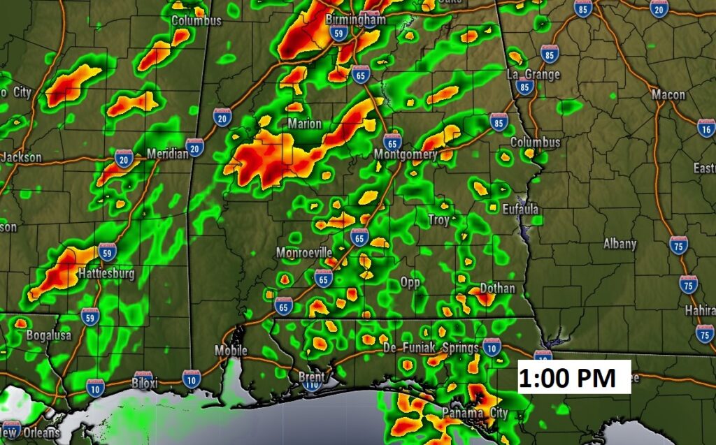
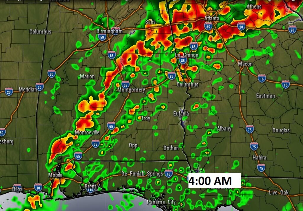
Here is a couple of Future Radar snapshots tomorrow afternoon. It clearly shows the possibility of discrete Super Cells as early as lunchtime and much of the afternoon. There, will also be an additional risk well into the evening hours, with the main band/line of storms ahead of the frontal system.
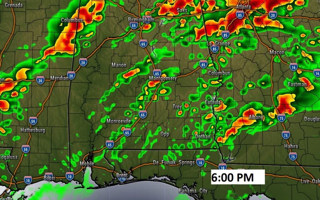
Even in the wee-hours of the morning, the risk of severe storms will continue. By then, we will be out of the cellular mode and into more of a linear (QLCS) mode. This, for many of us, unfortunately will be a multi-hour event.
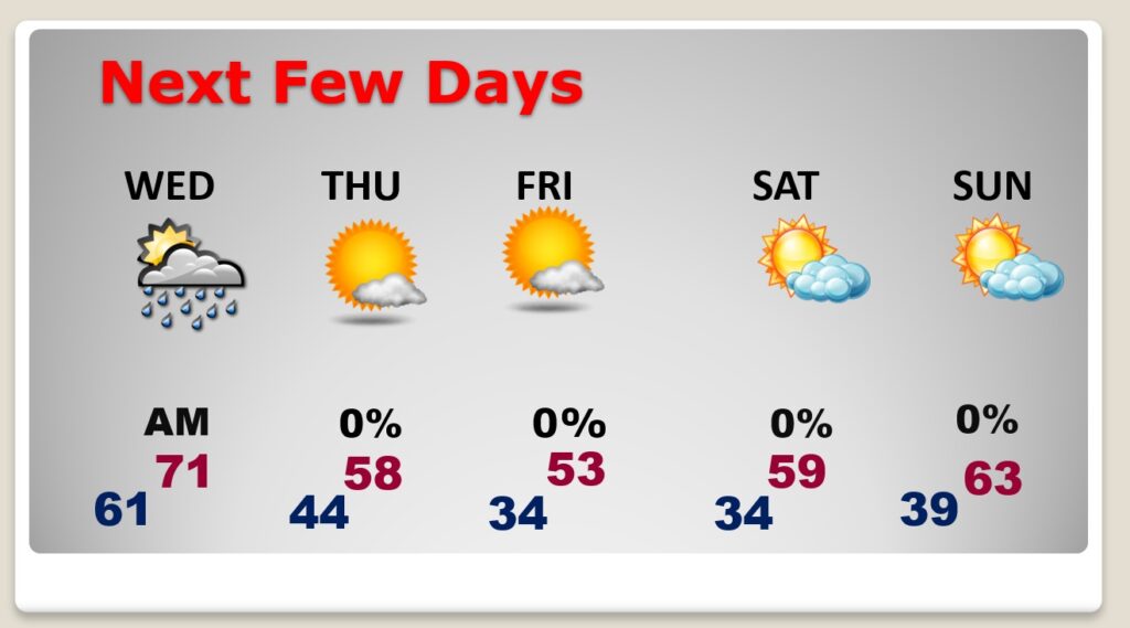
NEXT FEW DAYS: The risk of showers will continue through the early part of the day Wednesday. Wednesday afternoon will be dry and a little cooler. It will be quite a bit cooler Thursday through Saturday with highs in the 50’s and lows in the 30’s.
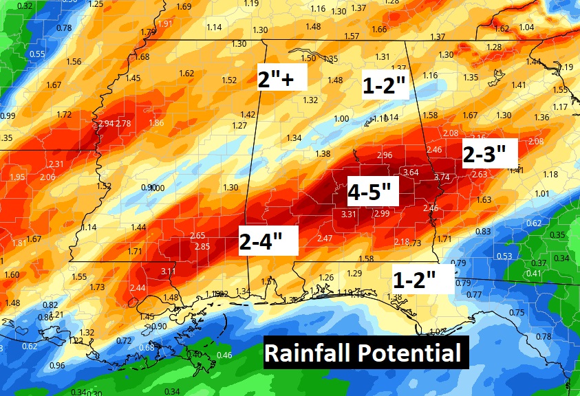
Locally heavy rainfall is possible in some areas. An Aerial Food Advisory is in effect for many of us.
Thanks for reading this Blog this morning! This morning we are LIVE on the radio from 6 to 9 on NewsTalk 93.1. Watch us on TV on CBS 8 and ABC 32. I’ll have another update for you in the morning. Stay Weather Aware. We’ll keep you up to date as much as possible on social media, on the radio, on TV and of course, on your weather app. Stay Weather aware.
–Rich