
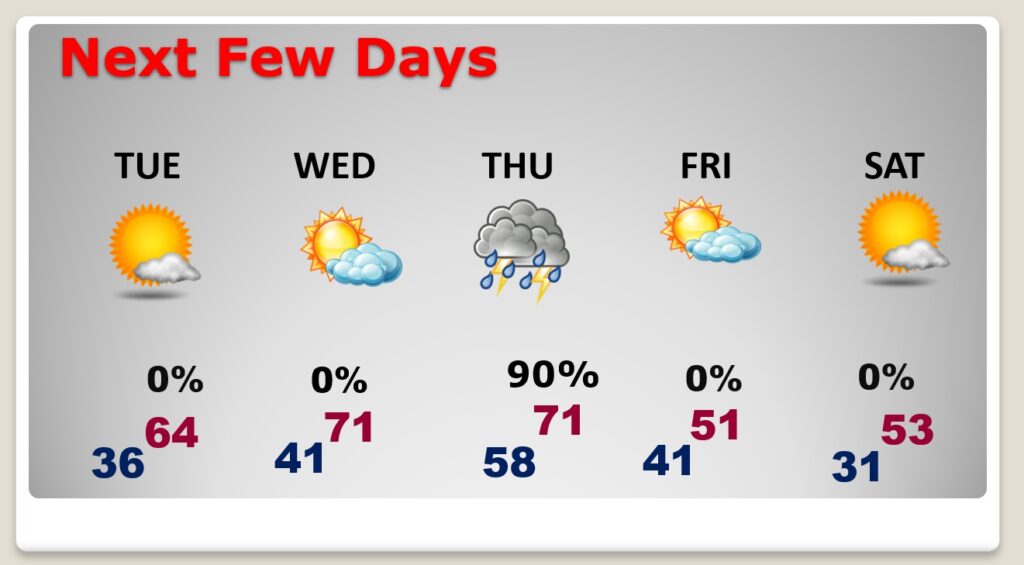
Good Morning! Not a bad start to our new week today. Cool sunshine with a high near normal. We’ll be in a quiet and rather nice pattern through Wednesday. Lots of sun and dry and Tuesday and Wednesday. Mid 60’s Tuesday. Perhaps lower 70’s Wednesday. Showers and thunderstorms Thursday. Sharply cooler behind the storm system Friday and Saturday. Here’s my brief forecast discussion.
TODAY: Mostly sunny. High 59. North wind at 6 to 12 mph. Mostly cloudy, chilly tonight. Low 36.
NEXT FEW DAYS: We’ll be in a quiet and rather nice pattern through Wednesday. Lots of sun and dry and Tuesday and Wednesday. Mid 60’s Tuesday. Perhaps lower 70’s Wednesday. Showers and thunderstorms Thursday. Sharply cooler behind the storm system Friday and Saturday.
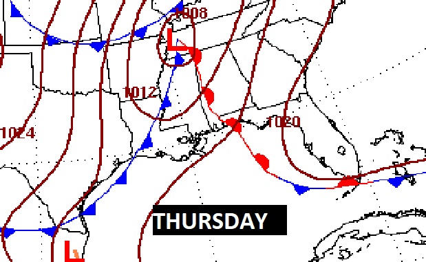
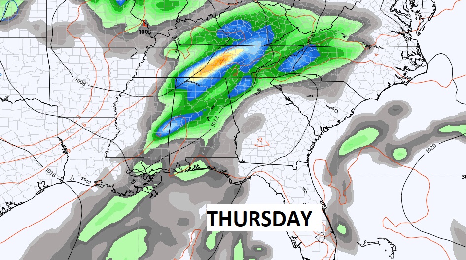
Our next significant storm system will bring a round of showers and storms into the state Thursday. The best chance of showers & storms will be daytime Thursday.
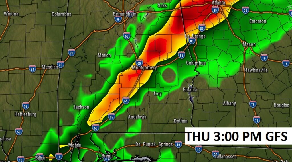
Here’s a GFS Future Radar Snapshot on Thursday afternoon. Strong to severe storms can not be ruled out with the line of thunderstorms. Damaging wind gusts would be the main threat. The tornado threat is not zero, but appears to be small.
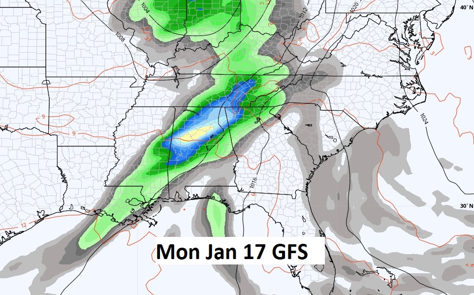
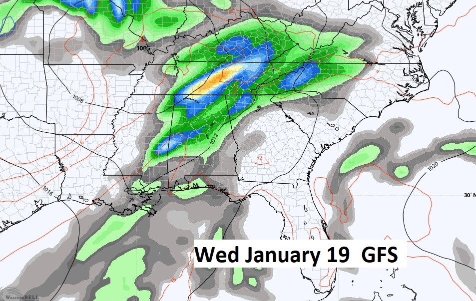
Active days ahead. The GFS advertises two potential future storm system around January 17 and again January 19.
Thanks for reading this Blog this morning! I’ll have another update for you in the morning. Have a nice day! –Rich