
BREAKING: NWS survey team preliminary report: At least EF-2 tornado damage in Selma, at least EF-3 damage in the Kingston Community Autauga county (same storm), track distance not known yet. Also, an EF-2 tornado Winston county, Double Springs. Surveys continue. #alwx
9:20AM:
BREAKING NEWS: Autauga county tornado death toll has now reached 7. The search continues. #alwx
EARLY MORNING UPDATE:
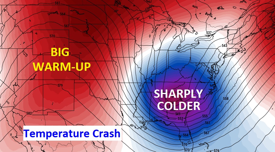
Good Morning. Alabama is reeling this morning after Thursday’s deadly tornado tragedy. Behind the big storm, temperatures are crashing. Sharply colder air is funneling into the state. Today’s high may only reach the mid 40’s. Wind Chill will be a big factor, with strong northwest winds. Some towns could even see brief flurries. It will melt as it falls, of course. We’re headed for the upper 20’s tonight. Wind chill could fall to the teens by morning. Saturday will be quite cold. The Cold Blast will not last long. Sunday temperatures will start to recover a bit. Temperatures will start a big turnaround by early next week. Here’s my brief forecast discussion.
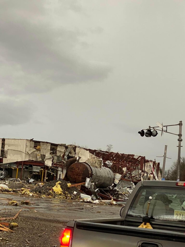
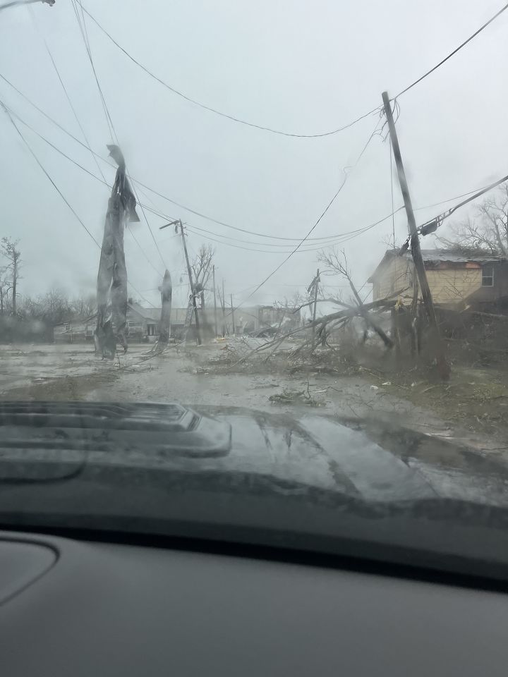
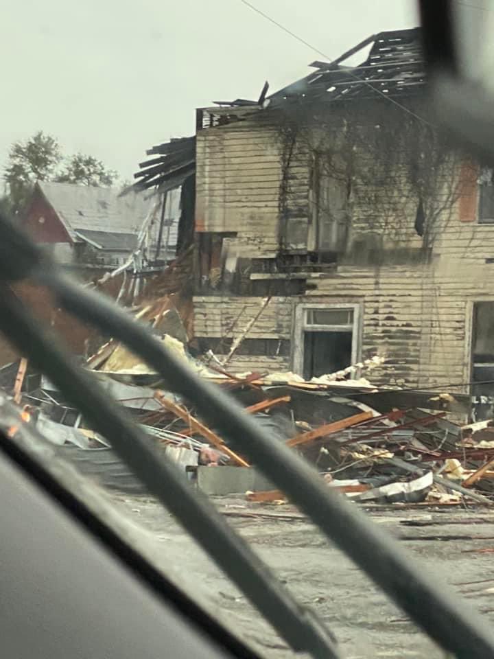
THURSDAY TORNADO TRAGEDY: One Super Cell thunderstorm on Thursday was responsible for so much death and destruction. Several tornadoes were associated with that Super Cell, which later tracked straight through Georgia. At least 6 fatalities in Alabama and one in Georgia. The National Weather Service will start the long process of surveying multiple locations in multiple counties over the next several days. The first twelve days of Alabama have been horrific so far. This is the second tornado event, following 15 tornadoes on January 3 and 4th.
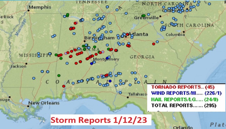
Here’s the preliminary Storm Reports map from SPC. Check out all those red dots representing Tornado Reports.
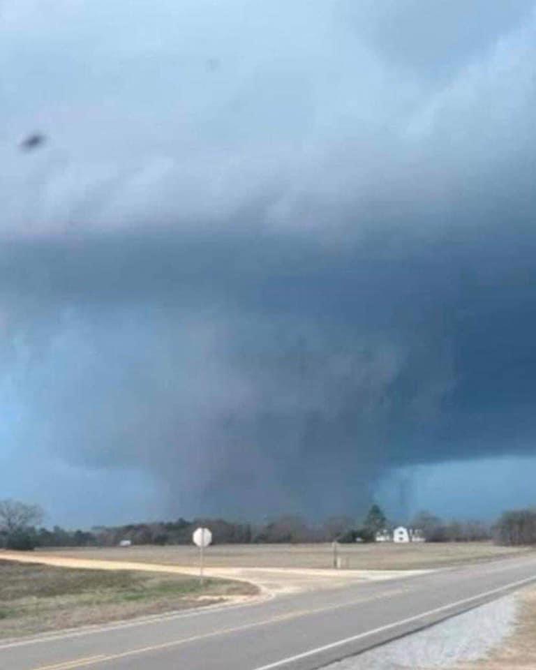
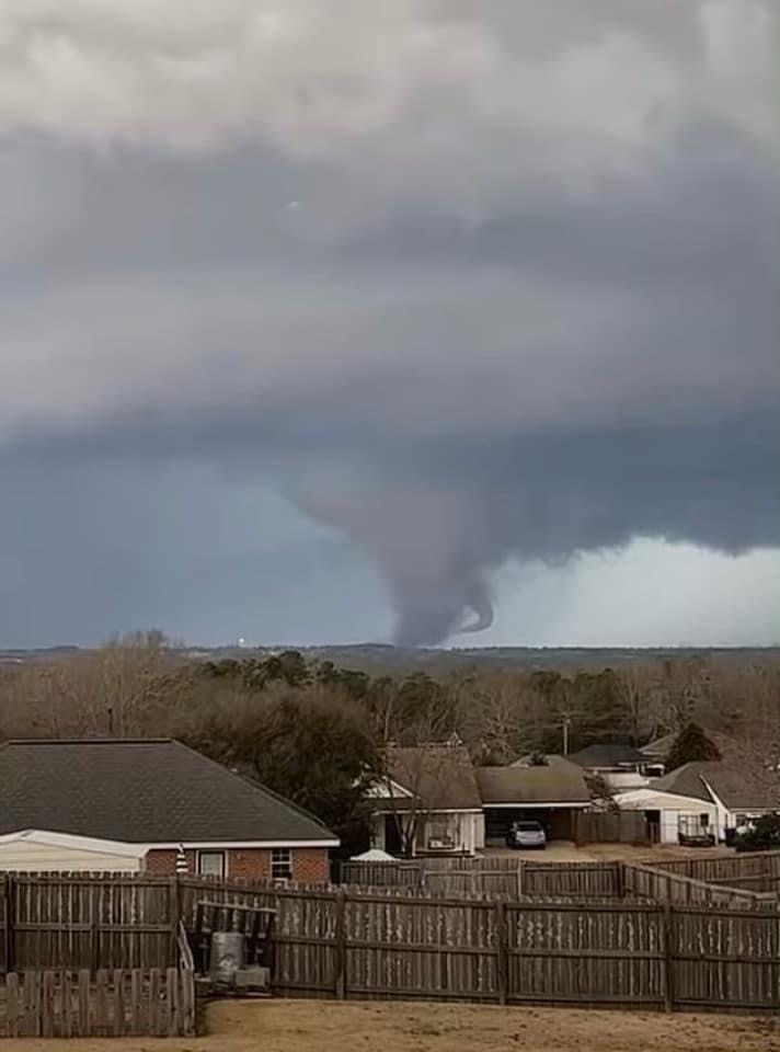
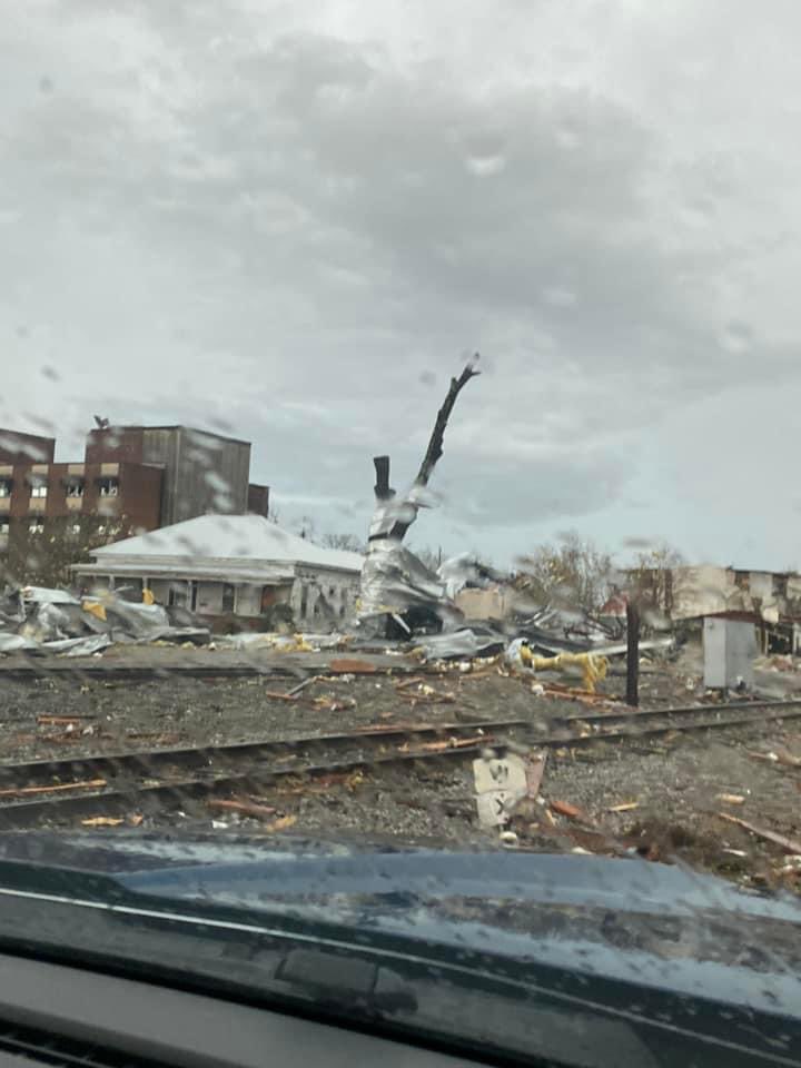
Here’s a snapshot of that large deadly tornado that tracked from Dallas through Autauga, into Elmore and eventually Tallapoosa county. Here’s a picture taken near Marbury.
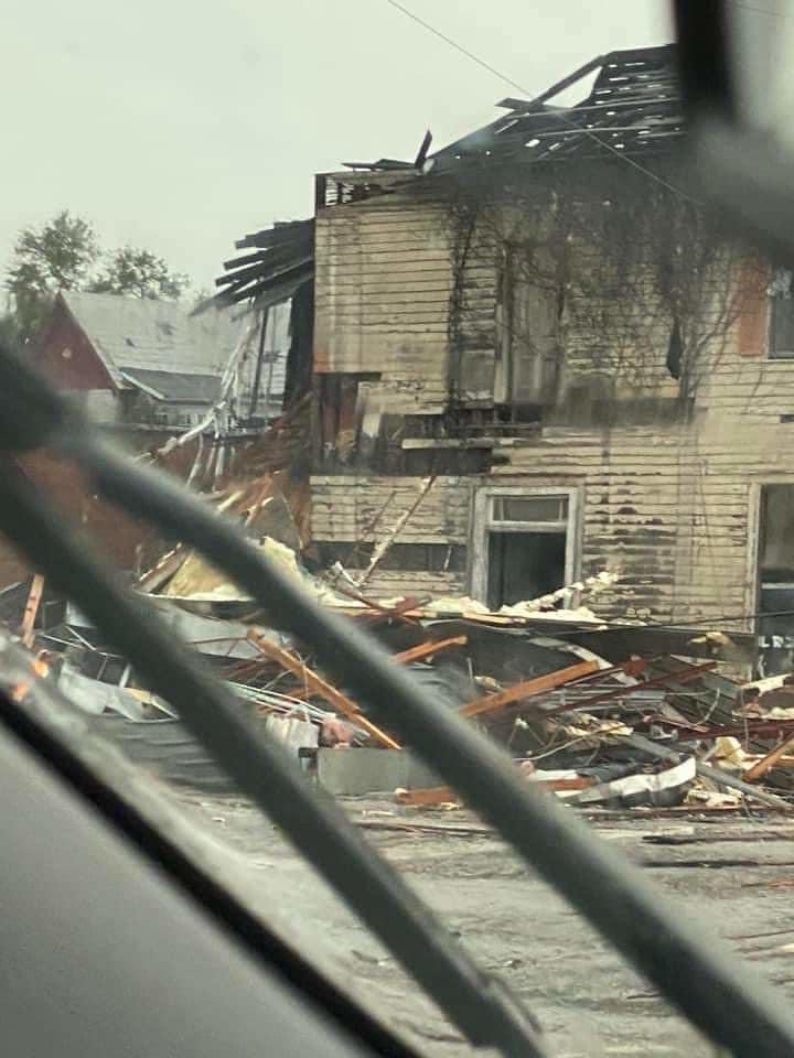
Many central Alabama towns have been ruined. The damage is staggering. Downtown Selma was hard hit. There were at least 6 fatalities in Autauga county, along with multiple injuries.
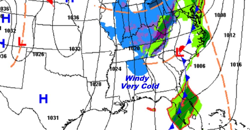
TODAY: Windy and extremely cold. Mostly cloudy. A few brief flurries are possible, but the flakes will melt as they fall. The high temperature may struggle to reach. But, northwest winds 15 to 25 mph will make it seem much colder. Wind chill will be a big factor. Tonight – Mostly cloudy, windy and cold. Overnight low 29. Wind chill will be in the 30’s much of this day, falling to the 20’s after sunset and perhaps upper teens by morning. Dress in layers.
What a shocker after the deadly storm. Bitterly cold air dominates the Southeast US today.
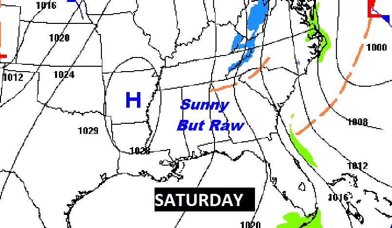
NEXT FEW DAYS: Saturday will be quite cold. Partly sunny early…sunny later. The high will struggle to reach 50. We’re headed for the upper 20’s Saturday night.
Sunday will show slight recovery. High in the upper 50’s. Low 60’s on MLK day will feel like a heatwave. Expect mid 70’s on Wednesday. Showers will return.
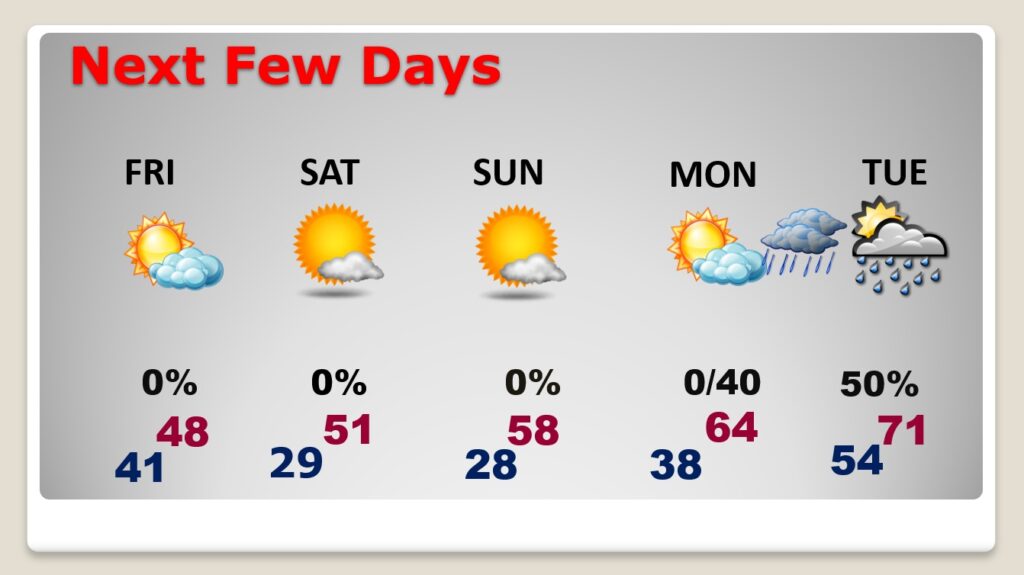
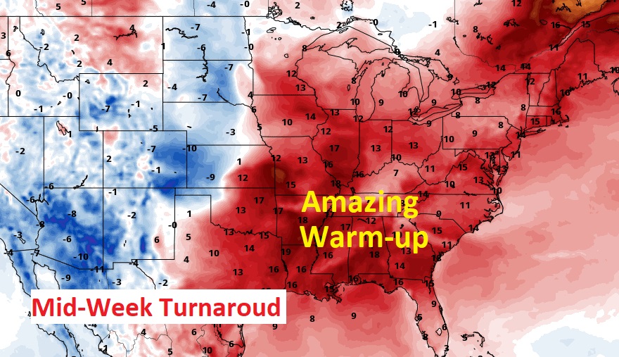
Amazing temperature turnaround next week. Big warm-up, ahead of the next storm system.
.
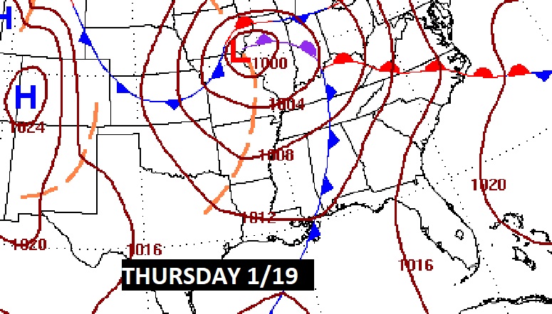
By next Wednesday night into Thursday we’ll be closely monitoring the next big deal storm system.
Thanks for reading this Blog this morning! This morning we are LIVE on the radio from 6 to 9 on NewsTalk 93.1. Watch us on TV on CBS 8 and ABC 32. I’ll have another update for you in the morning. Have a nice day!
–Rich