
Good Morning! A major warm-up is now underway. Expect the warming trend to continue well into this week.
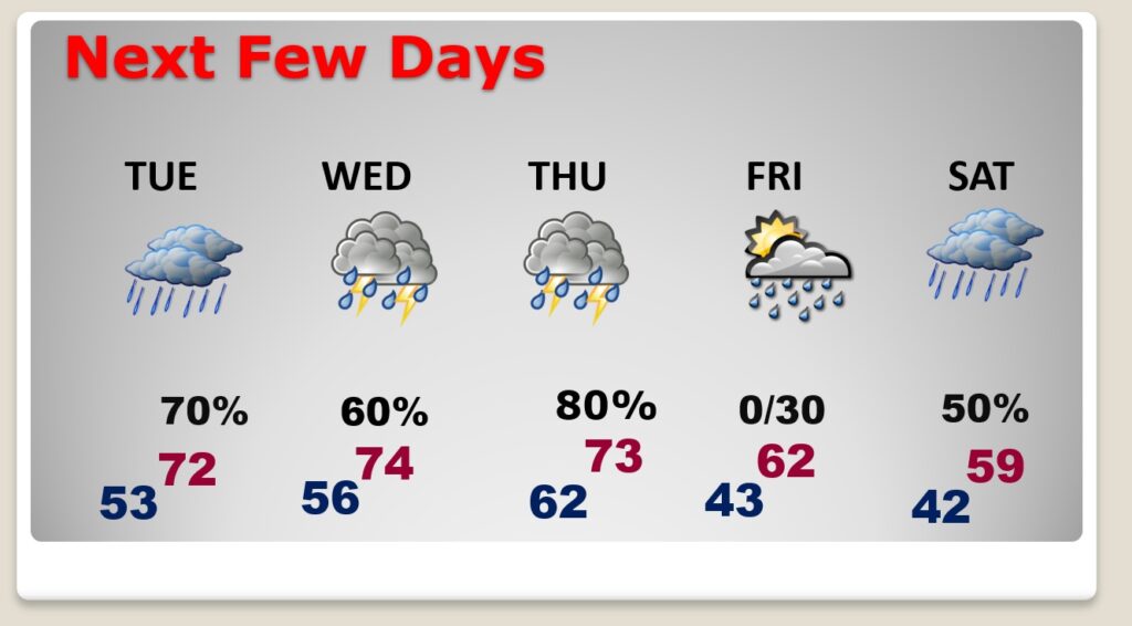
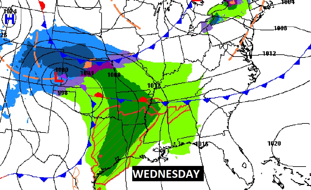
There will be two storm systems in the week ahead. The first storm system will be bring showers to the state by late tonight & tomorrow. There will be a brief break between storm systems until the second one delivers a round of showers and storms by late Wednesday/Wed. Night and into Thursday. Storm system number two could involve yet another round of strong to severe storms in the overnight hours Wednesday/Thursday. Here’s my brief forecast discussion.
THURSDAY TORNADO TRAGEDY SURVEYS: The National Weather Service continued surveying central Alabama tornado damage yesterday. Nine tornadoes have been surveyed so far, including the Selma Tornado (EF-2), which may have lifted near the Dallas/Autauga line, before touching down again in Autauga county, reaching EF-3 strength and becoming deadly. Now, we officially know, there was an extremely long, 5 county long track EF3 tornado. 76 miles, 1500 yard wide called the Old Kingston-Lake Martin tornado. Quoting NWS:
“NWS Birmingham survey teams have completed surveys
and have determined one continuous tornado damage path from
Autauga County into western Chambers County. The Old Kingston-Lake
Martin EF3 Tornado had a long-track path of over 76 miles and was
at least 1,500 yards wide. This tornado caused 7 fatalities and
16 injuries. This brings the final count of documented Central
Alabama tornadoes to 9 from January 12th, 2023. ”
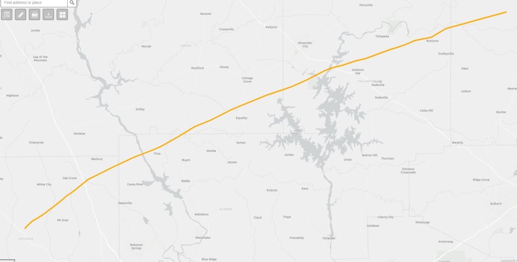
Here’s the updated Storm survey from NWS Birmingham.
https://forecast.weather.gov/product.php?site=NWS&product=pns&issuedby=BMX
TODAY: Mostly sunny. The warm-up continues. High 66. South wind 5 to 10 mph. Mostly cloudy tonight. Milder. Low 54. Small risk of showers late tonight after Midnight. (Normal 59/36)
NEXT FEW DAYS: The big warm-up continues Tuesday, Wednesday and Thursday. Sunday’s high was 60, after a morning low of 27. There will be two storm systems in the week ahead. The first storm system will be bring showers to the state by Tuesday. There will be a brief break between storm systems until the second one delivers a round of showers and storms by late Wednesday/Wed. Night and into Thursday.
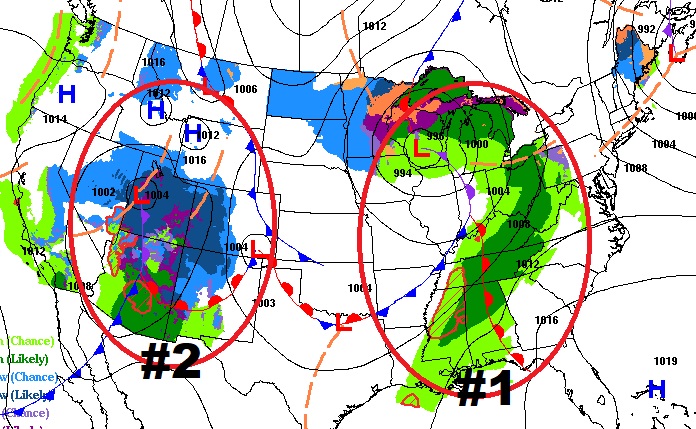
Storm system number two could produce a severe weather threat in the overnight hours on Wednesday. A line of strong storms will could possibly produce damaging wind gusts and perhaps a couple of spin-up tornadoes. Details are still a bit murky. Stay tuned.
Already states west of us are included in a Severe Weather Risk from SPC.
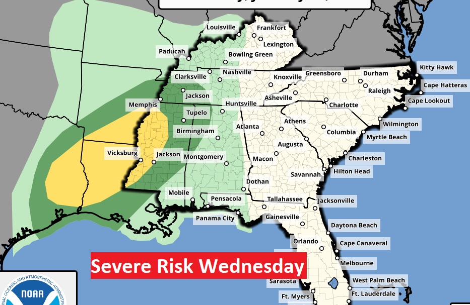
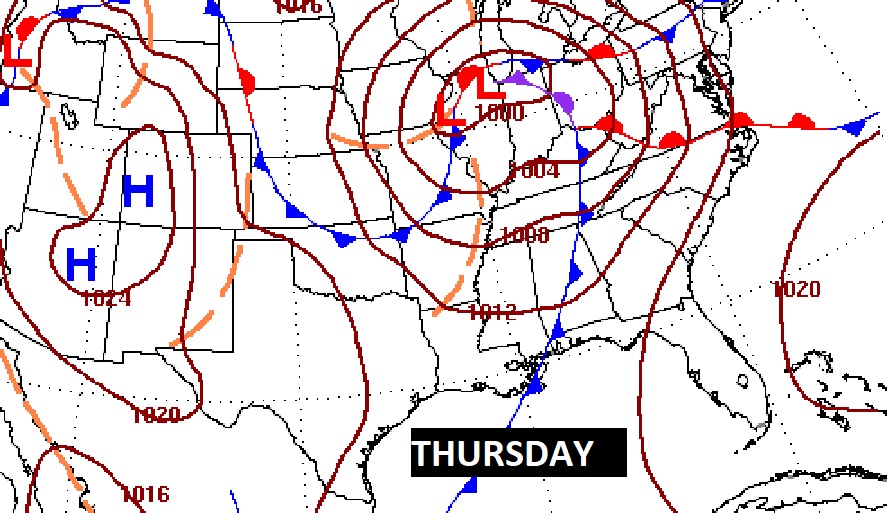
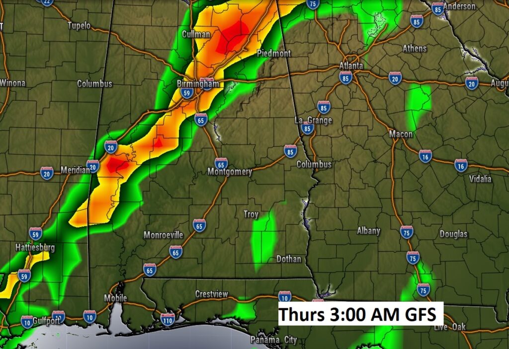
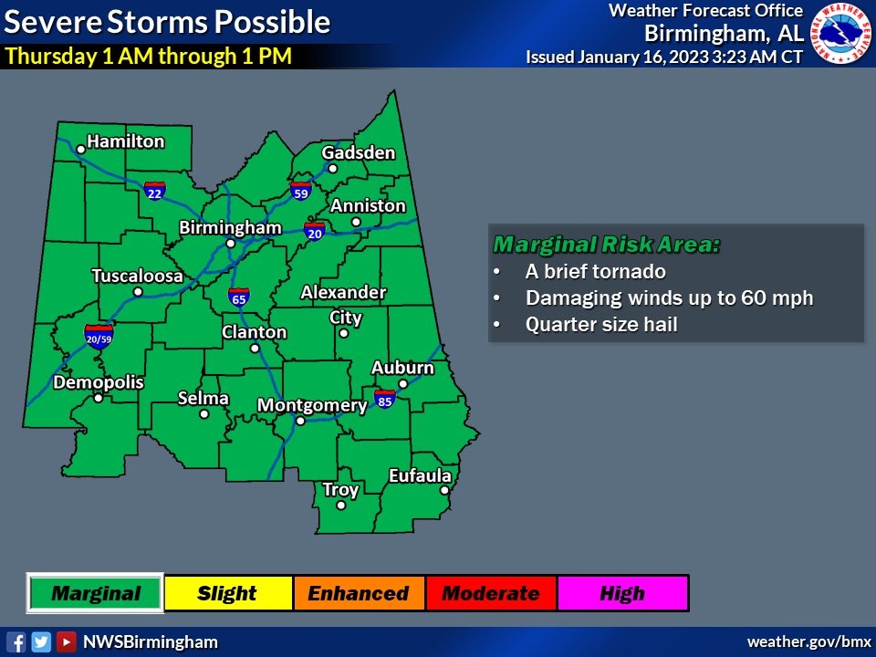
NWS is mentioning a Marginal Severe Risk early Thursday, starting in the overnight hours (Late Wed. Night, early Thursday) A brief tornado is possible, damaging wind gusts to 60 mph, and large hail is possible.
.
Thanks for reading this Blog this morning! I’ll have another update for you in the morning. Have a nice day!
–Rich