
Good Morning! Our major warm-up continues. We’re headed for the mid 70’s today. Showers and a few thunderstorms are possible today. A stronger lined of storms will cross into the state tonight. Some of the storms in the overnight hours tonight could be strong to severe, along a line of storms with very gusty winds. Yet another storm system will drench the state with more rain this weekend, especially by Saturday night and Sunday. The active pattern continues next week. Here’s my brief forecast discussion.
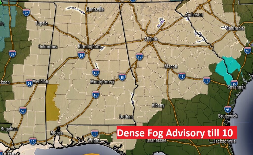
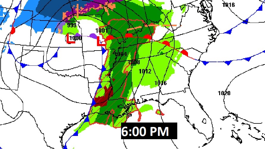
TODAY: DENSE FOG ADVISORY this morning. Cloudy, breezy & mild. High 76. South wind 10 to 20 gusting to 25 mph. Risk of scattered showers & thunderstorms, especially by afternoon. Tonight: Windy & very Mild. A line of thunderstorms will move through in the overnight hours. Some storms along the line, could be quite strong with very gusty winds.
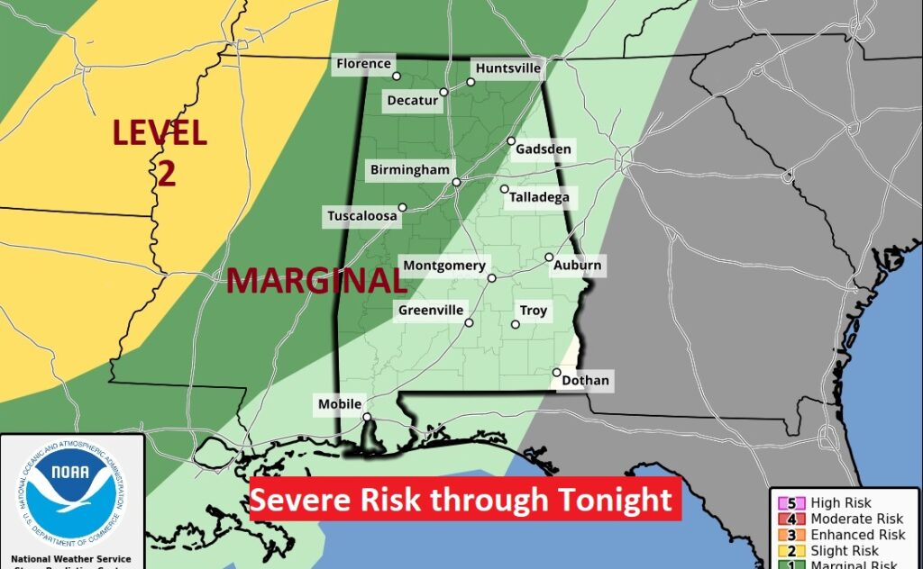
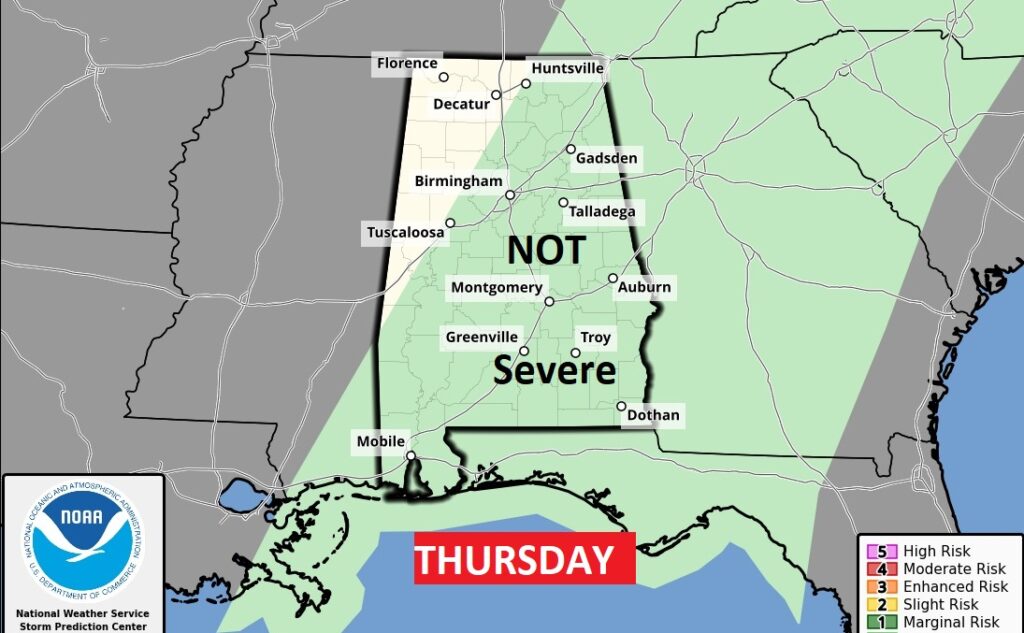
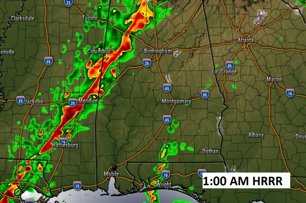
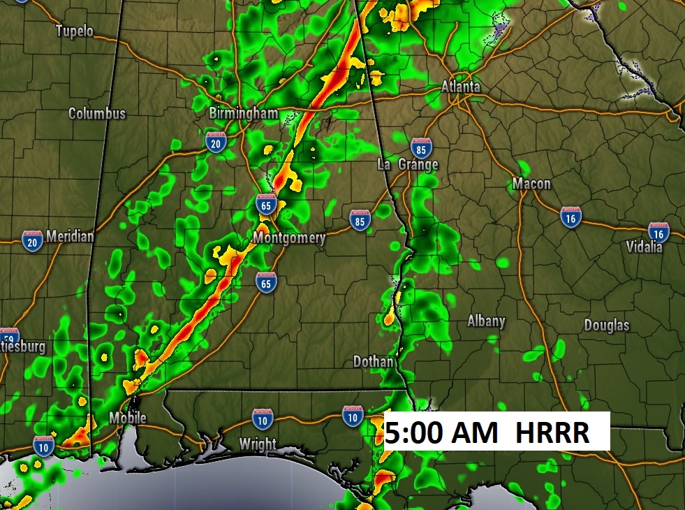
The severe weather outlook through tonight shows the Marginal Risk through much of west Alabama through 6AM Thursday. After 6AM, the Thursday Severe Outlook no longer carries a Severe Threat from the Storm Prediction Center, as the line of storms begins to weaken as it heads toward the I-65 corridor. Fingers crossed that this trend continues.
The line of strong to severe storms will move into the state after Midnight. Most of the models show the line of storms losing intensity as it progresses eastward. We hope this trend will continue. The line of storms should reach the I-65 corridor by about 5AM, and into southeast Alabama by about 9AM.
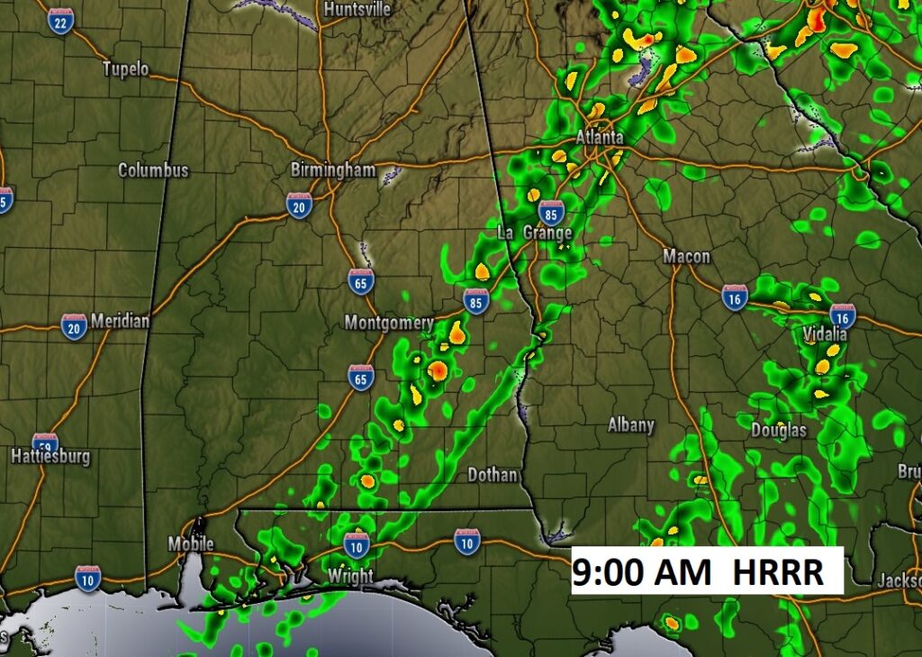
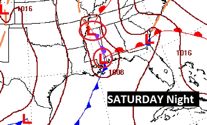
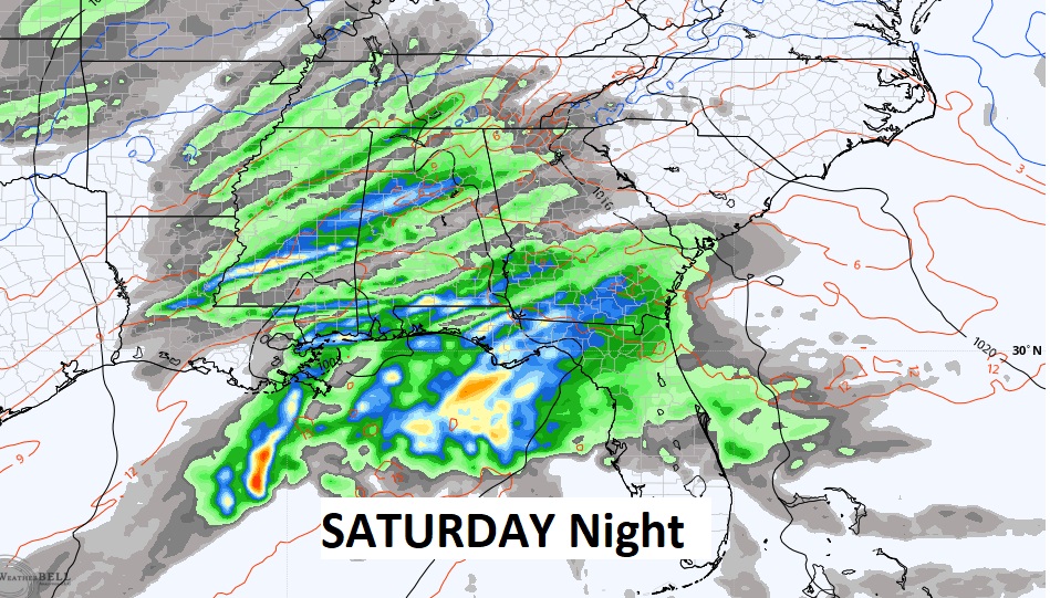
NEXT FEW DAYS: The line of storms will depart the state by mid to late morning tomorrow. It will turn much cooler Friday and Saturday. A Gulf Coast storm system will spread more rain across the Gulf South over the weekend, especially Saturday night and Sunday.
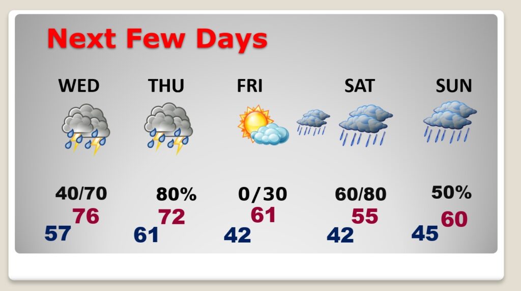
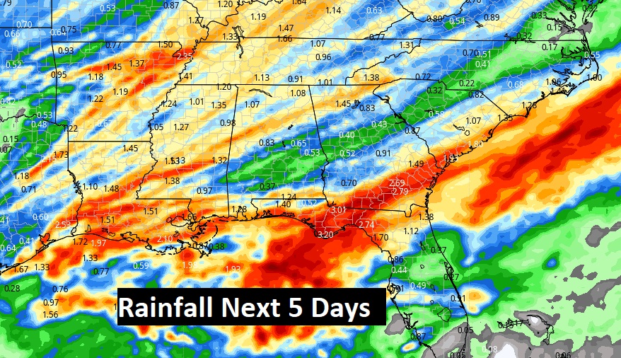
Could be a lot of rain across the region over the next 5 days, especially closer to the coast, where rainfall amounts could be excessive.
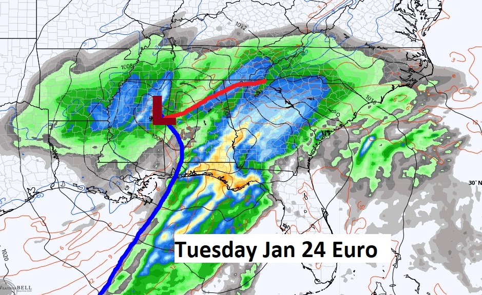
The active weather pattern continues next week. Looks like a pretty impressive storm system next Tuesday, 1/24.
.
Thanks for reading this Blog this morning! I’ll have another update for you in the morning. Have a nice day!
–Rich