
Good Morning! We are enjoying a brief break between storm systems. It will be noticeably cooler today by about 15 degrees, but we should see a lot of sunshine. Enjoy today, because another storm system will bring drenching rains over the weekend. Best chance of rain will be Saturday night and mainly early Sunday. The active pattern continues next week. Here’s my brief forecast discussion.
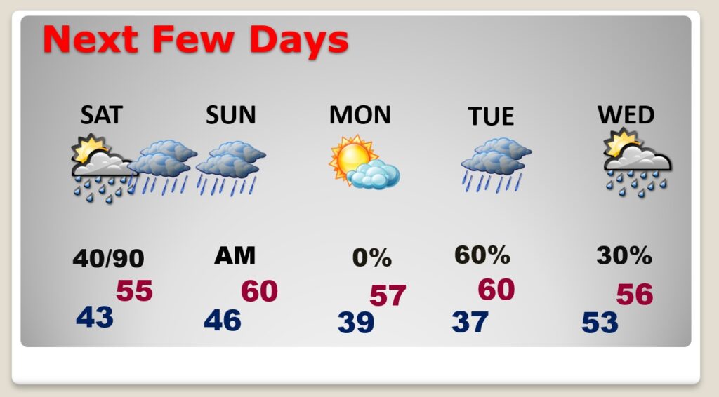
TODAY: Noticeably cooler today. Yesterday’s high was 76. Today’s high 61. Mostly sunny. Northwest wind 6 to 12 mph. Cloudy tonight. Risk of isolated showers late tonight. Low 43.
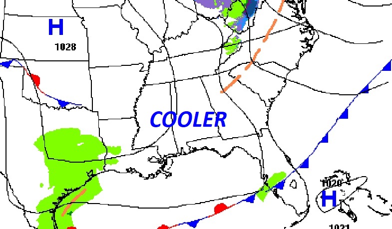
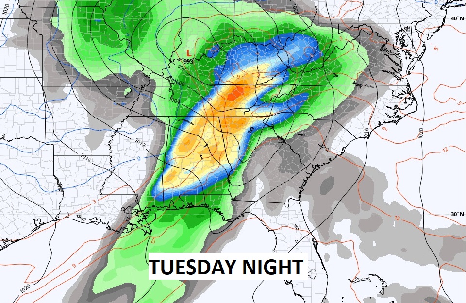
NEXT FEW DAYS: It will be cool Saturday with highs in the 50’s. A Gulf Coast storm system will spread more rain across the Gulf South over the weekend, especially Saturday night and Sunday morning. Monday looks dry, but more rain will return Tuesday and maybe some thunderstorms, as the active pattern continues.
Could be a lot of rain across the region over the week ahead, especially closer to the coast.
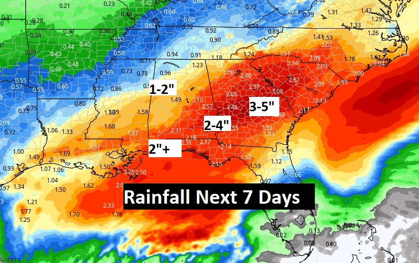
The Storm system next week looks substantial. Will it be severe? Too early to make that pronouncement yet.
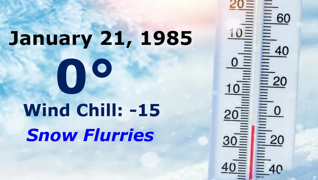
COLDEST DAY OF THE 20th CENTURY: 38 years ago today was the coldest 36 hours I ever covered for you in my weather career in Montgomery. On January 20, 1985, the temperature crashed. There were snow flurries. By Midnight the temperature fell to 4 degrees. By morning it was ZERO. Montgomery’s coldest temperature in the 20th century. Wind Chill -15. More flurries.
Thanks for reading this Blog this morning! This morning we are LIVE on the radio from 6 to 9 on NewsTalk 93.1. Watch us on TV on CBS 8 and ABC 32. I’ll have another update for you in the morning. Have a nice day!
–Rich