
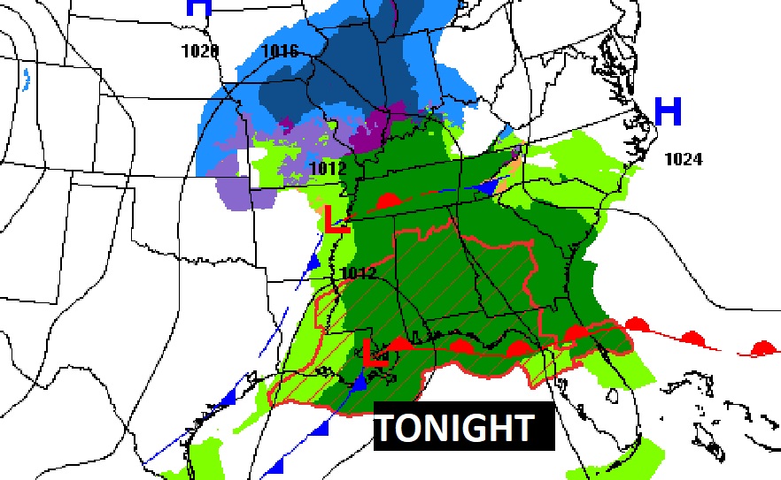
Good Morning! Have the rain gear ready. Be flexible with your plans. A Gulf coast storm system will drench the area this weekend, especially tonight and first half of the day Sunday. It will be a cool series of days, but actually close to the seasonal normal for late January. Looking ahead, the next “big deal” storm system could bring a Severe Weather Threat to the area by Tuesday afternoon through the overnight hours on Tuesday into Wednesday morning. Details on this system are still emerging. We’ll know more as we get closer.
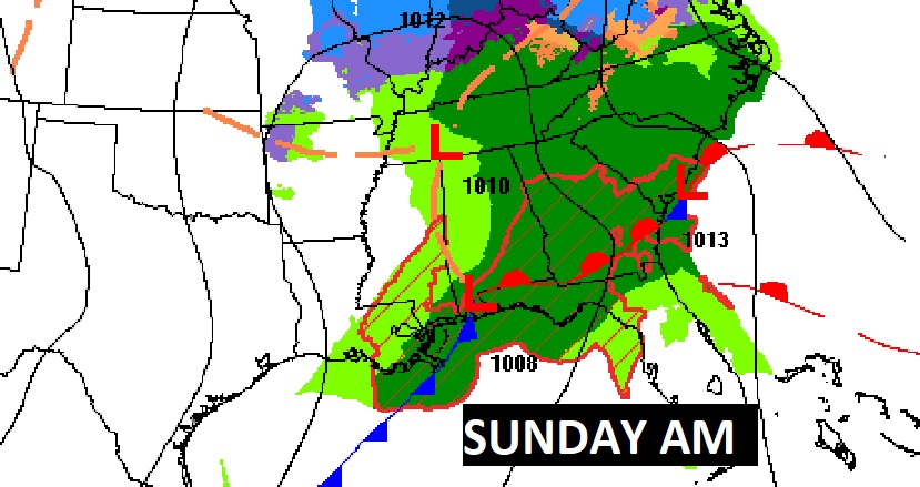
TODAY & SUNDAY: Showers are possible anytime today, but the rain chances start small this morning and gradually increase as the day progresses. Cloudy & cool. High 55. Periods of rain and maybe a few thunderstorms tonight and through the first half of the day Sunday. Locally heavy rainfall. No severe weather is expected, except near the coast. Low tonight 49. Rain tapers off Sunday afternoon. High Sunday 62. Low Sunday night 41.
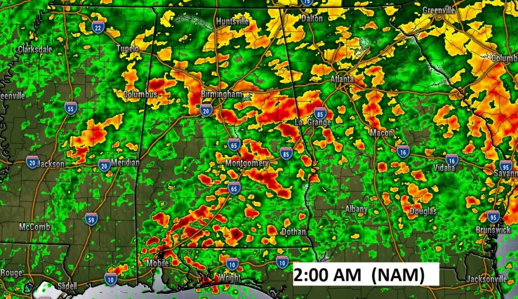
A picture is worth a thousand words. Here’s a Future Radar snapshot late tonight.
NEXT FEW DAYS: Monday looks like a nice day between storm systems. Cool sunshine. Near normal high 57. The next “big deal” storm system could bring a Severe Weather Threat to the area by Tuesday afternoon through the overnight hours on Tuesday into Wednesday morning. The rain should move out by mid-day Wednesday. Thursday looks dry but COLD.
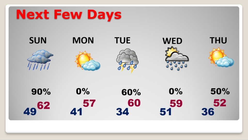
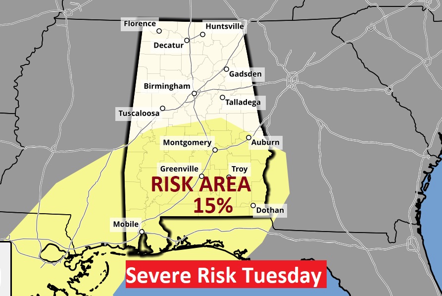
The Storm Prediction Center has already outlooked much of south Alabama in a severe weather risk for Tuesday. Mostly Tuesday night through 6AM Wednesday. All modes of severe weather are on the table including the risk of tornadoes. It’s always a big deal when SPC issues a severe risk beyond three days.
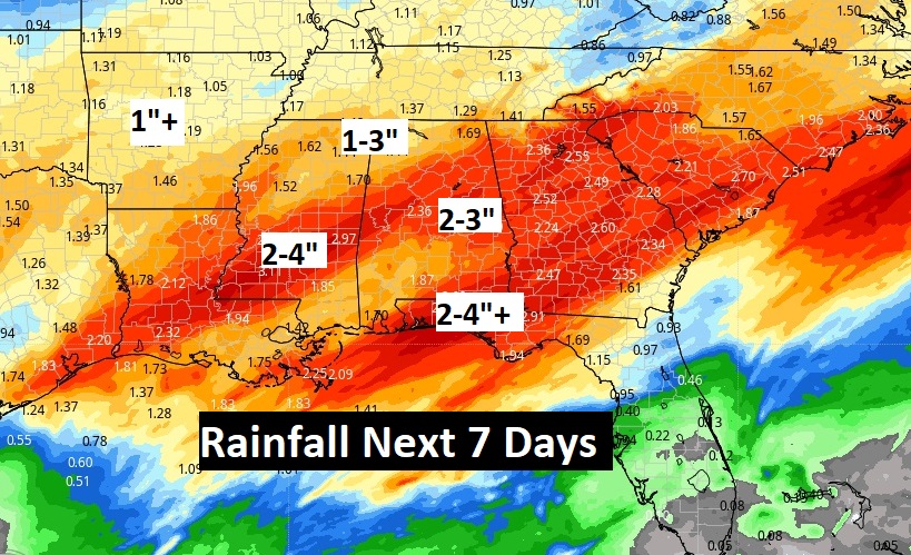
Could be a lot of rain across the region over the week ahead, especially closer to the coast.
.
Thanks for reading this Blog this morning! I’ll have another update for you in the morning. Have a good weekend, despite the gloomy weather!
–Rich