
Good Morning! We’re not done with the risk of rain yet, as a storm system cruises along the northern Gulf coast. It will be cloudy, cool and drab through tonight. Monday will be nicer day in between storm systems. There will be quite a bit of cool sunshine with highs only in the 50’s. The next “Big Deal” storm system will bring yet another severe weather threat to the area in the overnight hours on Tuesday night/early Wednesday morning. This will include the risk for damaging wind gusts and a few tornadoes can’t be ruled out. Much cooler air will follow the storm system, with chilly days and cold nights.
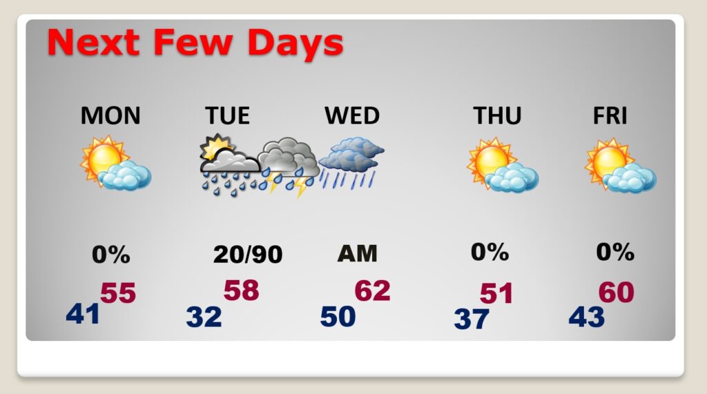
TODAY: While the main surge of rain will exit the area early this morning, there will be a continued risk of showers later in the day, as the main trough is still west of us. So, Cloudy, cool, risk of scattered showers. Kind of a drab day, again. High 57. East wind 5 to 10 mph. Continued cloudy tonight. Chilly. Low 41.
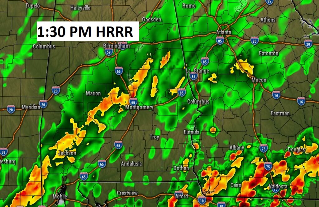
Here’s a future radar snapshot early this afternoon, showing the last batch of showers before we dry out.
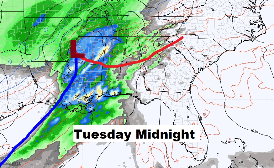
NEXT FEW DAYS: Monday looks like a nice day between storm systems. Cool sunshine. Near normal high 55. The next “big deal” storm system could bring a Severe Weather Threat to the area by Tuesday afternoon through the overnight hours on Tuesday into Wednesday morning. The rain should move out by Wednesday morning. Thursday & Friday looks dry but COLD.
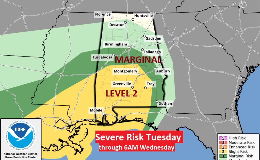
The Storm Prediction Center has already outlooked much of south Alabama in a severe weather risk for Tuesday night in the overnight hours. . Mostly Tuesday night through 6AM Wednesday. All modes of severe weather are on the table including the risk of tornadoes.
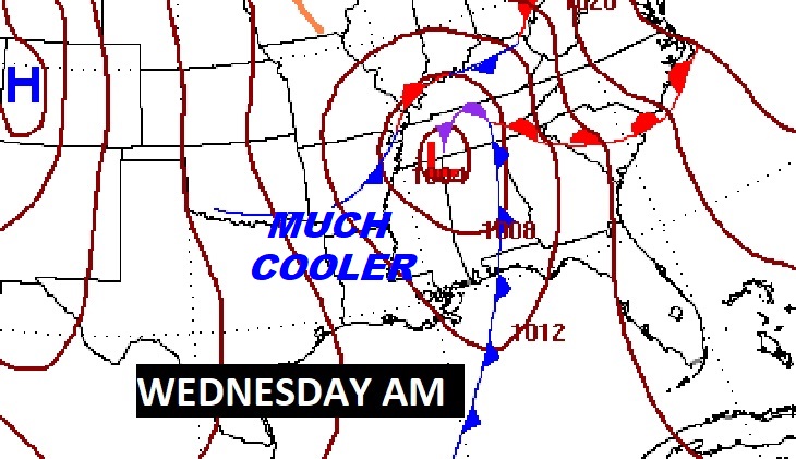
Much Cooler air will spill into the state Wednesday through Friday, but NO ARCTIC AIR is foreseen at this point. That’s always good news.
RECORD NUMBER OF JANUARY TORNADOES: NWS says we have reached an all-time Record Number of Tornadoes for the month of January with 28 so far! (Second only to 2016) Click here for more details.
https://nwschat.weather.gov/p.php?pid=202301220244-KBMX-NOUS44-PNSBMX
LOTS OF TORNADOES IN 2022: 98 TORNADOES in 2022 is second only to that landmark tornado year 2011. Click here for more details.
https://nwschat.weather.gov/p.php?pid=202301220045-KBMX-NOUS44-PNSBMX
.
Thanks for reading this Blog this morning! I’ll have another update for you in the morning. Have a nice Sunday, despite the gloomy weather!
–Rich