
Good Morning! We’re enjoying a very brief break between storm systems. Today should be a quiet start to the week. The next “Big Deal” storm system will bring another severe weather threat to the area in the overnight hours on Tuesday night/early Wednesday morning. This will include the risk for damaging wind gusts and a few tornadoes can’t be ruled out. Much cooler air will follow the storm system, with chilly days and cold nights. Here’s my brief forecast discussion.
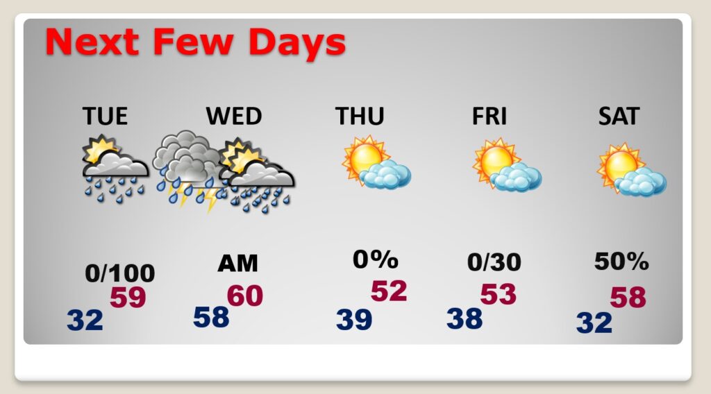
TODAY: Should be a quiet start to the week. A nice beak between storm systems. Cloudy at first, then gradually mostly sunny. A chilly day. High barely 53. (Normal 60/36). Breezy. North 10 to 15 gusting to 20. Mainly clear and cold tonight. Low 32.
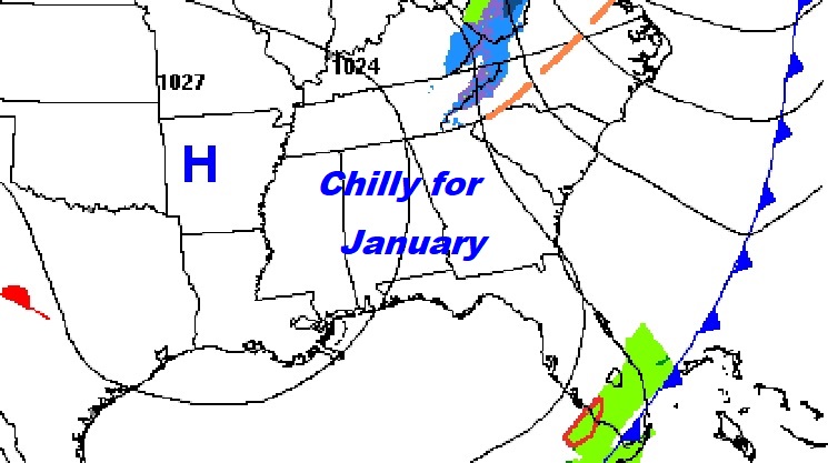
Quiet today, but all eyes on the next storm system in the Southwest which will migrate eastward.
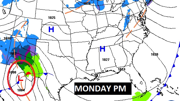
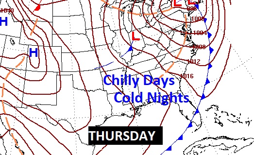
NEXT FEW DAYS: Much of Tuesday looks dry and comfortable. The next “big deal” storm system will bring a Severe Weather Threat to the area by Tuesday night.. through the overnight hours on Tuesday into Wednesday morning. The rain should move out by mid-day Wednesday. Thursday through Saturday looks dry but COLD.
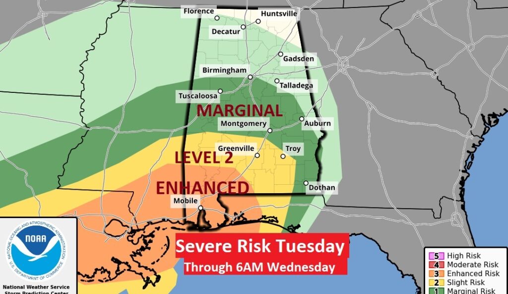
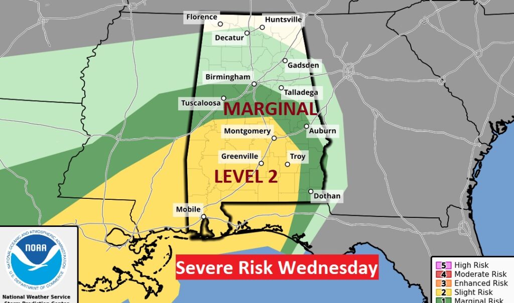
The Storm Prediction Center has already outlooked much of south Alabama in a severe weather risk for Tuesday night in the overnight hours. This includes a Level 3 Enhanced Risk. The Tuesday outlook ends at 6AM Wednesday, Then the Wednesday Day 3 outlook continues with a Level 2 severe risk covering much of the southern half of Alabama. All modes of severe weather are on the table including tornadoes.
Much Cooler air will spill into the state Wednesday through Saturday. Very chilly days and COLD sub-freezing nights.
.
Thanks for reading this Blog this morning! This morning we are LIVE on the radio from 6 to 9 on NewsTalk 93.1. Watch us on TV on CBS 8 and ABC 32. I’ll have another update for you in the morning. Have a nice day!
–Rich