
Good Morning! Much of the day today will be quiet. It breezy with lot of sun early and increasing clouds later. But stand by. A powerful storm system will move in from the southwest overnight. A powerful line of storms will enter the state around Midnight and spread eastward, bringing a Severe Weather Threat overnight. This will include the risk for damaging wind gusts and a few tornadoes can’t be ruled out. Even outside of thunderstorm areas, winds could gust over 40 mph. A Wind Advisory is in effect. Much cooler air will follow the storm system, with chilly days and cold nights. Here’s my brief forecast discussion.
TODAY: Quiet during the day. A good bit of sunshine. Clouds increase later. Breezy. East wind 10 to 15+. High 58. The big action happens overnight tonight.
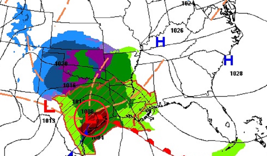
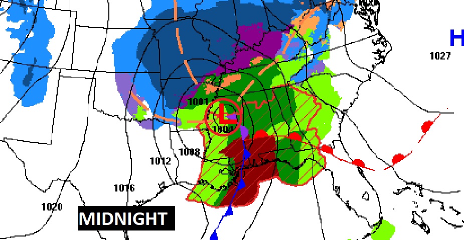
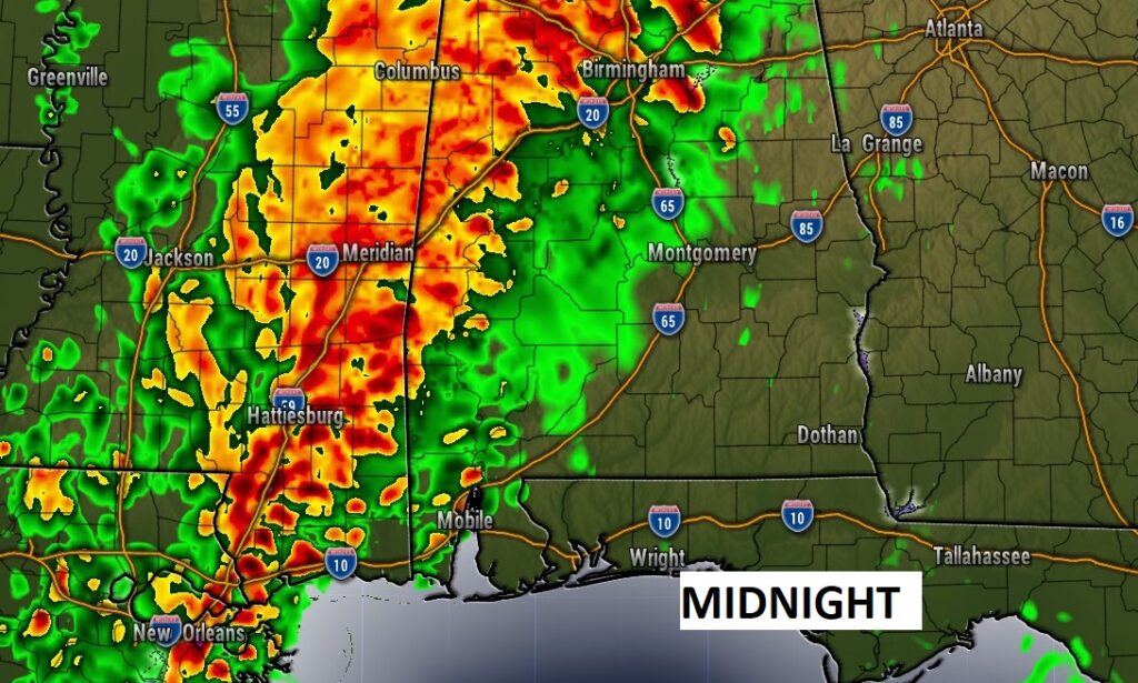
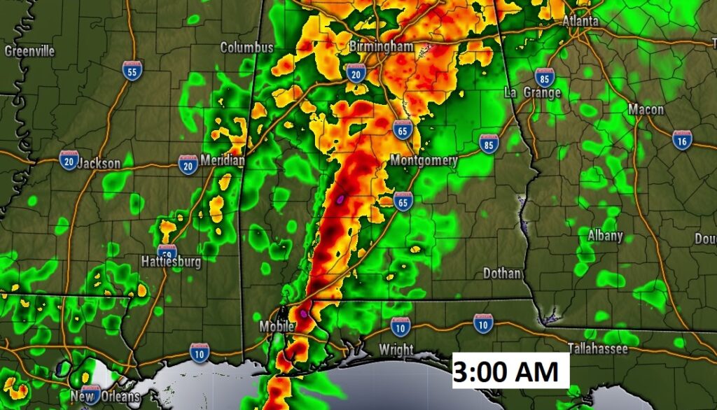
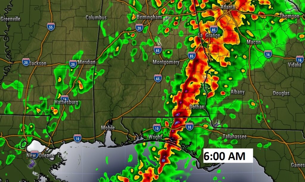
Here’s the maps at Noon and Midnight tonight as a powerful storm system moves from coastal Texas to north central Mississippi at Midnight.
TONIGHT:
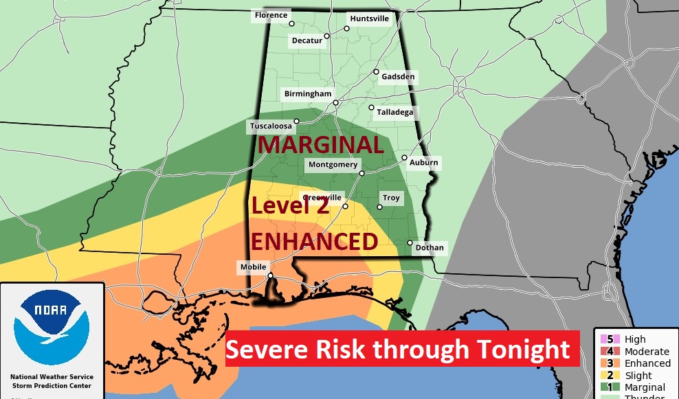
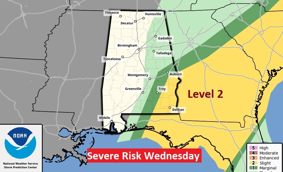
The Storm Prediction Center has outlooked much of south Alabama in a severe weather risk for tonight, in the overnight hours. This includes a Level 3 Enhanced Risk in southwest Alabama. This outlook ends continues until 6AM Wednesday. All modes of severe weather are on the table including damaging thunderstorm winds and tornadoes. Wednesday AM at 6AM, the Day 2 outlook shifts eastward into southeast Alabama, and eastward into Georgia and the Carolinas.
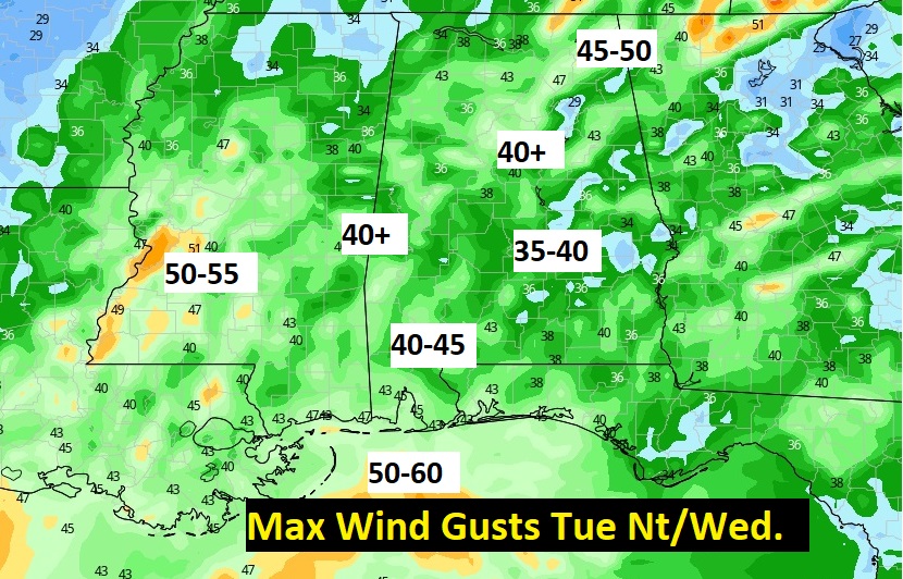
Future Radar (HRRR) shows the progression of the powerful line of storms through the overnight hours from Midnight through 6AM. Damaging thunderstorm wind gusts to 60 mph are possible, along with a few spin up tornadoes.
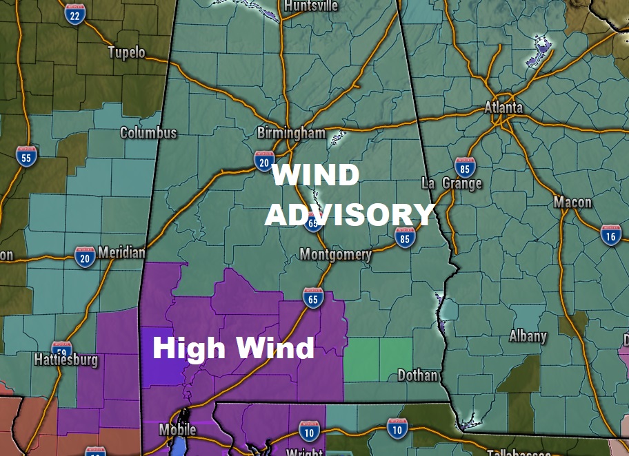
WIND ADVISORY: Sustained winds of 20-30 mph with gusts perhaps over 40 mph for most of us from 9PM tonight till 3PM Wednesday. In Southwest Alabama, there is a High Wind watch. Winds could gust to over 50 mph.
* IMPACTS...Gusty winds could blow around unsecured objects.
Tree limbs could be blown down and a few power outages may
result.
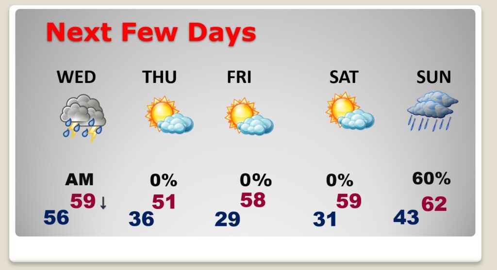
NEXT FEW DAYS: The rain should move out Wednesday morning. Much Cooler air will spill into the state Wednesday. It will be windy with falling temperatures. Expect low 50’s by Wednesday afternoon and 30’s Wednesday night. Get ready for a series of very chilly days and COLD sub-freezing nights. The next rain arrives by Sunday.
.
Thanks for reading this Blog this morning! This morning we are LIVE on the radio from 6 to 9 on NewsTalk 93.1. Watch us on TV on CBS 8 and ABC 32. I’ll have another update for you in the morning. Stay weather aware!
–Rich