
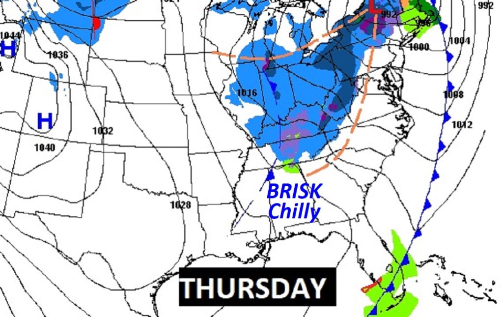
Good Morning! The powerful storm system which brought storms to the state will depart early. In it’s wake, expect a windy cool-down. Temperatures will fall during the day, today. We’re headed for the 30’s tonight. Gusty winds will make it seem colder. Thursday will be brisk and quite chilly. We could potentially fall to the upper 20’s by Dawn Friday. Still chilly Friday. Not quite as cool Saturday. The next chance of rain arrives on Sunday. Here’s my brief forecast discussion.
TODAY: Risk of showers and storms ending early. Mostly Cloudy. Wind Advisory. Southeast wind 15 to 25 gusting 30+. Mostly cloudy. Falling temperatures today, reaching 49 by mid to late afternoon. Mostly cloudy, windy & colder tonight. Low 37.
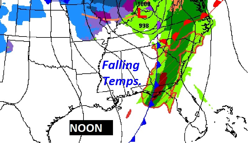
The frontal system will exit into extreme southeast Alabama by 6AM. The rest of the day will be windy with falling temperatures.
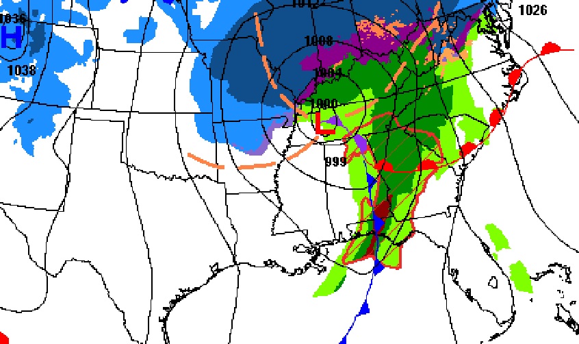
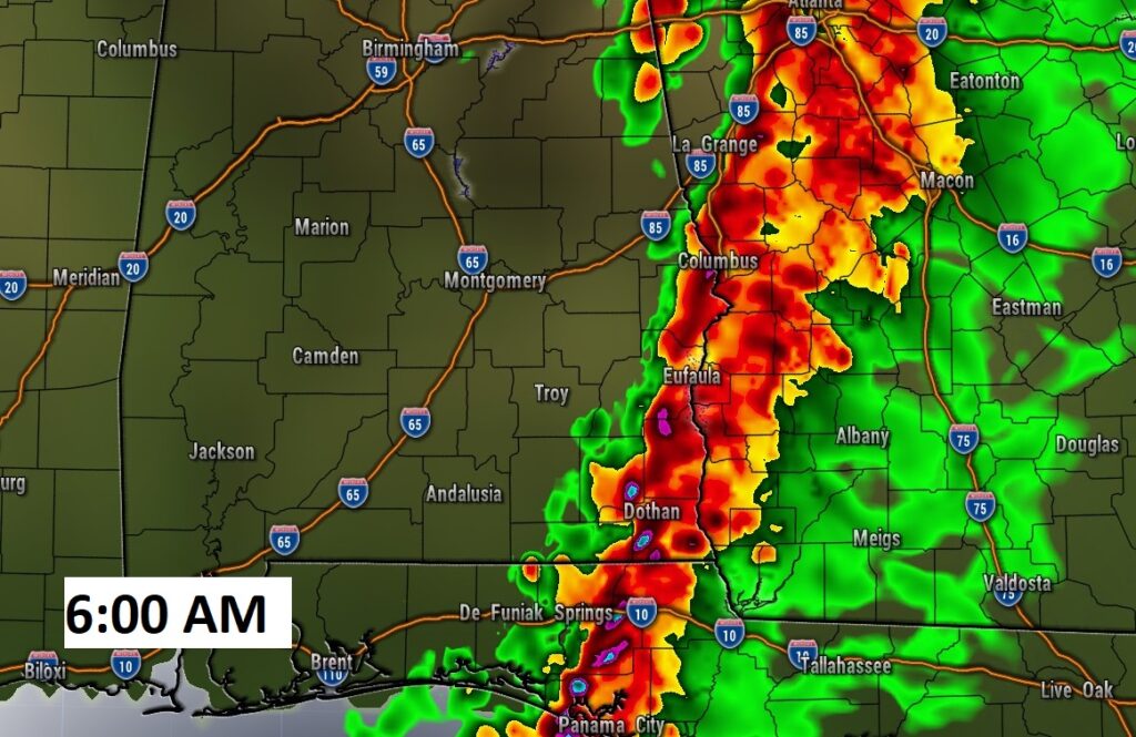
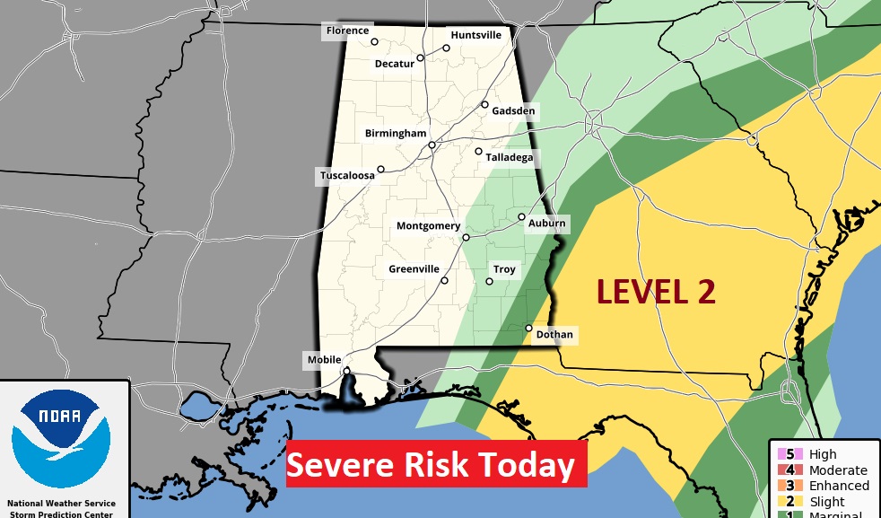
The Severe threat today will shift to extreme SE Alabama early, then into Georgia, Florida and the Carolinas.
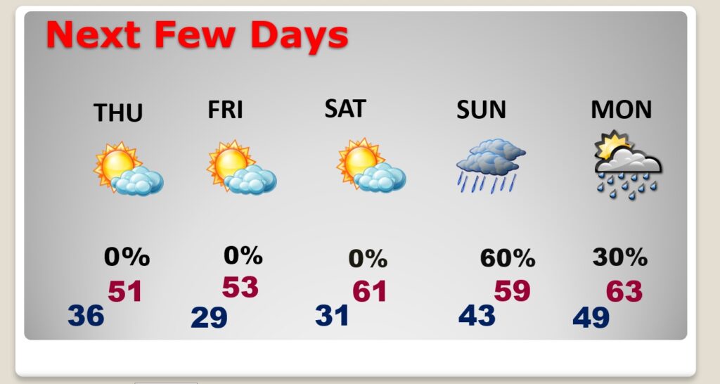
NEXT FEW DAYS: Get ready for a series of very chilly days and COLD sub-freezing nights. Thursday’s high will barely reach 51. Brisk. Partial sunshine.
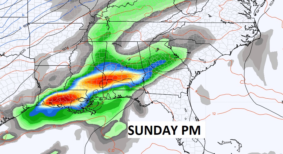
Clear and cold Thursday night. Low 29 by Friday Dawn. Chilly Friday. Sunshine. High 54. Another freeze Friday night. A little warmer Saturday. High 61. The next rain arrives by Sunday.
.
Thanks for reading this Blog this morning! This morning we are LIVE on the radio from 6 to 9 on NewsTalk 93.1. Watch us on TV on CBS 8 and ABC 32. I’ll have another update for you in the morning. Have a nice day!
–Rich