
Good Morning! Today will be not quite as cool. Actually, it will be near normal for the end of January. This is the last dry day in awhile. Rain returns by Sunday afternoon and Sunday night. Locally heavy rainfall. Next week looks rather active. A series of disturbances will move across the Gulf South. Thursday has the highest rain chance and the best chance for heavy rain and storms. Not sure about a potential Severe Weather Threat at this point. Here’s my brief forecast discussion.
TODAY: Not quite as cool today. Yesterday’s high was 54. High today near 60. Mostly sunny. (Normal 60/37). SE wind at 6 to 12. Not as cold tonight. Mostly cloudy. Low 41.
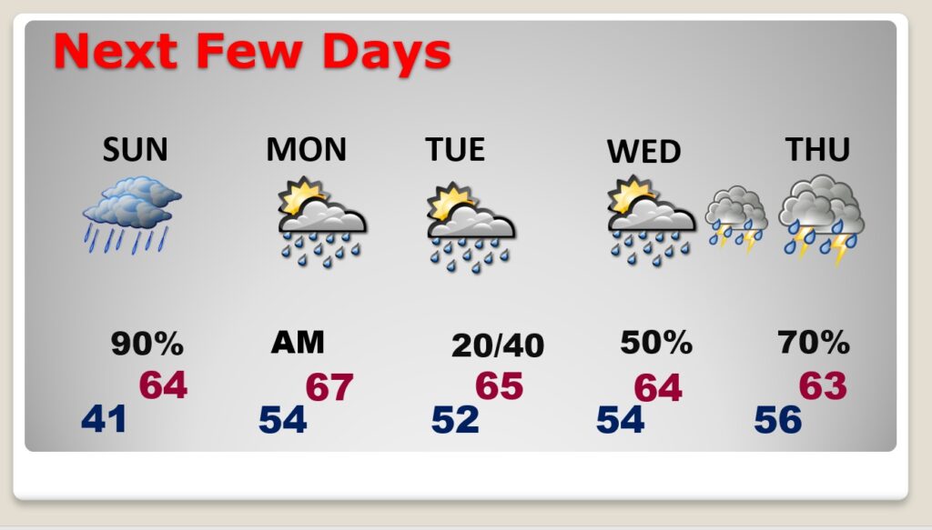
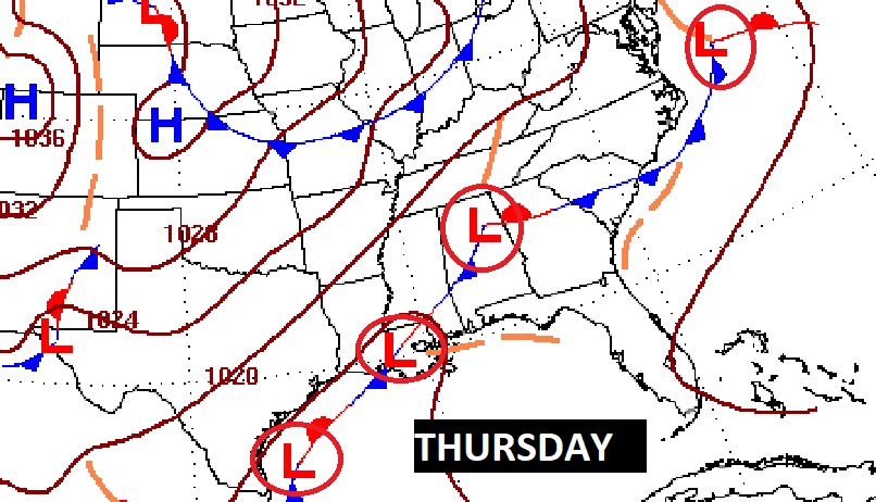
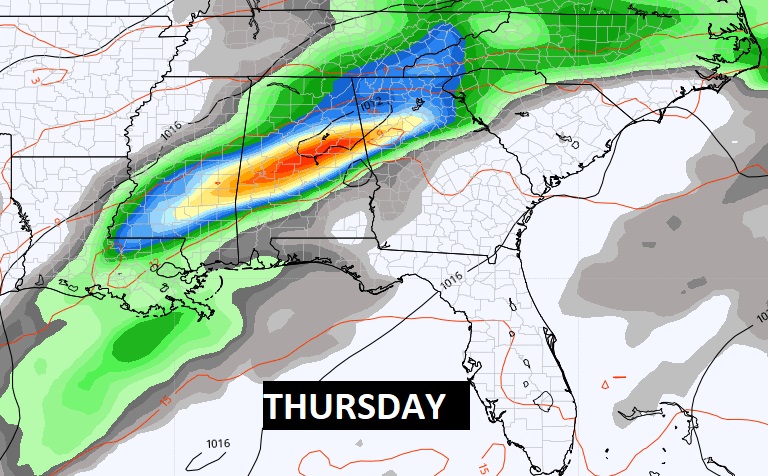
NEXT FEW DAYS: Rain returns by Sunday afternoon and Sunday night. Locally heavy rainfall. Next week looks rather active. A series of disturbances will move across the Gulf South. Highs will rebound to the 60’s. Thursday has the highest rain chance and the best chance for heavy rain and storms. Not sure about a potential Severe Weather Threat at this point.
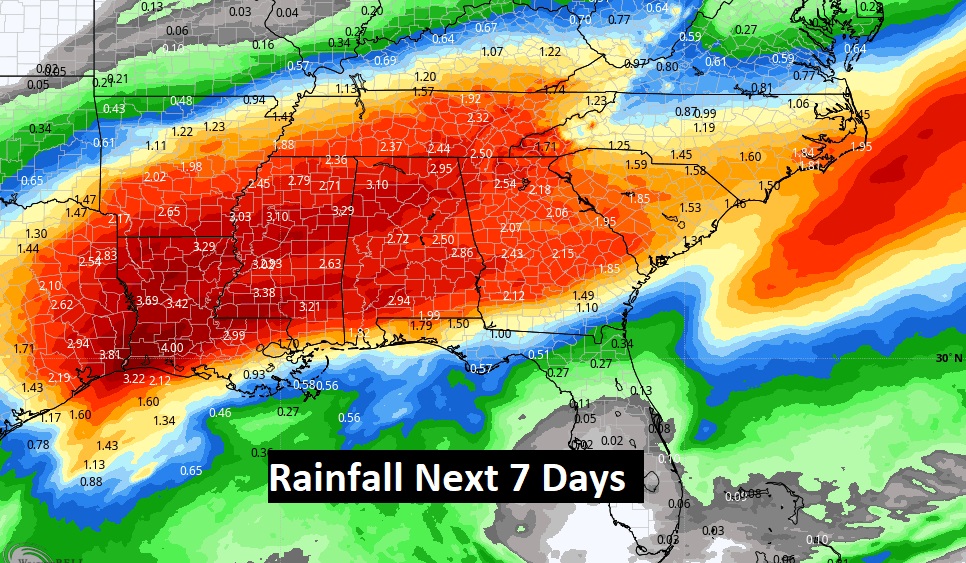
Wet times in the week ahead. WOW. Look at the some of the expected Rainfall Totals across the Southeastern U.S. on the Model Blend from WPC.
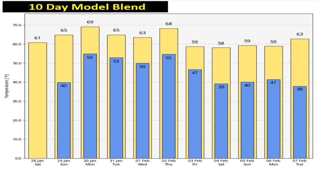
Here’s the 10-day Temperature trend. Today may be the last freeze for quite a while. No ARCTIC air in the next 10 days. Finger’s crossed.
Thanks for reading this Blog this morning! I’ll have another update for you in the morning. Have a nice day!
–Rich