
Good Morning!. It has been a wet 24 hours across the state. A series of disturbances will move across the Gulf South this week. Don’t expect any sunshine till perhaps Friday or Saturday. It will be wet at times. Temperatures will be relatively mild compared to normal. (Normal 61/37) The Best chance of rain this week will be on Thursday. Rain and thunderstorms. Looks like it could be a soaker. Here’s my brief forecast discussion.
TODAY: Cloudy and rather mild today. High 67. East wind 5 to 10 mph. Spotty showers are possible just about anytime. Nothing heavy. The most concentrated rain will be in the early morning. Mostly cloudy tonight. Low 56.
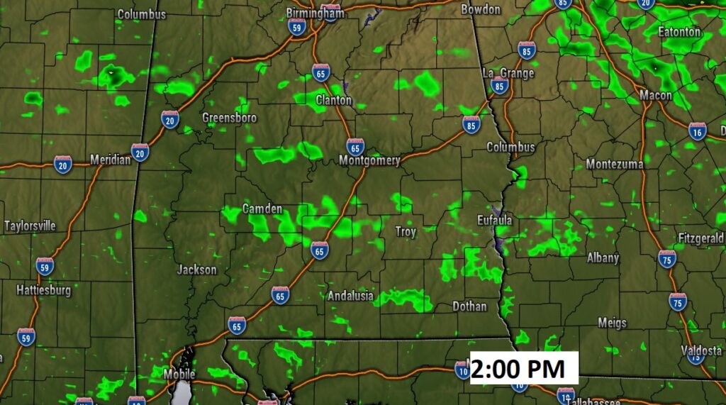
Here’s Future Radar at mid-afternoon. A few spotty showers here and there.
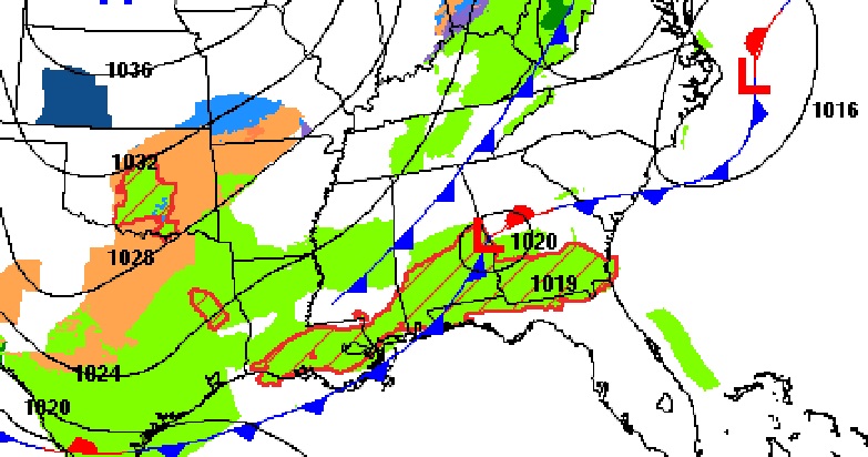
Active Weather Day across the Southern half of the U.S. Nasty winter storm in Texas.
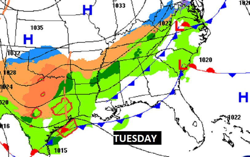
NEXT FEW DAYS: A series of disturbances will move across the Gulf South, this week. Small chance of rain Tuesday & Wednesday. Best chance of rain will be Thursday. Rain and thunderstorms. Locally heavy rainfall. Cooler Friday and Saturday.
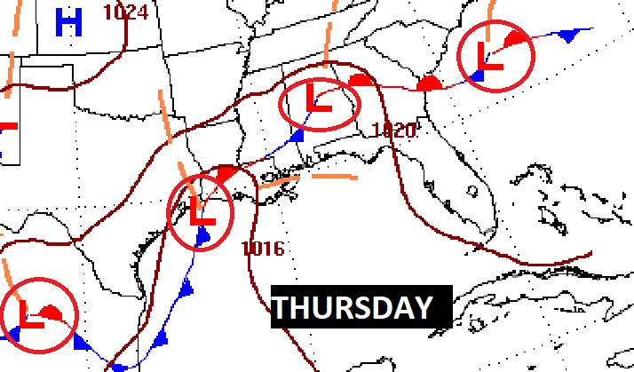
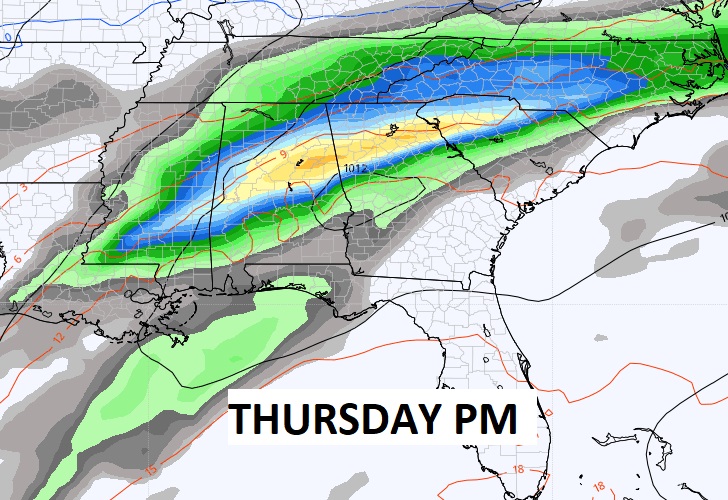
Here’s the set-up for a potentially wet and active Thursday.
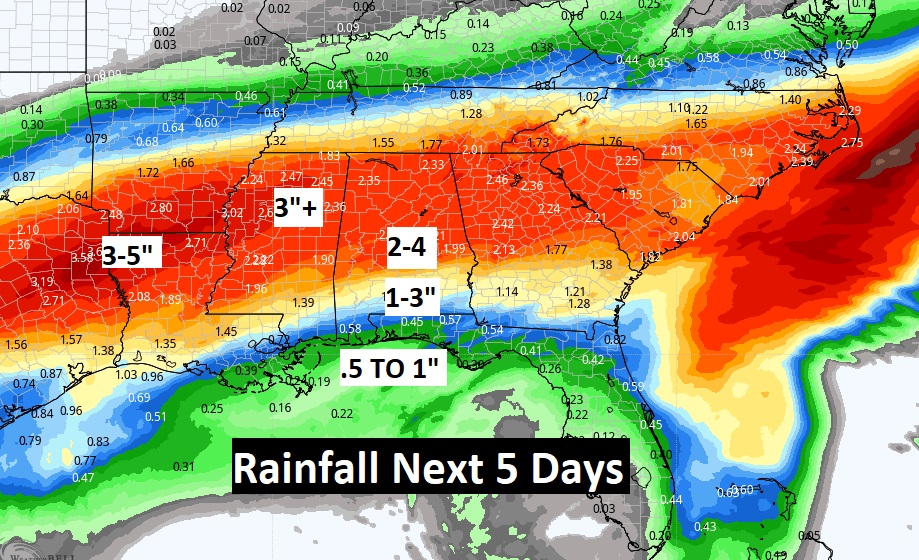
Potentially a lot of rain in the week ahead. Look at the Rainfall Potential Rainfall map in the next 6 days.
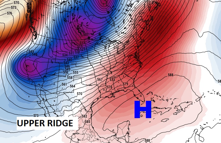
The HUGE Sub-tropical High Pressure Ridge anchored near Cuba will keep Arctic air from invading the Southeast for the next several days. Good news….
.
Thanks for reading this Blog this morning! This morning we are LIVE on the radio from 6 to 9 on NewsTalk 93.1. Watch us on TV on CBS 8 and ABC 32. I’ll have another update for you in the morning. Have a nice day!
–Rich