Good Morning! Welcome to February! Compared to the awful Winter Weather in other parts of the country, February will start off quiet today.
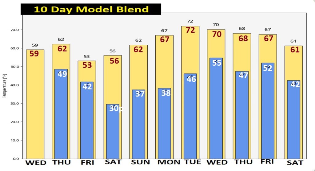
Temperatures will be a little cooler than yesterday. We have a storm system on the way. Rain and thunderstorms will return by Thursday afternoon and especially Thursday. Locally heavy rainfall. Colder air will follow the storm, but nothing brutal. Finally we’ll start to see the sun by Friday afternoon and into the weekend. Here’s my brief forecast discussion.
TODAY: Patchy fog early. Cloudy and cooler today. Yesterday’s high was 73. High today near 60. (Normal 61/37) Northwest wind 5 to 10 mph. Mostly cloudy tonight. Low 51.
.
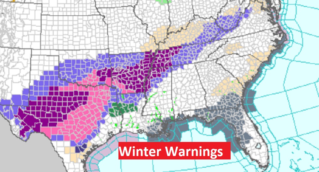
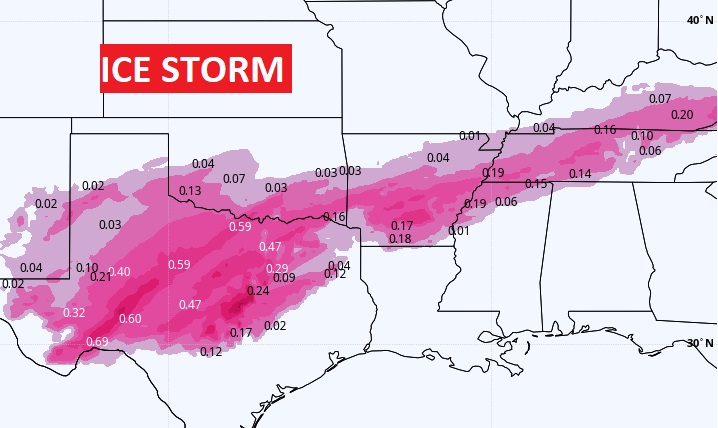
If you’re going to be traveling, be aware of a nasty winter ICE storm continues northwest and west of us, from Texas through The Tennessee valley. Numerous winter weather advisories from the Ohio valley to Texas. Winter Storm Warning for much of north central Texas. A serious Ice Storm. Travel is impossible.
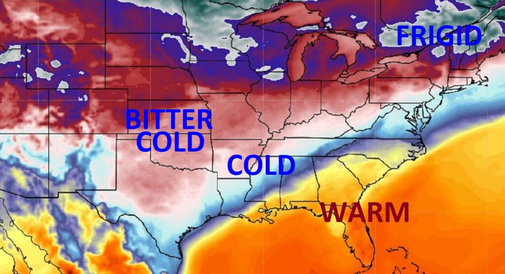
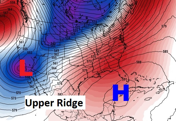
You don’t have to go far to get into extremely COLD air which is gripping most of the nation. But that Upper High over Cuba is our best friend. It’s keeping the Brutal Arctic air away.
NEXT FEW DAYS: We have a storm system on the way. Rain and thunderstorms will return by Thursday afternoon and especially Thursday. Locally heavy rainfall. Colder air will follow the storm, but nothing brutal. Finally we’ll start to see the sun by Friday afternoon and into the weekend.
Here’s the set-up for a potentially wet and active Thursday.
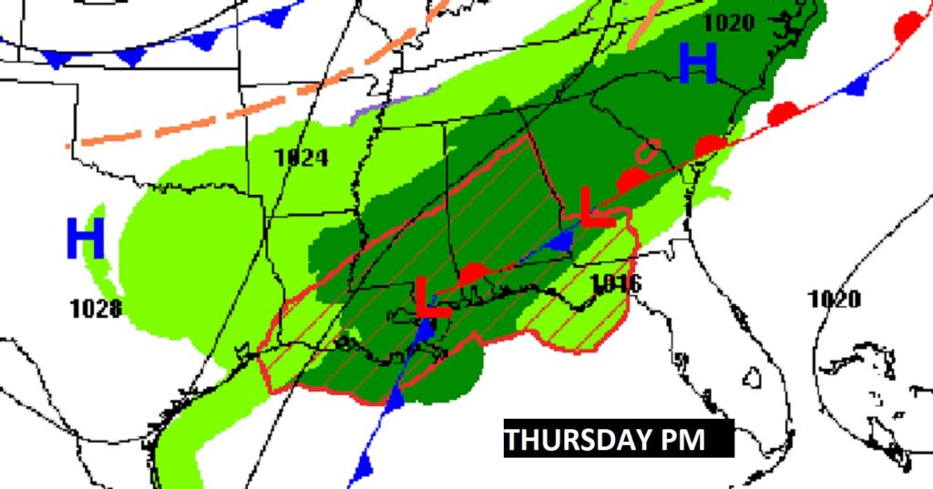
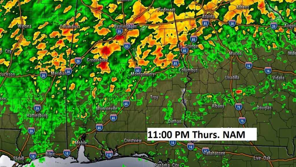
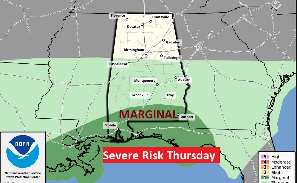
Marginal Severe Risk covers south Alabama Thursday.
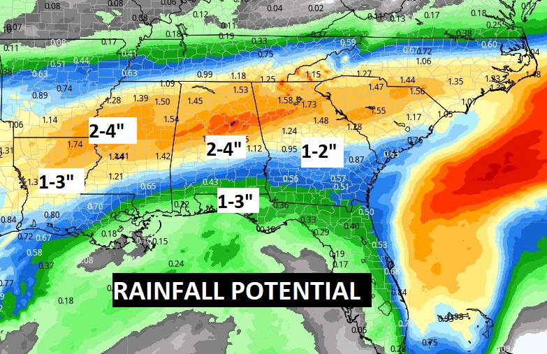
Potentially a lot of rain in the next few days. Look at the Rainfall Potential Rainfall map in the next 5 days.
.
Although we will turn colder behind the storm system, the chill air will not last long and fortunately the brutal air will stay away.
Thanks for reading this Blog this morning! This morning we are LIVE on the radio from 6 to 9 on NewsTalk 93.1. Watch us on TV on CBS 8 and ABC 32. I’ll have another update for you in the morning. Have a nice day! –Rich
