
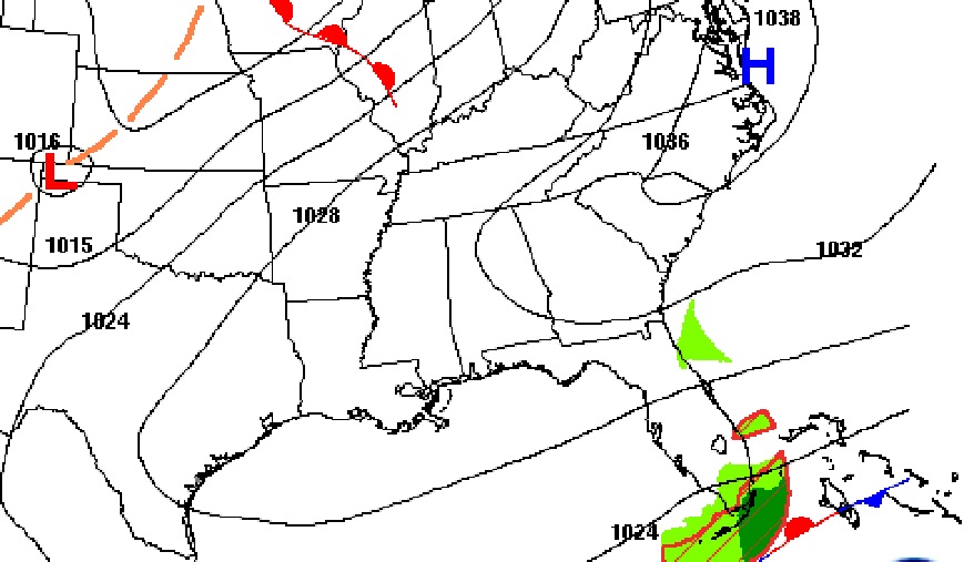
Good Morning! This first weekend of February looks pretty good, all things considered. After a cold, sub-freezing start this morning, sunshine will help us recover quite a bit. Expect upper 50’s today. Still below normal, but not too bad. Fortunately, the chilly air will not stick around long. We should back in the mid 60’s tomorrow, upper 60’s Monday, and 70’s by Tuesday and Wednesday. The Next big-deal storm system will arrive sometime in the Wednesday night / Thursday timeframe. Right now the models are not in agreement on the potential for strong to severe storms.
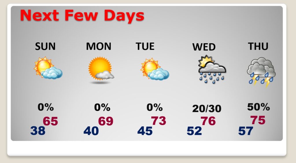
TODAY: Good bit of sunshine. Increasing clouds later. Cool again. High 57. (Normal 62/38) East wind 6 to 13 gusting to 18. Mostly cloudy, not quite as cold tonight. Low 38.
NEXT FEW DAYS: Sunday will be a milder day with clouds in the morning and afternoon sun. Nice recovery Monday & Tuesday. In fact, we’ll be in the 70’s by Tuesday & Wednesday. Small risk of showers Wednesday. Better chance of showers and thunderstorms Wednesday night into Thursday.
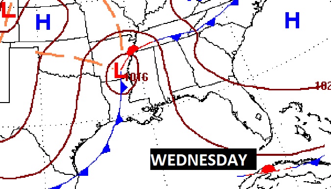
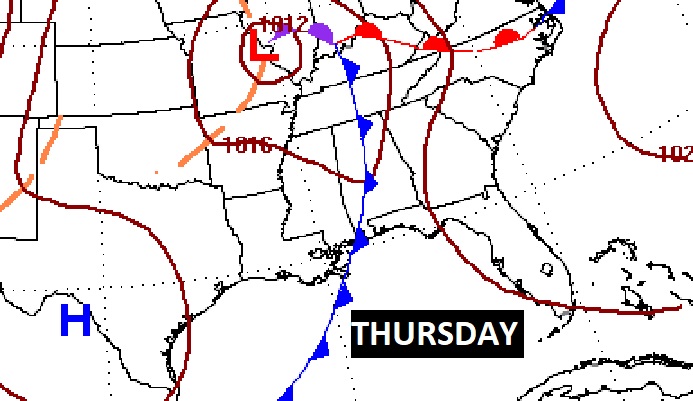
The Next big-deal storm system will arrive sometime in the Wednesday night / Thursday timeframe. Right now the models are not in agreement on the potential for strong to severe storms.
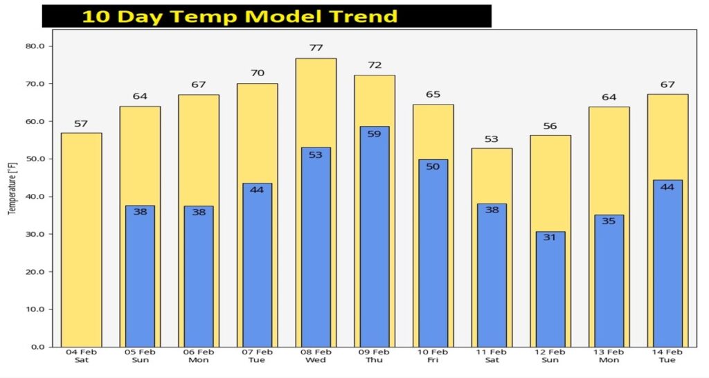
This current CHILL won’t stick around long. A nice recovery starts Sunday & Monday. We’ll be in the 70’s by Tuesday through Thursday. Here’s the 10 day temperature trend.
.
We’re in two Mardi Gras parades today. Millbrook at Noon. And, Prattville at 2:00PM. We’ve been told that we are one of the first vehicles in both parades. Say hi to us. We’ll see you there.

Thanks for reading this Blog this morning! I’ll have another update for you in the morning. Have a nice weekend!
–Rich