
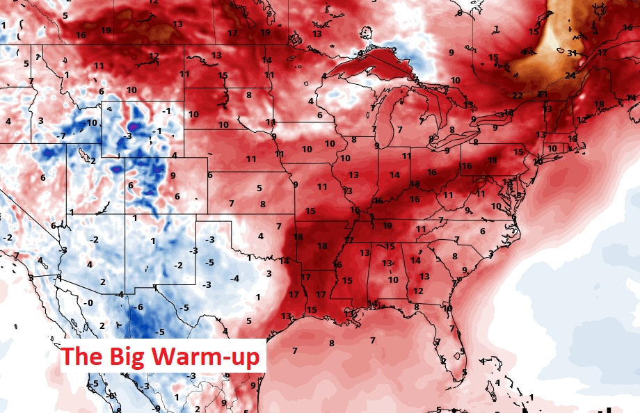
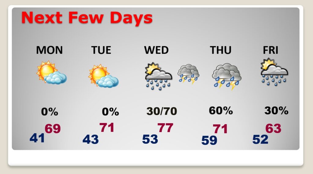
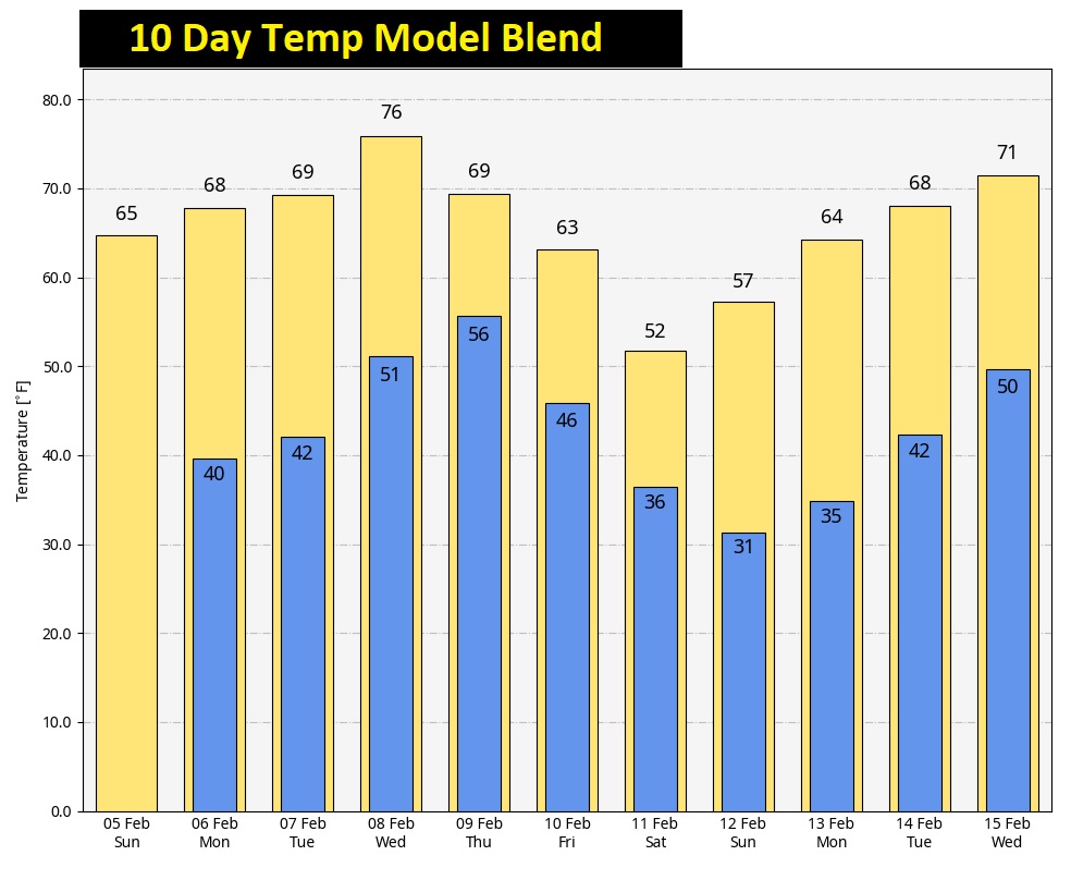
Good Morning! The Chill is about to fade. A significant warming trend is on the menu. Today, we’re headed for the mid 60’s. I think we tease 70 degrees on Monday. The warmest day will be Wednesday, with perhaps mid to upper 70’s. But, everything comes with a cost.
The Next big-deal storm system will arrive late Wednesday night into early Thursday. Even though the models do not agree on the details, if I was a betting man, I’m pretty sure we’ll have to deal with a severe weather threat, including the risk for tornadoes. Stay tuned. So far, the Storm Prediction Center has not issued an outlook.
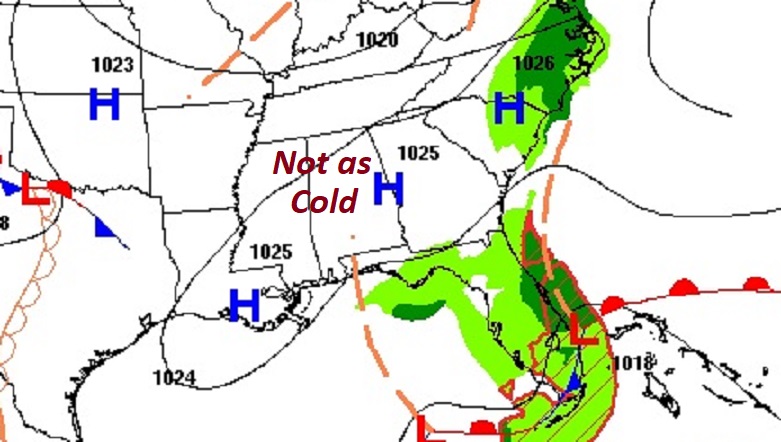
TODAY: Cloudy early in the day, then gradually mostly sunny. A milder day. Noticeably swarmer. High 65. East wind 6 to 12. Mainly clear, not as cold tonight.
NEXT FEW DAYS: Monday will be just a great day. Tuesday looks really nice, too. Warmer. That “big deal”, potentially severe storm system begins to affect us by Wednesday afternoon/night. The system slows up, so we’ll hang on to a chance of rain both Thursday and Friday for now. It will turn colder, but not for too many days.
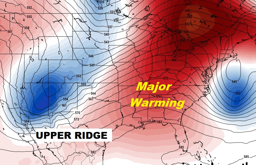
Upper Ridge is our friend. Warmer Days…
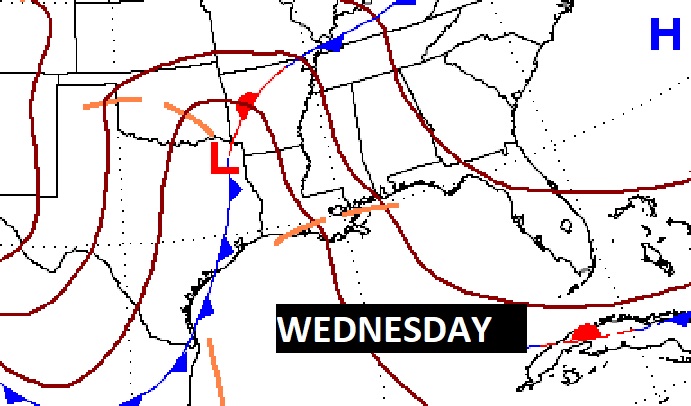
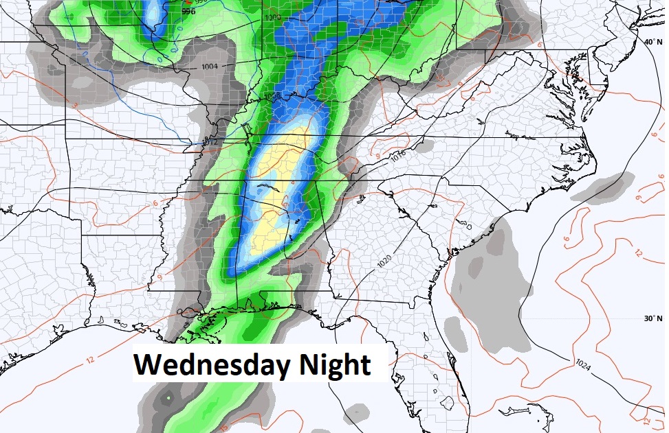
The Next big-deal storm system will arrive late Wednesday night into early Thursday. Even though the models do not agree on the details, if I was a betting man, I’m pretty sure we’ll have to deal with a severe weather threat, including the risk for tornadoes. Stay tuned. So far, the Storm Prediction Center has not issued an outlook.
A nice warming trend starts today and continues through Wednesday. Colder late week, but not for long. Here’s the 10 day temperature trend.
.
Thanks for reading this Blog this morning! I’ll have another update for you in the morning. Have a nice Sunday!
–Rich