
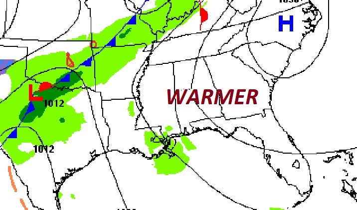
Good Morning! Our nice warming trend continues. Yesterday’s high was 70. Today will be warmer. Enjoy today. Changes are on the way. The Next “big-deal” storm system will arrive late Wednesday night into Thursday. Strong to severe storms are possible. All modes of severe weather are possible. The main threat window will be in the overnight hours Wednesday night and into early Thursday. Colder air will follow the storm system.
TODAY: Get ready for another great day. Mostly sunny. High near 74. (Yesterday’s high 70…normal 63/38) Southeast wind 5 to 10. Mostly cloudy tonight. Milder. Low 55.
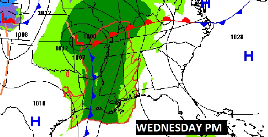
NEXT FEW DAYS: Wednesday will be the warmest day of the week. High in the mid to upper 70’s. Spotty showers are possible Wednesday afternoon. But, the main rain and thunderstorm shield arrives in the pre-dawn hours of Thursday morning. Possibly severe. The front slows down Thursday. We’ll hang onto a small rain risk through Friday. Colder air will follow the storm system, especially Friday night into Saturday. Fortunately, the cold will not last long.
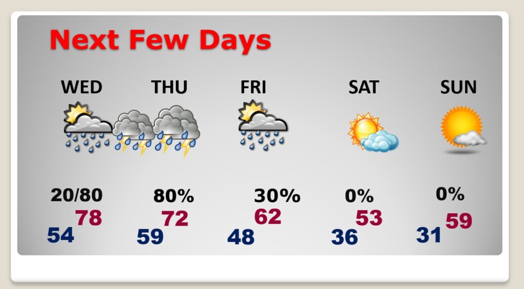
Wednesday starts off dry. But, the main rain and thunderstorm shield arrives in the pre-dawn hours of Thursday morning. Possibly severe.
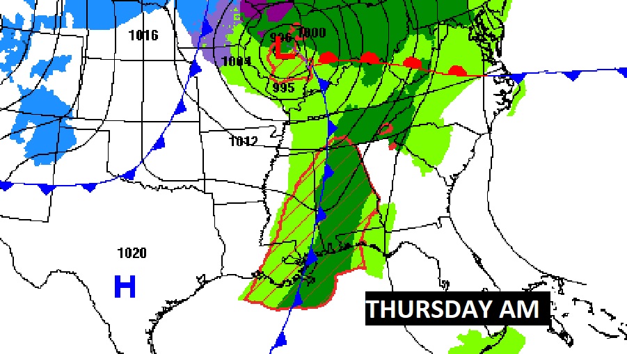
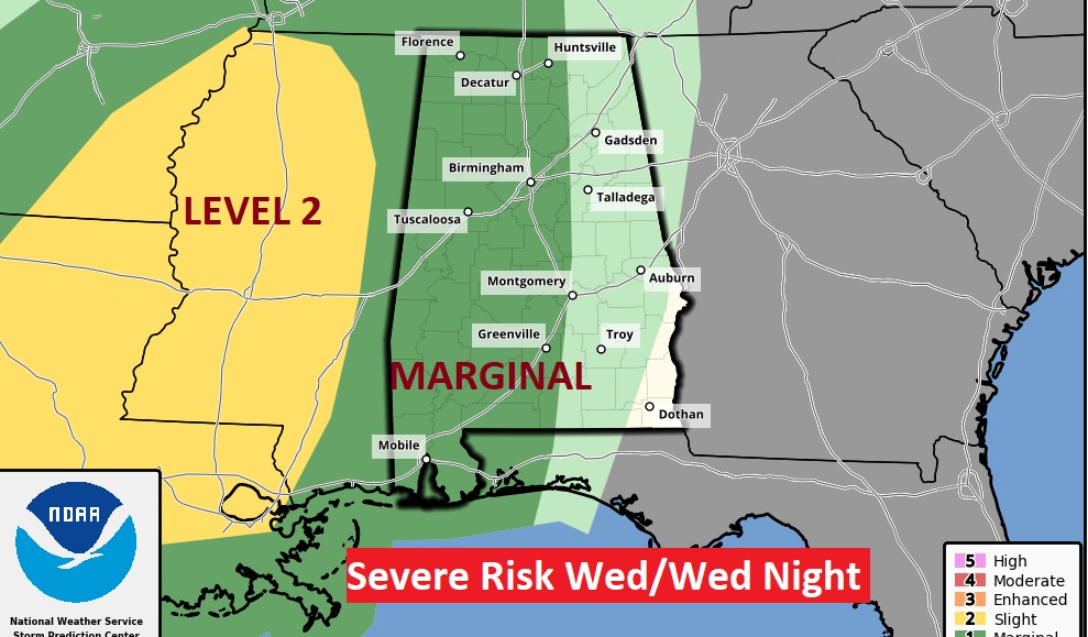
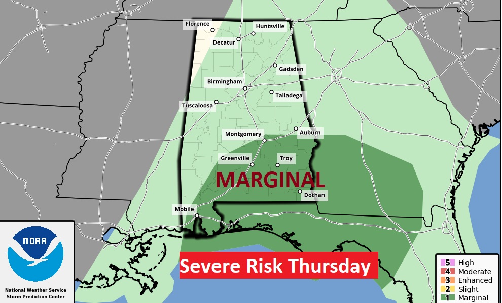
SPC has put much of the area under at least a Level 1 Marginal Risk, especially from I-65 eastward. The Day 2 Risk map goes through 6AM Thursday. The Day 3 Marginal Risk begins across SE Alabama at 6AM Thursday.
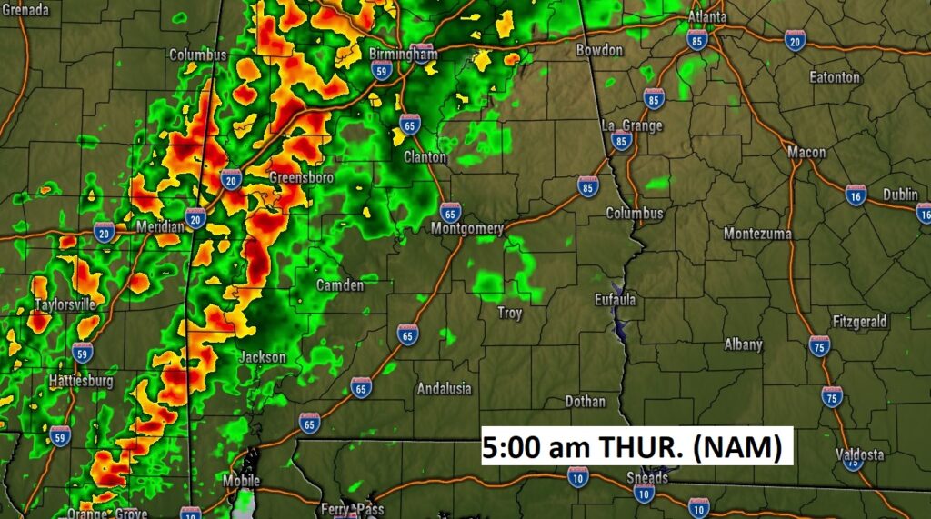
Here’s the high-res NAM model at 5AM Thursday. The line of strong to severe storms is in west Alabama. It will tend to become less severe as it progresses eastward.
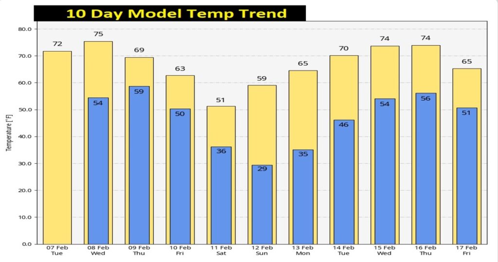
A nice warming trend continues through Wednesday. Colder late week, but not for long. Here’s the 10 day temperature trend.
Thanks for reading this Blog this morning! This morning we are LIVE on the radio from 6 to 9 on NewsTalk 93.1. Watch us on TV on CBS 8 and ABC 32. I’ll have another update for you in the morning. Have a nice day!
–Rich