
Good Morning! Today will truly be an awful day. Cold, windy and Wet. Winds could gust over 30 mph. Sunday rain clears out by dawn. Cloudy in the AM, but we should see the sun by Sunday afternoon. Although Sunday will be chilly compared to normal, on Monday recovery will begin as we head for the low to mid 60’s. On Valentine’s Day we’ll be near 70. Next week will be very active. Showers return Tuesday night & Wednesday. Thursday could be a big severe weather. In fact, SPC has already issued a Severe Weather Risk several days out. Concern for Thursday is increasing. Here’s my brief forecast discussion.
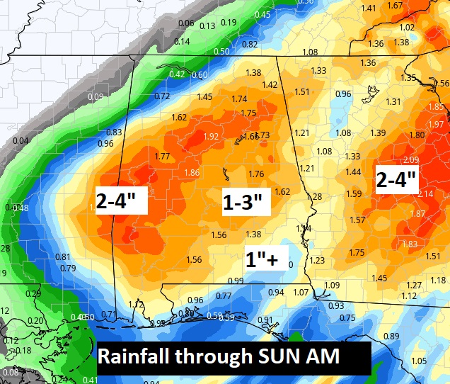
TODAY: Cold, Wet and Windy. Periods of a cold rain. Total rain today and tonight perhaps 1-3”. COLD. High 53. Wind advisory in effect from 2PM till Midnight. Northeast wind could gust over 30 mph. Rain continues tonight. Cold. Low 42.
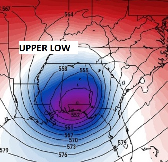
The combination upper low combined with a surface low will funnel Gulf moisture into the state today.

Lots of rainfall expected.
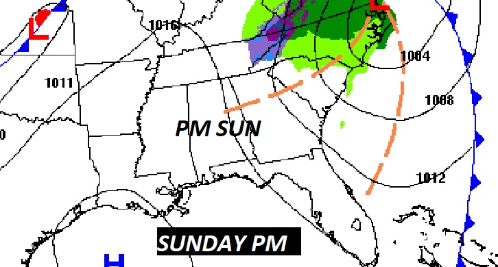
SUNDAY: Sunday rain clears out by dawn. Cloudy in the AM, but we should see the sun by Sunday afternoon. Breezy & cool. Northwest wind 15 to 20 mph. High 56. Clear and quite cold Sunday night. Low 33.
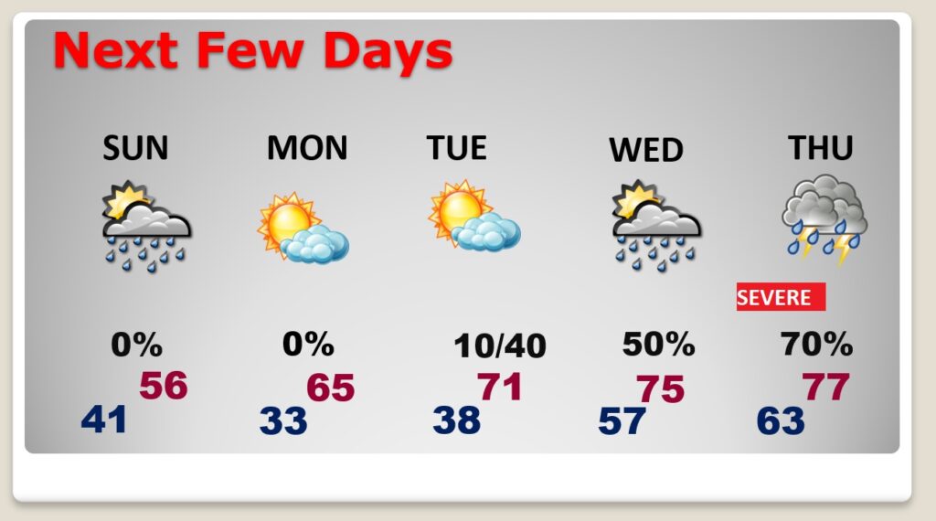
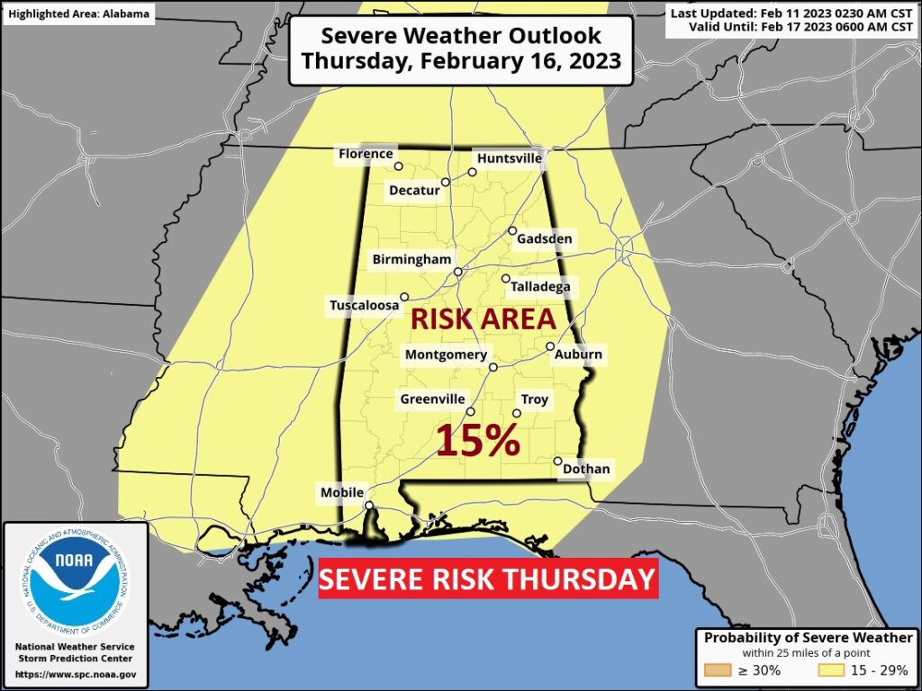
NEXT FEW DAYS: On Monday recovery will begin as we head for the low to mid 60’s. On Valentine’s Day we’ll be near 70. Next week will be very active. Showers return Tuesday night & Wednesday. Thursday could be a big severe weather. In fact, SPC has already issued a Severe Weather Risk several days out. Concern for Thursday is increasing.
THURSDAY SEVERE THREAT: It’s always a big deal when the Storm Prediction Center issues a Severe Weather Threat beyond Day 3. But, when SPC issues an outlook 7 days out (like they did yesterday), it’s concerning. That’s next Thursday. All modes of severe weather are possible including tornadoes. The Severe threat begins Wednesday in the lower Mississippi valley and spreads east to Alabama Thursday. Too early to get into details, but the action could begin Thursday morning and continue well into Thursday evening. Stay tuned. We’ll know a little more, as far as details and threat levels as we get closer to this event.

.
Thanks for reading this Blog this morning! I’ll have another update for you in the morning. Stay dry! Have a plan B and a plan C!
–Rich