
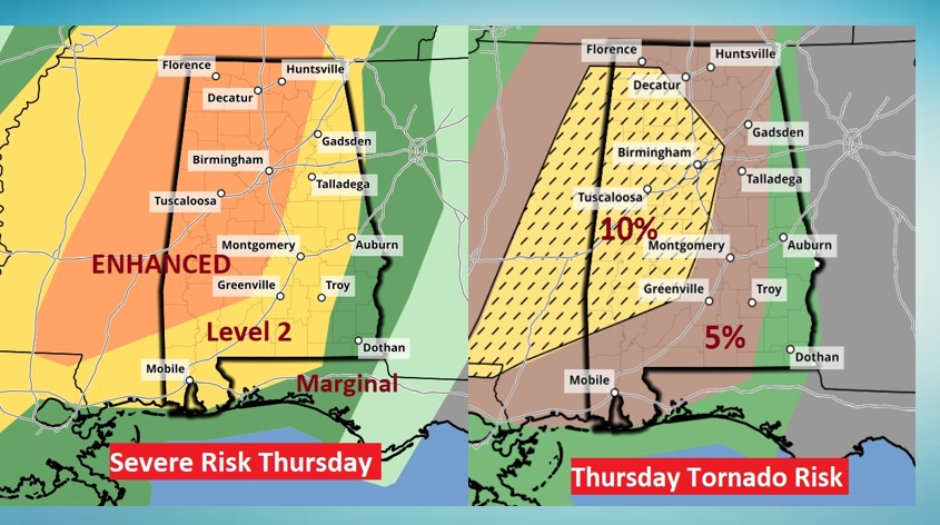
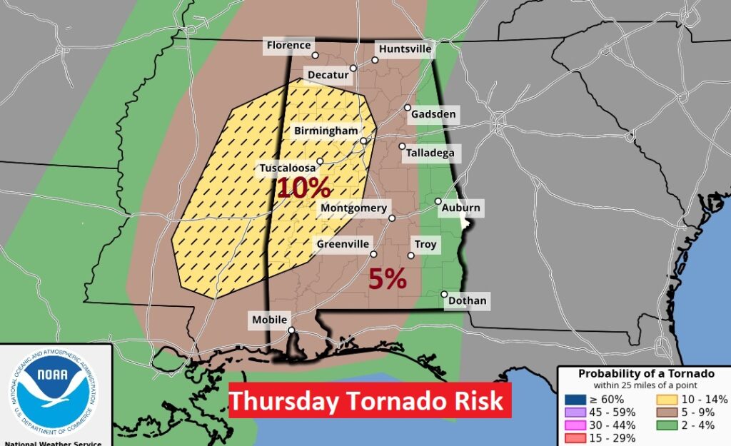
SPC 11:30 Day 2 Thursday Severe Risk Update: Nudging the Level 3 Enhanced Risk just a tad eastward, covering much of the state west of I-65. 10% hatched tornado risk for much of west Alabama, with “several tornadoes, potentially strong tornadoes” 70 mph wind gusts. #alwx
EARLY MORNING UPDATE:
Good Morning! Today will be warm and routine for most of us. But, all eyes are on the approaching storm system which will bring another severe weather threat Thursday & Thursday night. SPC has upgraded the risk area. The western half of the state, especially, could see a significant tornado risk. A few strong tornadoes are possible. Colder air follows the big storm. The “cold shot” will not last long. Here’s my brief forecast discussion.
TODAY: The warm-up continues. Mostly cloudy. Isolated showers are possible. High 77. (Normal 65/40) South wind 10 to 15 mph. Most cloudy tonight. Low 62.
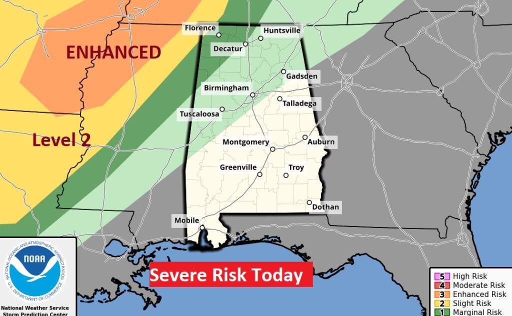
Today, the severe weather risk will stay northwest of us.
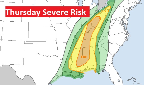
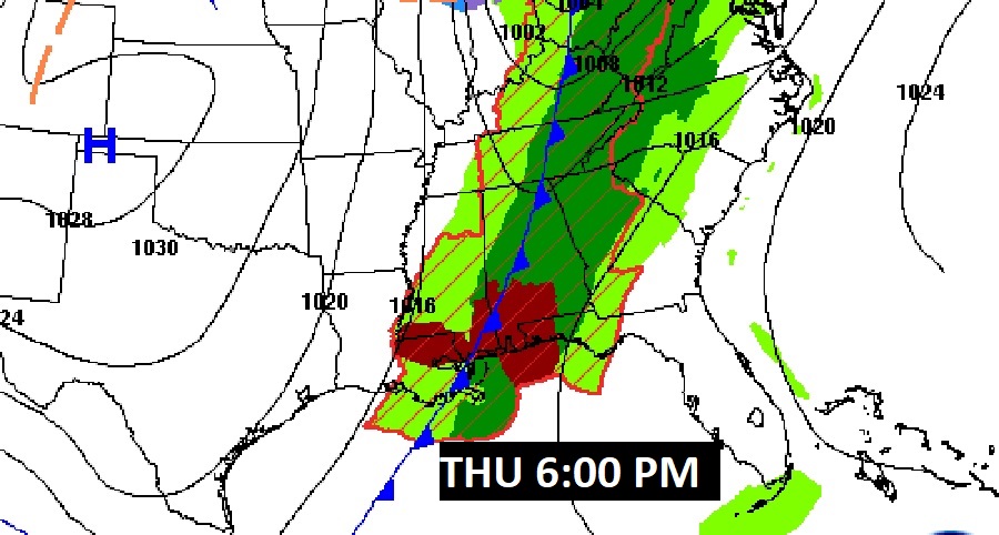
THURSDAY SEVERE THREAT: There will be a multi-day Severe Weather Event starting tomorrow in the ArkLaTex and lower Mississippi valley today, spreading eastward to Alabama Tomorrow. All modes of severe weather are possible including tornadoes. SPC has upgraded the risk, especially for the western half of the state. Showers and storms begin Thursday afternoon and continue Thursday night. Some severe, including all modes of severe weather. They have upgraded to an ENHACED Risk for all of the state west of a Clanton/Selma line.
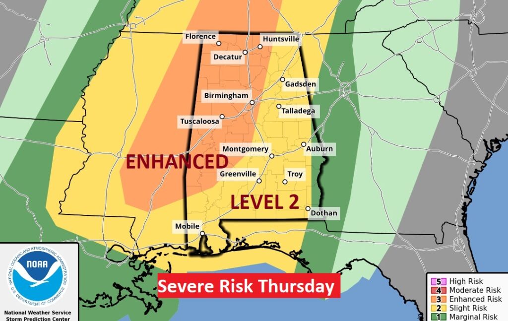
The Hatched 10% Tornado Risk area across the western half of the state is concerning. SPC has “several tornadoes, some strong are likely”, especially late afternoon into early evening. By late evening, SPC says the tornado threat will wane farther east.
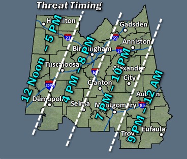
Large time line from 12 Noon in the WEST to 12 Midnight in the far southeast and east. NWS Discussion includes this:
A few hi-res models indicate discrete
cells developing ahead of the line, which would warrant an early
start time for severe. By 12 Noon Thursday
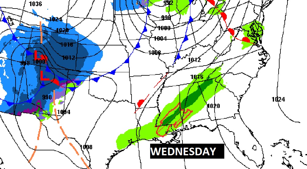
This timing map from NWS is helpful for planning purposes.
Thursday’s Severe Threat will extend from the Gulf Coast to Lake Erie.
NEXT FEW DAYS: We’ve been talking about Thursday’s Severe Weather potential for about 7 days now. SPC has upgraded the risk, especially for the western half of the state. Showers and storms begin Thursday afternoon and continue Thursday night. Some severe. Tornadoes are possible.
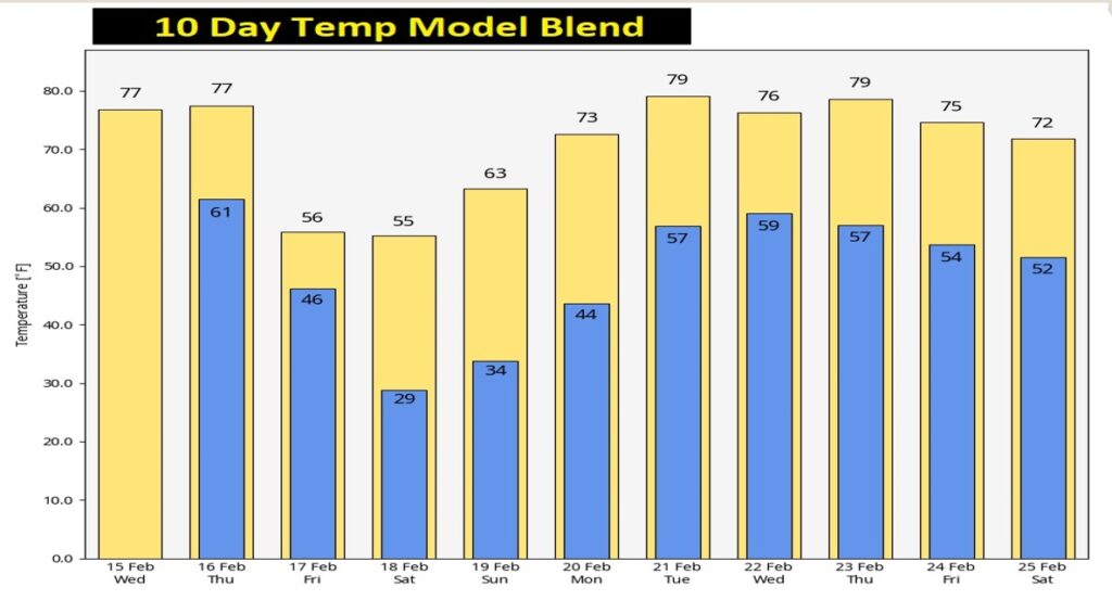
Colder air follows the big storm. Friday will be chilly, with highs in the low 50’s. Upper 20’s are possible by Dawn Saturday. Saturday will be sunny and cool. Sunday & Monday will be a little warmer.
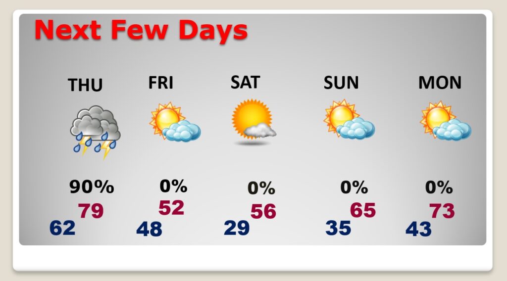
The weekend chill won’t last long. Look for another big warm-up next week. Spring-like.
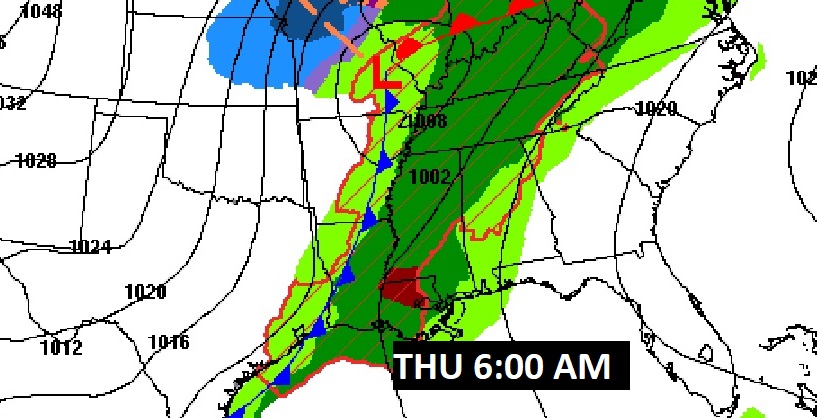
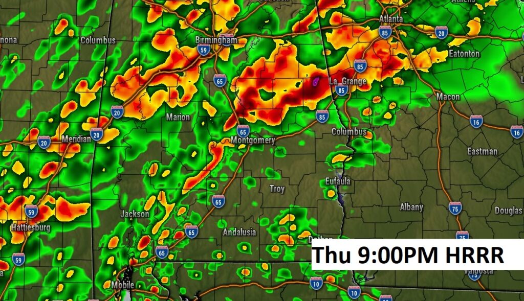
Here’s a couple of Future Radar Snapshots for Thursday evening from the HRRR model. Late afternoon and well into the evening looks quite active.
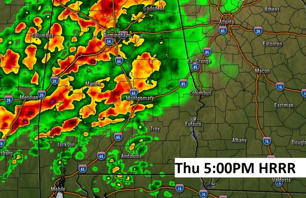
.
Thanks for reading this Blog this morning! This morning we are LIVE on the radio from 6 to 9 on NewsTalk 93.1. Watch us on TV on CBS 8 and ABC 32. I’ll have another update for you in the morning. Have a nice day!
–Rich