
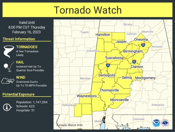
(1:50 PM 2/16/23)
Tornado Watch for much of west and central Alabama until 8PM, as far east as Chilton, Autauga, Dallas and Wilcox counties. A Few tornadoes are likely, 70 mph damaging wind gusts, quarter size hail. Stay weather aware.
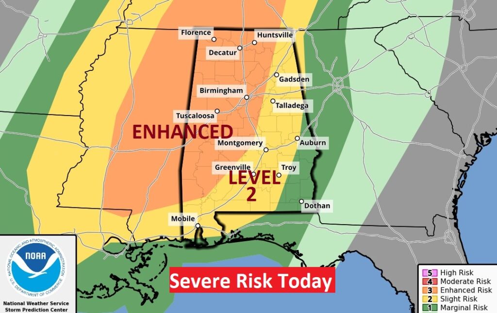
Good Morning! Here comes yet another Thursday Severe Weather Threat today and tonight. All of us are in the threat zone, but the western half of Alabama is in the Enhanced Risk. All modes of severe weather are on the table including tornadoes. The threat for strong/severe storms begins this afternoon, with an increasing risk by evening. Storms will move out late tonight. Colder air follows the storm system. Friday will be chilly. The cold will not last long. We’ll be back to the 60’s by Sunday. Here’s my brief forecast discussion.
TODAY: Cloudy, breezy & Mild today. High 78-80. South winds 10 to 15 gusting to 25 mph. Thunderstorms develop in the afternoon hours, increasing as we go into early evening. Strong to Severe Storms are likely. All modes of severe weather are possible including tornadoes. The tornado risk is particularly higher over the western half of Alabama in the Enhanced Risk area. Storms end and move out later tonight. Colder late tonight. Low 47.
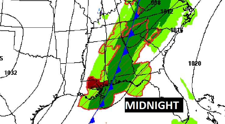
The Cold Front has slowed down on it’s eastward progress. It should reach the west Alabama border by 6PM tonight, and central Alabama by midnight.
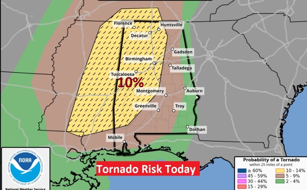
The Hatched 10% Tornado Risk area across the western half of the state is concerning. SPC says a few strong tornadoes are possible. The timeline has changed. There could be an earlier start time for storm development this afternoon. And, the front has slowed, so the end time for strong/severe storms appears to be later. The storm risk should exit extreme southeast Alabama in the wee hours on Friday morning.
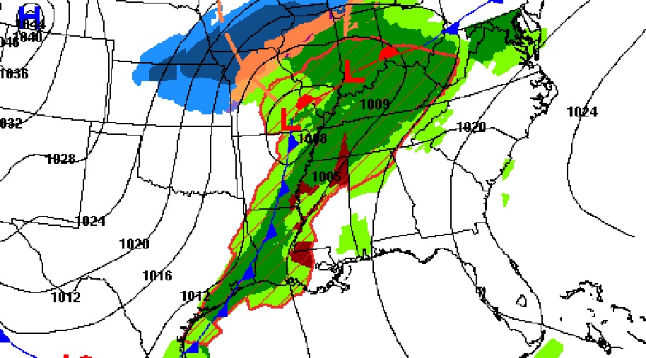
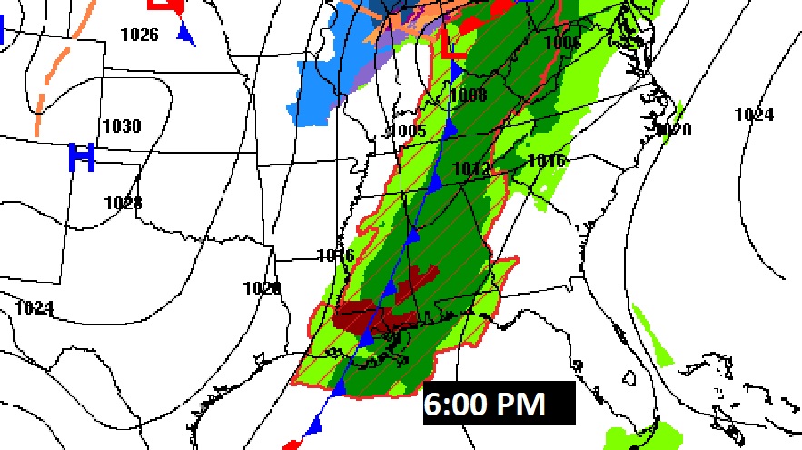
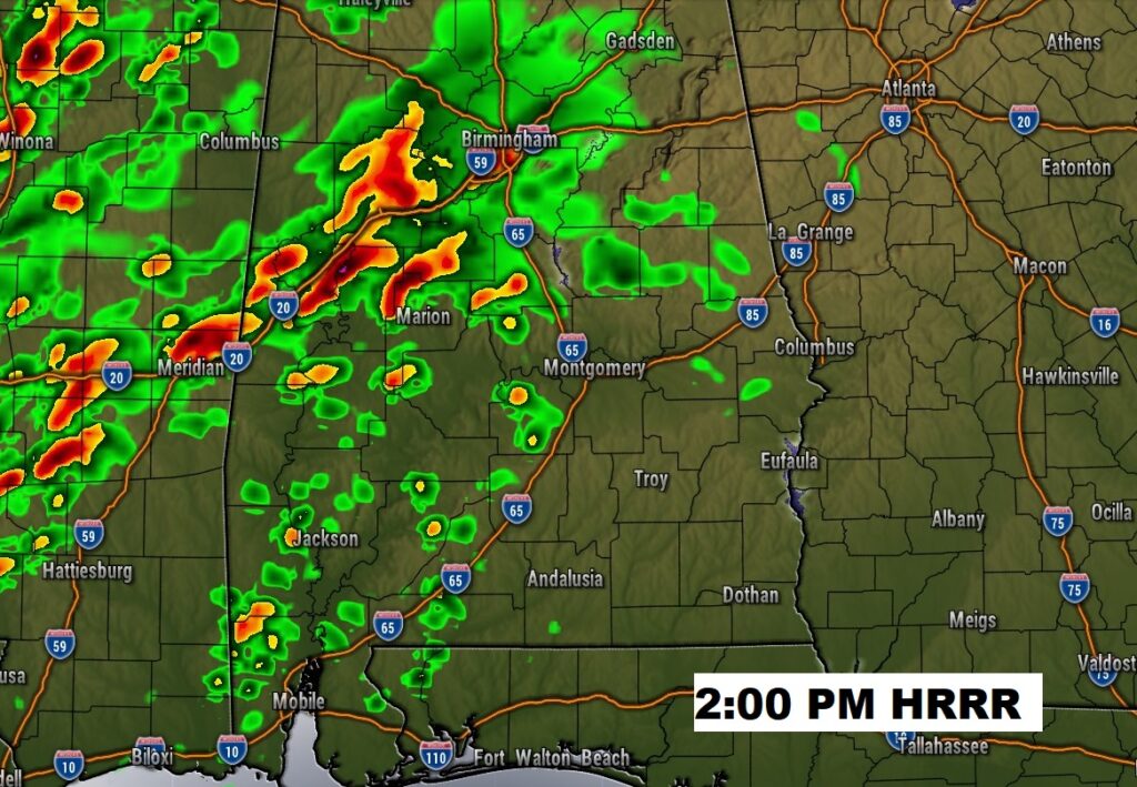
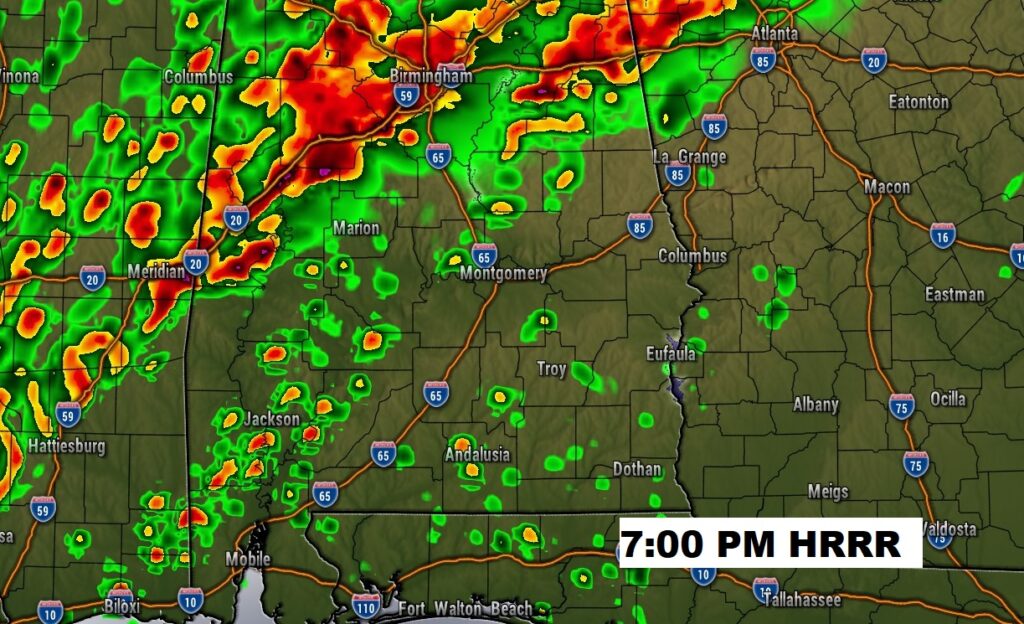
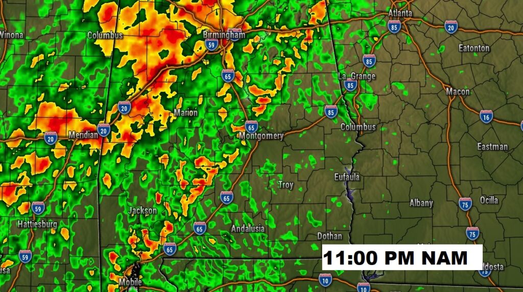
Here’s a few Future Radar snapshots. Unfortunately, there could be an earlier start time for storm development this afternoon. And, the front has slowed, so the end time for strong/severe storms appears to be later, now. Looks like an extended window for the severe threat.
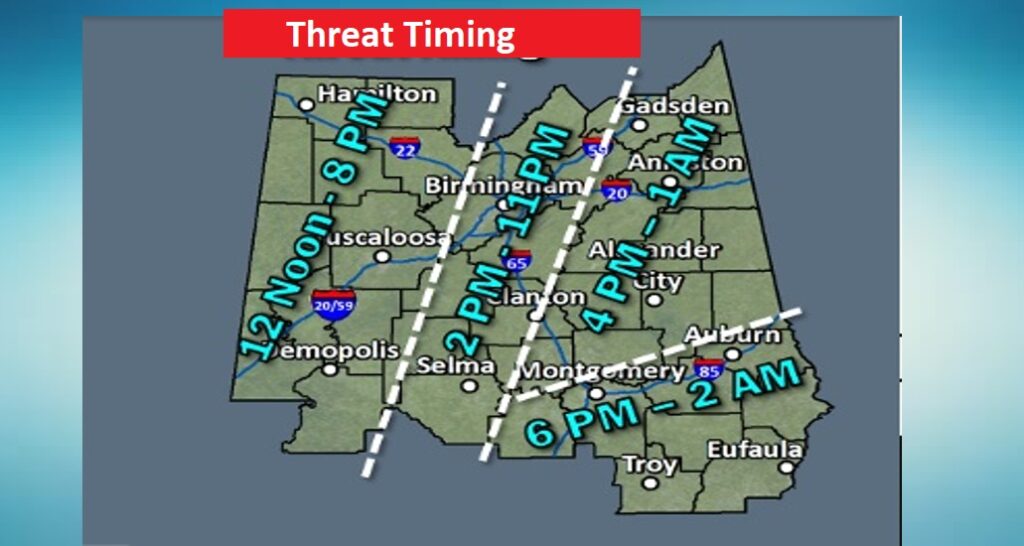
Updated Risk Time Line from NWS. Unfortunately — a longer window.
NEXT FEW DAYS: Colder air follows the big storm. There could be a few left-over showers Friday morning. Tomorrow will be chilly, with highs in the low to mid 50’s. Upper 20’s are possible by dawn Saturday. Saturday will be sunny and cool. We’ll be back to the 60’s Sunday, and 70’s Monday, and perhaps near 80 on Tuesday. More rain is in the cards by mid week.
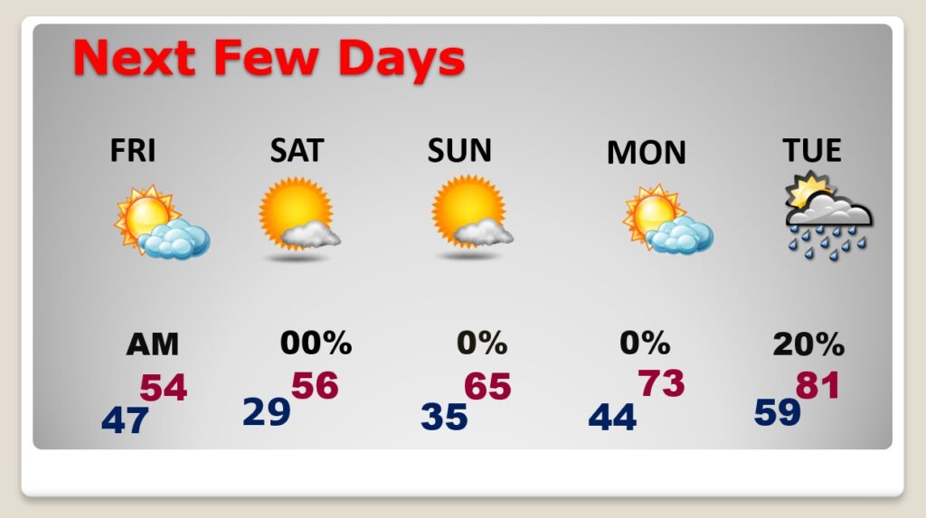
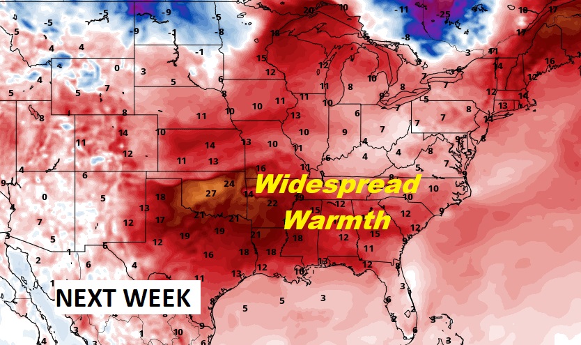
The weekend chill won’t last long. Look for another big warm-up next week. Spring-like.
Thanks for reading this Blog this morning! This morning we are LIVE on the radio from 6 to 9 on NewsTalk 93.1. Watch us on TV on CBS 8 and ABC 32. I’ll have another update for you in the morning. Have a nice day!
–Rich