
Good Morning! Following the Cold Front, which brought the rain overnight, much colder air will follow. The rain will end early, during the morning hours. Today will be a breezy chilly day. Expect sub-freezing temperatures overnight tonight. The weekend will be storm-free. Saturday will be a cool day, compared to normal but sunny. A nice warming trend begins Sunday. Mid 60’s Sunday. Low 70’s Monday. Lower 80’s Tuesday & Wednesday. The next rain risk returns Wednesday, and a better chance Thursday. Here’s my brief forecast discussion.
STORM REPORTS: After we have dealt with SO MANY severe weather threats since November, Thursday’s threat greatly under performed. Most of the severe weather reports were over Mississippi and Tennessee. FINALLY, Alabama got a break, at least this time.

TODAY: Risk of a few morning showers, early before ending. Sunshine later. Breezy and cool today. High 53, falling to 47 by 5PM. Clear and cold tonight. Low 29.
Early this morning, the actual cold front will have made it to Dothan by about 6AM. It will be breezy and colder behind the front with some sunshine this afternoon.
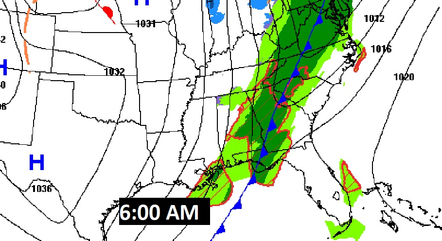

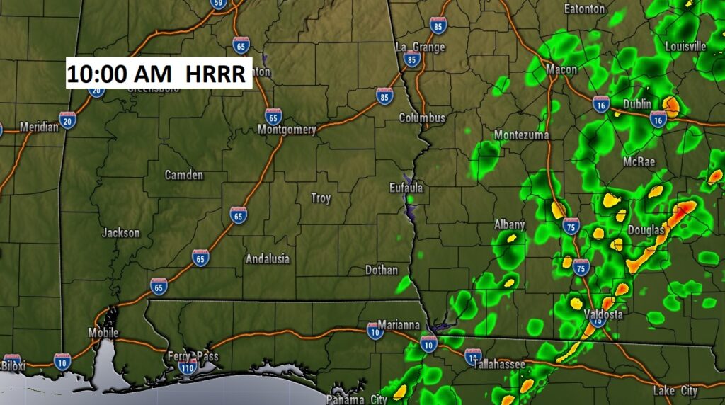
FUTURE RADAR shows the rain departing the state this morning.

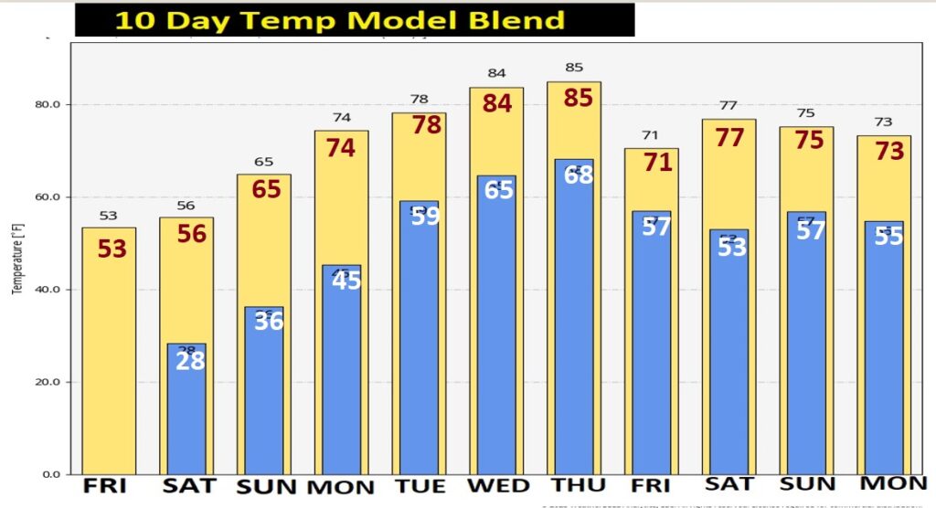
NEXT FEW DAYS: Saturday will be sunny but cool, compared to normal. (Normal 65/40) We’ll be back to the mid 60’s Sunday, and 70’s Monday, and perhaps lower 80’s on Tuesday & Wednesday. Risk of showers and thunderstorms by Wednesday. Better chance Thursday.
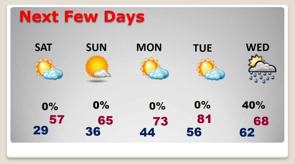
Temperature recovery begins Sunday with highs in the 60’s.
HUGE warm-up ahead next week. Look at the 10 day Temperature Model Blend. 80’s possible by Mid-week.
Thanks for reading this Blog this morning! This morning we are LIVE on the radio from 6 to 9 on NewsTalk 93.1. Watch us on TV on CBS 8 and ABC 32. I’ll have another update for you in the morning. Have a nice day!
–Rich