
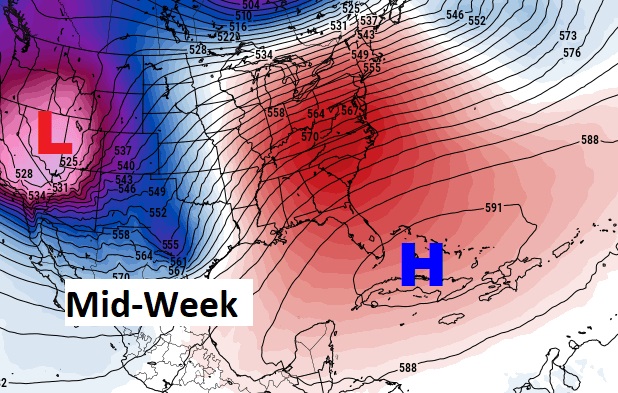
Good Morning! Technically it is still “the dead of winter”. But by the middle of this week, you’ll wonder if we have jumped into the middle of May. Get ready for major trend. It begins today. We’ll add about 10 degrees to yesterday’s high. Big warming continues tomorrow on President’s Day tomorrow. Expect highs well into the 80’s by Wednesday and Thursday. There will be a small chance of rain by mid-week as disturbances brush by the area. But, the main action stays north of us. A huge upper level dome of high pressure centered over Cuba will keep us warm and divert storm systems away.
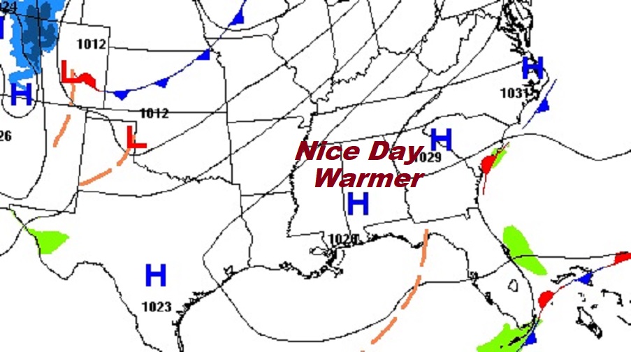
TODAY: Great day ahead! Mostly sunny and warmer. High 67. (Normal 66/41) Southwest wind 5 to 10 mph today. Partly cloudy, not as cold tonight. Low 44.
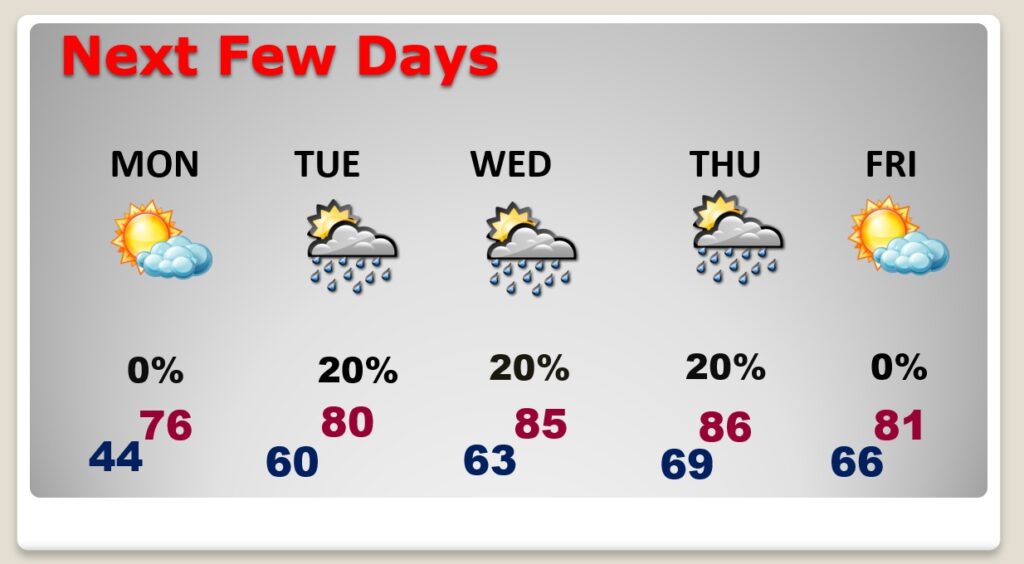
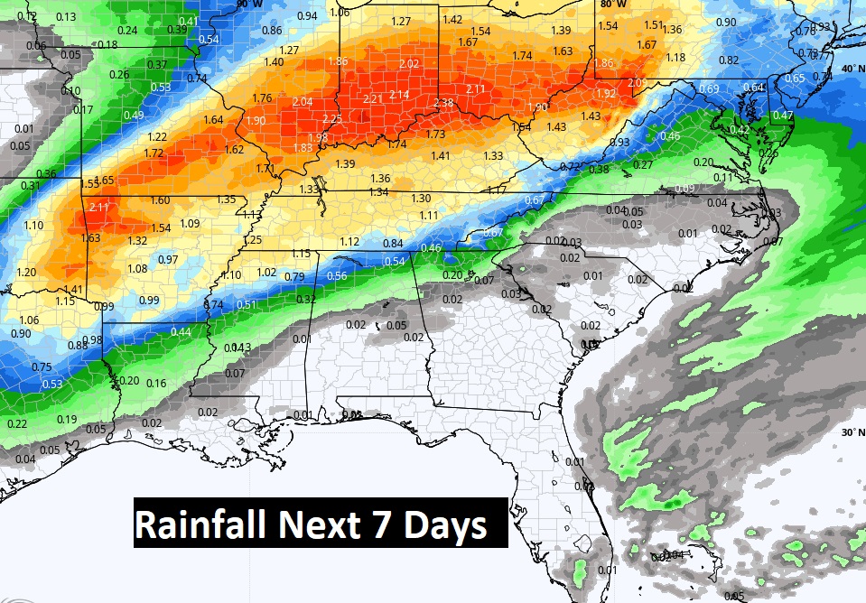
NEXT FEW DAYS: Expect a rather remarkable warm-up. Call it a Spring Preview. We’ll be in the mid to upper 70’s on President’s Day. Expect highs well into the 80’s by Wednesday and Thursday. There will be a small chance of rain by mid-week as disturbances brush by the area. The warm pattern continues through Friday and Saturday, too.
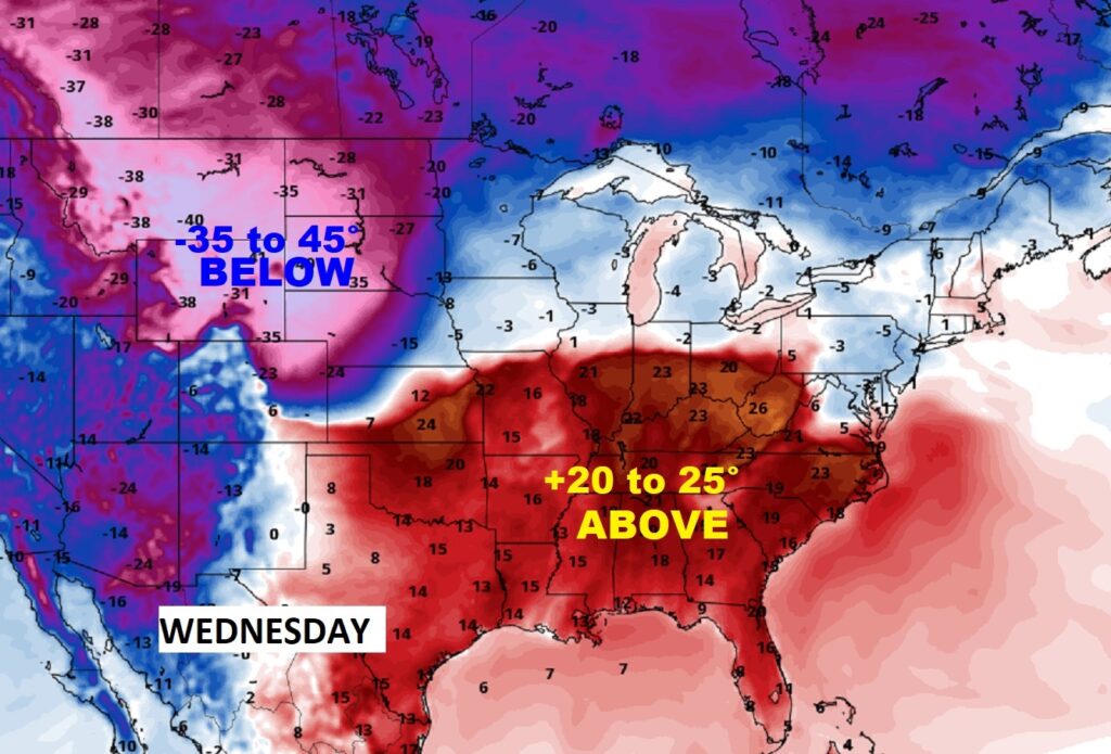
Massive warmth will invade the Southeast this week.
There will be a small chance of rain by mid-week as disturbances brush by the area. But, the main action stays north of us. A huge upper level dome of high pressure centered over Cuba will keep us warm and divert storm systems away.
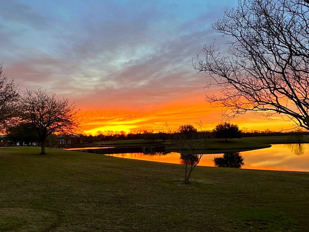
Beautiful pre-dawn start to this day!
Thanks for reading this Blog this morning!
I’ll have another update for you in the morning Enjoy this beautiful Sunday.
–Rich